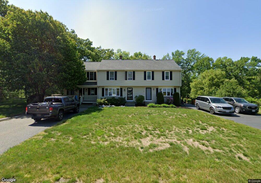
19 Meadow Rd Uxbridge, MA 01569
Estimated Value: $369,000 - $436,000
2
Beds
2
Baths
1,290
Sq Ft
$306/Sq Ft
Est. Value
About This Home
This home is located at 19 Meadow Rd, Uxbridge, MA 01569 and is currently estimated at $394,393, approximately $305 per square foot. 19 Meadow Rd is a home located in Worcester County with nearby schools including Uxbridge High School, Our Lady of the Valley Regional School, and Whitinsville Christian School.
Ownership History
Date
Name
Owned For
Owner Type
Purchase Details
Closed on
Mar 23, 2004
Sold by
Vaudrain Kenneth O and Vaudrain Tracy M
Bought by
Brandel Anthony and Brandel Michelle
Current Estimated Value
Home Financials for this Owner
Home Financials are based on the most recent Mortgage that was taken out on this home.
Original Mortgage
$197,600
Outstanding Balance
$92,608
Interest Rate
5.71%
Mortgage Type
Purchase Money Mortgage
Estimated Equity
$301,785
Purchase Details
Closed on
Jul 11, 1996
Sold by
Musseulli Michael and Mussulli Denise
Bought by
Vaudrain Kenneth and Vaudrain Tracy
Home Financials for this Owner
Home Financials are based on the most recent Mortgage that was taken out on this home.
Original Mortgage
$90,700
Interest Rate
7.98%
Mortgage Type
Purchase Money Mortgage
Purchase Details
Closed on
Nov 7, 1990
Sold by
Audet Bros Inc
Bought by
Jandrue Denise M
Create a Home Valuation Report for This Property
The Home Valuation Report is an in-depth analysis detailing your home's value as well as a comparison with similar homes in the area
Home Values in the Area
Average Home Value in this Area
Purchase History
| Date | Buyer | Sale Price | Title Company |
|---|---|---|---|
| Brandel Anthony | $208,000 | -- | |
| Vaudrain Kenneth | $95,500 | -- | |
| Jandrue Denise M | $99,900 | -- |
Source: Public Records
Mortgage History
| Date | Status | Borrower | Loan Amount |
|---|---|---|---|
| Open | Brandel Anthony | $197,600 | |
| Previous Owner | Jandrue Denise M | $135,000 | |
| Previous Owner | Jandrue Denise M | $88,700 | |
| Previous Owner | Jandrue Denise M | $90,700 | |
| Previous Owner | Jandrue Denise M | $80,100 |
Source: Public Records
Tax History
| Year | Tax Paid | Tax Assessment Tax Assessment Total Assessment is a certain percentage of the fair market value that is determined by local assessors to be the total taxable value of land and additions on the property. | Land | Improvement |
|---|---|---|---|---|
| 2025 | $45 | $345,100 | $0 | $345,100 |
| 2024 | $3,761 | $291,100 | $0 | $291,100 |
| 2023 | $3,316 | $237,700 | $0 | $237,700 |
| 2022 | $3,212 | $211,900 | $0 | $211,900 |
| 2021 | $3,011 | $190,300 | $0 | $190,300 |
| 2020 | $3,458 | $206,600 | $0 | $206,600 |
| 2019 | $3,585 | $206,600 | $0 | $206,600 |
| 2018 | $3,370 | $196,300 | $0 | $196,300 |
| 2017 | $2,702 | $159,300 | $0 | $159,300 |
| 2016 | $2,722 | $154,900 | $0 | $154,900 |
| 2015 | $2,640 | $151,700 | $0 | $151,700 |
Source: Public Records
Map
Nearby Homes
- 35 Pouts Ln
- 44 Pouts Ln
- 218 E Hartford Ave Unit 218
- 76 Pouts Ln
- 25 Dunny Cove Ln
- 223 Mendon St
- 3 Strathmore Shire Unit A
- 12 Hartford Ave E
- 288-290 Providence Rd
- 26 Rivulet St
- 16 Farnum St
- 71 Rivulet St Unit B
- 138 Elm St
- 125 Heritage Dr
- 164 Heritage Dr Unit 164
- 5 Peter St Unit D
- 79 High St
- 95 High St Unit C
- 35 Beverly Ave
- 237 Heritage Dr Unit 237
Your Personal Tour Guide
Ask me questions while you tour the home.