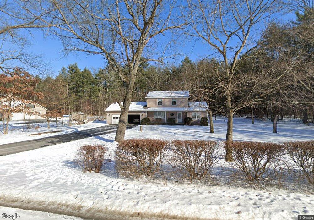
19 Michael Rd Fort Edward, NY 12828
Moreau NeighborhoodEstimated Value: $372,230 - $432,000
3
Beds
2
Baths
1,768
Sq Ft
$225/Sq Ft
Est. Value
About This Home
This home is located at 19 Michael Rd, Fort Edward, NY 12828 and is currently estimated at $398,558, approximately $225 per square foot. 19 Michael Rd is a home located in Saratoga County.
Create a Home Valuation Report for This Property
The Home Valuation Report is an in-depth analysis detailing your home's value as well as a comparison with similar homes in the area
Home Values in the Area
Average Home Value in this Area
Tax History Compared to Growth
Tax History
| Year | Tax Paid | Tax Assessment Tax Assessment Total Assessment is a certain percentage of the fair market value that is determined by local assessors to be the total taxable value of land and additions on the property. | Land | Improvement |
|---|---|---|---|---|
| 2024 | $3,758 | $295,000 | $55,000 | $240,000 |
| 2023 | $3,157 | $276,000 | $55,000 | $221,000 |
| 2022 | $3,022 | $251,000 | $44,200 | $206,800 |
| 2021 | $2,974 | $232,000 | $44,200 | $187,800 |
| 2020 | $2,758 | $215,000 | $44,200 | $170,800 |
| 2019 | $2,782 | $215,000 | $44,200 | $170,800 |
| 2018 | $2,697 | $215,000 | $44,200 | $170,800 |
| 2017 | $2,654 | $215,000 | $44,200 | $170,800 |
| 2016 | $2,660 | $215,000 | $44,200 | $170,800 |
Source: Public Records
Map
Nearby Homes
- 22 Oak View Dr
- 8 Coriander Dr
- 480 Selfridge Rd
- 516 Selfridge Rd
- 550 E Selfridge Rd
- 414 Reynolds Rd
- 408 Reynolds Rd
- 570 Selfridge Rd
- 347 Diane Ln
- 37 Curtis Ln
- 1384 State Route 9
- 18 Amber Ln
- 273 Gansevoort Rd
- 360 Selfridge Rd
- 350 Selfridge Rd
- 330 Selfridge Rd
- 169 Reservoir Rd
- 228 Reynolds Rd
- 7 Balsam Ln
- 151 Reservoir Rd