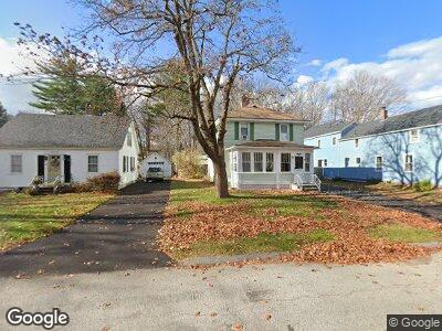
19 Middle St Westbrook, ME 04092
Estimated Value: $432,251 - $499,000
3
Beds
2
Baths
1,440
Sq Ft
$324/Sq Ft
Est. Value
About This Home
This home is located at 19 Middle St, Westbrook, ME 04092 and is currently estimated at $466,813, approximately $324 per square foot. 19 Middle St is a home located in Cumberland County with nearby schools including Westbrook High School, The Little Dolphin School Foundation, and Breakwater School.
Ownership History
Date
Name
Owned For
Owner Type
Purchase Details
Closed on
Nov 23, 2009
Sold by
Toppi Patricia A
Bought by
Trecartin David F
Current Estimated Value
Home Financials for this Owner
Home Financials are based on the most recent Mortgage that was taken out on this home.
Original Mortgage
$183,673
Interest Rate
4.86%
Mortgage Type
FHA
Purchase Details
Closed on
Aug 15, 2005
Sold by
Kelly Carol S
Bought by
Toppi Patricia A and Salpietra Paul D
Home Financials for this Owner
Home Financials are based on the most recent Mortgage that was taken out on this home.
Original Mortgage
$208,500
Interest Rate
5.54%
Mortgage Type
Purchase Money Mortgage
Create a Home Valuation Report for This Property
The Home Valuation Report is an in-depth analysis detailing your home's value as well as a comparison with similar homes in the area
Home Values in the Area
Average Home Value in this Area
Purchase History
| Date | Buyer | Sale Price | Title Company |
|---|---|---|---|
| Trecartin David F | -- | -- | |
| Toppi Patricia A | -- | -- |
Source: Public Records
Mortgage History
| Date | Status | Borrower | Loan Amount |
|---|---|---|---|
| Open | Trecartin David F | $125,000 | |
| Closed | Trecartin David F | $181,069 | |
| Closed | Toppi Patricia A | $183,673 | |
| Previous Owner | Toppi Patricia A | $208,500 | |
| Previous Owner | Kelley Carol | $85,000 |
Source: Public Records
Tax History Compared to Growth
Tax History
| Year | Tax Paid | Tax Assessment Tax Assessment Total Assessment is a certain percentage of the fair market value that is determined by local assessors to be the total taxable value of land and additions on the property. | Land | Improvement |
|---|---|---|---|---|
| 2023 | $4,397 | $263,600 | $82,200 | $181,400 |
| 2022 | $3,987 | $220,300 | $68,500 | $151,800 |
| 2021 | $3,928 | $220,300 | $68,500 | $151,800 |
| 2020 | $3,935 | $220,300 | $68,500 | $151,800 |
| 2019 | $3,935 | $220,300 | $68,500 | $151,800 |
| 2018 | $4,000 | $200,500 | $59,600 | $140,900 |
| 2017 | $3,785 | $200,500 | $59,600 | $140,900 |
| 2016 | $3,689 | $200,500 | $59,600 | $140,900 |
| 2015 | $3,601 | $200,500 | $59,600 | $140,900 |
| 2014 | $3,449 | $200,500 | $59,600 | $140,900 |
| 2013 | $3,449 | $200,500 | $59,600 | $140,900 |
Source: Public Records
Map
Nearby Homes
- 154 Brackett St
- 124 Brackett St
- 199 Central St
- 27 & 31 Cross St
- 7 Blue Spruce Farm Rd
- 29 Winslow St
- 11 New Gorham Rd
- 75-77 Bridge St
- 345 Saco St Unit 20
- 500 Spring St
- 71 New Gorham Rd
- 0 Eisenhower Dr
- 30 Lincoln St Unit 120
- 197 Bridge St
- 18 Locust St
- 38 Cottage Place
- 35 Greenfield Dr Unit 35
- 156 Lot A Conant St
- 5 Everett Ct
- 95 Harrisburg Ave