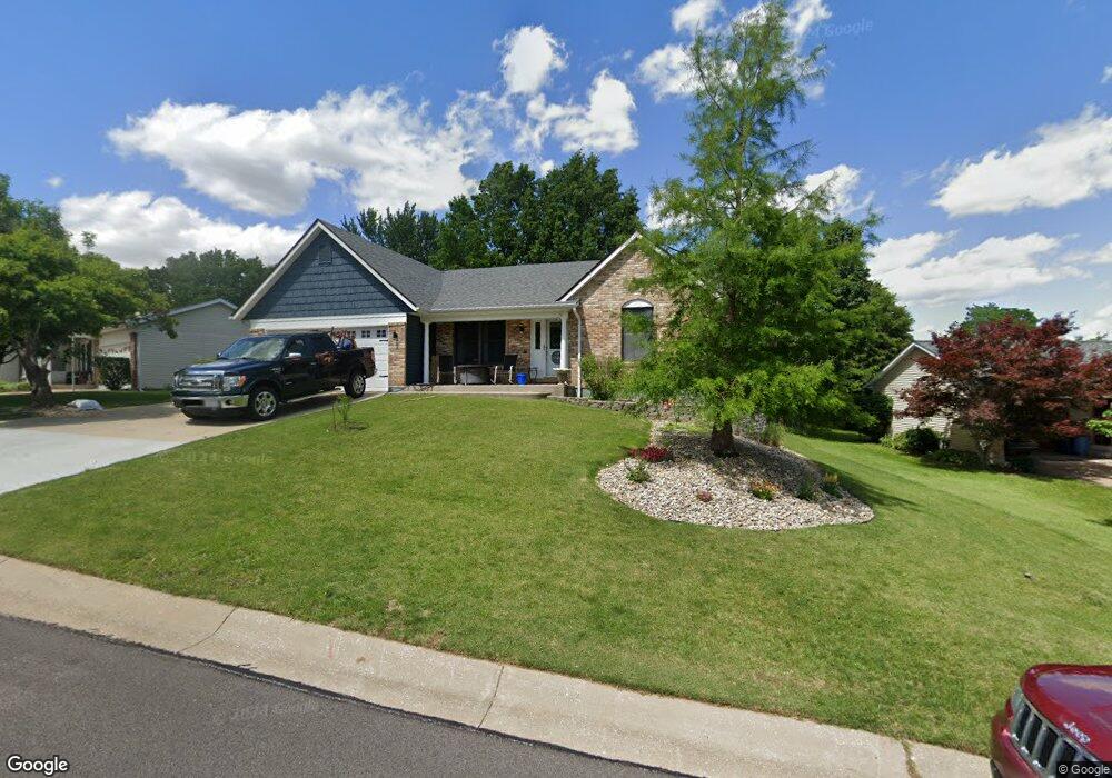
19 Mike Alan Dr Washington, MO 63090
Estimated Value: $308,182 - $365,000
3
Beds
3
Baths
1,589
Sq Ft
$213/Sq Ft
Est. Value
About This Home
This home is located at 19 Mike Alan Dr, Washington, MO 63090 and is currently estimated at $338,546, approximately $213 per square foot. 19 Mike Alan Dr is a home located in Franklin County with nearby schools including Washington High School, Our Lady of Lourdes Catholic School, and St. Francis Borgia Catholic School.
Ownership History
Date
Name
Owned For
Owner Type
Purchase Details
Closed on
Jun 29, 2009
Sold by
Richards Thomas Clay and Richards Christina L
Bought by
Richards Thomas Clay and Richards Christina L
Current Estimated Value
Purchase Details
Closed on
Sep 9, 2005
Sold by
Benson Michael and Benson Krissy D
Bought by
Richards Thomas Clay and Hughes Christina L
Home Financials for this Owner
Home Financials are based on the most recent Mortgage that was taken out on this home.
Original Mortgage
$145,600
Outstanding Balance
$77,553
Interest Rate
5.78%
Mortgage Type
New Conventional
Estimated Equity
$260,993
Create a Home Valuation Report for This Property
The Home Valuation Report is an in-depth analysis detailing your home's value as well as a comparison with similar homes in the area
Home Values in the Area
Average Home Value in this Area
Purchase History
| Date | Buyer | Sale Price | Title Company |
|---|---|---|---|
| Richards Thomas Clay | -- | None Available | |
| Richards Thomas Clay | -- | None Available |
Source: Public Records
Mortgage History
| Date | Status | Borrower | Loan Amount |
|---|---|---|---|
| Open | Richards Thomas Clay | $145,600 |
Source: Public Records
Tax History Compared to Growth
Tax History
| Year | Tax Paid | Tax Assessment Tax Assessment Total Assessment is a certain percentage of the fair market value that is determined by local assessors to be the total taxable value of land and additions on the property. | Land | Improvement |
|---|---|---|---|---|
| 2024 | $2,173 | $38,285 | $0 | $0 |
| 2023 | $2,173 | $38,285 | $0 | $0 |
| 2022 | $2,044 | $35,971 | $0 | $0 |
| 2021 | $2,038 | $35,971 | $0 | $0 |
| 2020 | $1,913 | $32,507 | $0 | $0 |
| 2019 | $1,909 | $32,507 | $0 | $0 |
| 2018 | $1,849 | $31,246 | $0 | $0 |
| 2017 | $1,846 | $31,246 | $0 | $0 |
| 2016 | $1,653 | $28,464 | $0 | $0 |
| 2015 | $1,652 | $28,464 | $0 | $0 |
| 2014 | $1,666 | $28,724 | $0 | $0 |
Source: Public Records
Map
Nearby Homes
- 101 Wenona Dr
- 203 Wenona Dr
- 136 Monticello Dr
- 176 Pellins Ct
- 2205 Ashton Hills Ct
- 2995 Halls Green Dr
- 178 Hank's Close Ct Unit 178 STB
- 180 Hank's Close Unit 180 STB
- 162 Pellin's Ct Unit 162 STB
- 2286 Statten Dr
- 182 Hank's Close Unit 182 STB
- 2113 Weber Heights Dr
- 181 Hank's Close Unit 181 STB
- 1246 Deer Run Dr
- 2783 Earth Crest Dr
- 2785 Earth Crest Dr
- 2916 Shirley Close Rd
- 1205 Caroline Dr
- 2789 Earth Crest Dr
- 2313 Clare Ct Unit 70 STB
- 21 Mike Alan Dr
- 17 Mike Alan Dr
- 11 Rebecca Ct
- 15 Mike Alan Dr
- 13 Rebecca Ct
- 1 Edward Place
- 21 Edward Place
- 9 Rebecca Ct
- 28 Mike Alan Dr
- 25 Mike Alan Dr
- 26 Mike Alan Dr
- 13 Mike Alan Dr
- 19 Edward Place
- 15 Rebecca Ct
- 24 Mike Alan Dr
- 3 Edward Place
- 34 Mike Alan Dr
- 7 Rebecca Ct
- 106 Wenona Dr
- 11 Mike Alan Dr