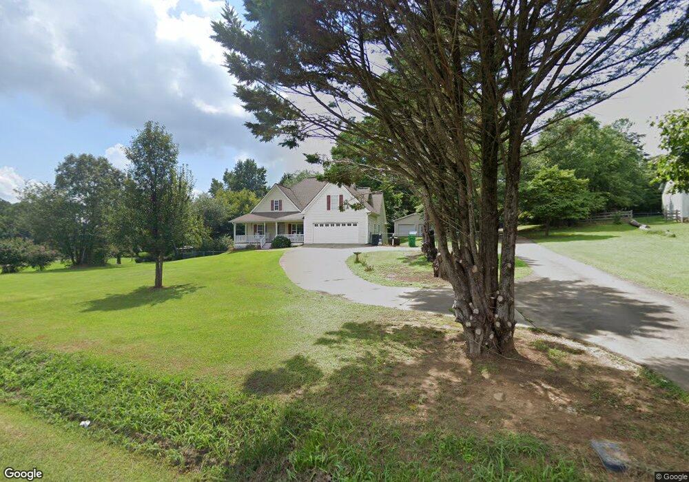
19 Mist Tree Ln Jasper, GA 30143
Estimated Value: $349,000 - $502,000
3
Beds
3
Baths
1,726
Sq Ft
$236/Sq Ft
Est. Value
About This Home
This home is located at 19 Mist Tree Ln, Jasper, GA 30143 and is currently estimated at $406,556, approximately $235 per square foot. 19 Mist Tree Ln is a home located in Pickens County with nearby schools including Hill City Elementary School, Pickens County Middle School, and Pickens County High School.
Ownership History
Date
Name
Owned For
Owner Type
Purchase Details
Closed on
Feb 7, 2007
Sold by
Faix James M
Bought by
Doss Jerry
Current Estimated Value
Purchase Details
Closed on
Mar 15, 2006
Sold by
Faix James M
Bought by
Faix Vivian Sheri
Purchase Details
Closed on
Jul 11, 2003
Sold by
Gibson William W
Bought by
Faix James M
Purchase Details
Closed on
Feb 13, 1984
Sold by
Doss Jerry and Doss Faye
Bought by
Gibson William W
Purchase Details
Closed on
Mar 29, 1973
Sold by
Doss Jerry and Doss Faye
Bought by
Gibson William W
Create a Home Valuation Report for This Property
The Home Valuation Report is an in-depth analysis detailing your home's value as well as a comparison with similar homes in the area
Home Values in the Area
Average Home Value in this Area
Purchase History
| Date | Buyer | Sale Price | Title Company |
|---|---|---|---|
| Doss Jerry | $215,000 | -- | |
| Faix Vivian Sheri | -- | -- | |
| Faix James M | $165,000 | -- | |
| Gibson William W | -- | -- | |
| Gibson William W | -- | -- |
Source: Public Records
Tax History Compared to Growth
Tax History
| Year | Tax Paid | Tax Assessment Tax Assessment Total Assessment is a certain percentage of the fair market value that is determined by local assessors to be the total taxable value of land and additions on the property. | Land | Improvement |
|---|---|---|---|---|
| 2024 | $2,269 | $122,404 | $12,504 | $109,900 |
| 2023 | $1,418 | $77,524 | $6,252 | $71,272 |
| 2022 | $539 | $77,524 | $6,252 | $71,272 |
| 2021 | $543 | $77,524 | $6,252 | $71,272 |
| 2020 | $552 | $77,524 | $6,252 | $71,272 |
| 2019 | $1,665 | $77,524 | $6,252 | $71,272 |
| 2018 | $1,681 | $77,524 | $6,252 | $71,272 |
| 2017 | $1,708 | $77,524 | $6,252 | $71,272 |
| 2016 | $1,730 | $77,284 | $6,012 | $71,272 |
| 2015 | $1,686 | $77,284 | $6,012 | $71,272 |
| 2014 | $1,686 | $77,284 | $6,012 | $71,272 |
| 2013 | -- | $77,284 | $6,011 | $71,272 |
Source: Public Records
Map
Nearby Homes
- 616 Gibson Trail
- 681 Mullinax Rd
- 310 Comet Ln
- 828 Rocky Ridge Rd
- 88 Hill City Trail
- 6472 Highway 53
- 126 Jerusalem Farms Dr
- 110 Jerusalem Farms Dr
- 280 Matthews Rd
- 344 Cain Trail
- Lot 4 Jerusalem Church Rd
- 1350 Stivers Rd
- 19 Thomason Farm Dr
- 0 Hill City Rd Unit 7600458
- 0 Hill City Rd Unit 10547283
- Lot 1 Thompson Ln
- 2075 Jerusalem Church Rd
- 171 Field Stone Cir
- 258 Westwind Ct
- 165 Field Stone Cir
- 236 Gibson Trail
- 77 Mist Tree Ln
- 200 Gibson Trail
- 24 Allies Way
- 100 Mist Tree Ln
- 106 Gibson Trail Unit 4
- 106 Gibson Trail
- 144 Mist Tree Ln
- 341 Gibson Trail
- 285 Gibson Trail
- 0 Gibson Trail Unit 8787044
- 0 Gibson Trail
- 175 Gibson Trail
- 100 Gibson Trail
- 462 Gibson Trail
- 420 Gibson Trail
- 984 Mullinax Rd
- 98 Gibson Trail
- 192 Allies Way
- 181 Allies Way