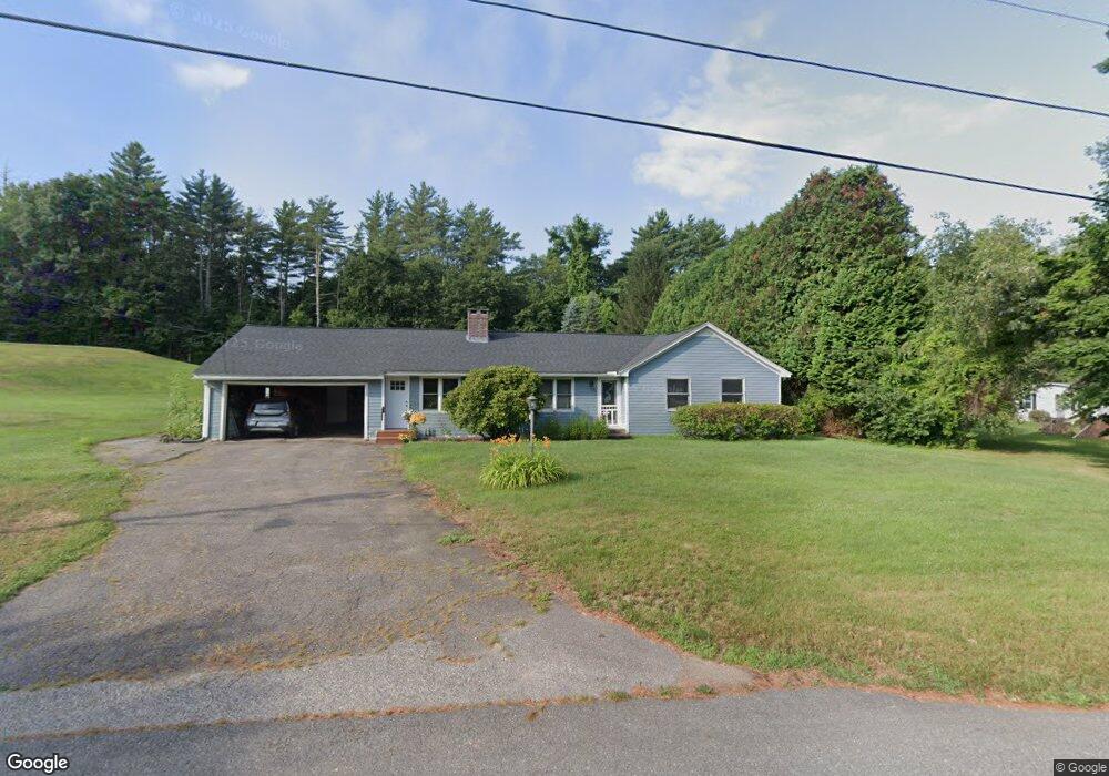
19 Old Turnpike Rd Northfield, MA 01360
Estimated Value: $368,719 - $431,000
4
Beds
2
Baths
1,696
Sq Ft
$236/Sq Ft
Est. Value
About This Home
This home is located at 19 Old Turnpike Rd, Northfield, MA 01360 and is currently estimated at $400,930, approximately $236 per square foot. 19 Old Turnpike Rd is a home located in Franklin County with nearby schools including Pioneer Valley Regional.
Ownership History
Date
Name
Owned For
Owner Type
Purchase Details
Closed on
Oct 19, 2010
Sold by
Laplante Peter J and Laplante Madeline L
Bought by
Garland Patrick R and Garland Diane E
Current Estimated Value
Home Financials for this Owner
Home Financials are based on the most recent Mortgage that was taken out on this home.
Original Mortgage
$160,000
Outstanding Balance
$105,223
Interest Rate
4.36%
Mortgage Type
Purchase Money Mortgage
Estimated Equity
$295,707
Purchase Details
Closed on
Nov 20, 1992
Sold by
Bauld Harold J and Straus Martha B
Bought by
Laplante Peter J and Laplante Madeline L
Create a Home Valuation Report for This Property
The Home Valuation Report is an in-depth analysis detailing your home's value as well as a comparison with similar homes in the area
Home Values in the Area
Average Home Value in this Area
Purchase History
| Date | Buyer | Sale Price | Title Company |
|---|---|---|---|
| Garland Patrick R | $204,000 | -- | |
| Laplante Peter J | $115,000 | -- |
Source: Public Records
Mortgage History
| Date | Status | Borrower | Loan Amount |
|---|---|---|---|
| Open | Garland Patrick R | $160,000 | |
| Previous Owner | Laplante Peter J | $20,000 | |
| Previous Owner | Laplante Peter J | $106,000 | |
| Previous Owner | Laplante Peter J | $112,000 | |
| Previous Owner | Laplante Peter J | $20,500 |
Source: Public Records
Tax History Compared to Growth
Tax History
| Year | Tax Paid | Tax Assessment Tax Assessment Total Assessment is a certain percentage of the fair market value that is determined by local assessors to be the total taxable value of land and additions on the property. | Land | Improvement |
|---|---|---|---|---|
| 2025 | $4,126 | $298,100 | $52,700 | $245,400 |
| 2024 | $3,933 | $289,600 | $49,700 | $239,900 |
| 2023 | $3,557 | $261,900 | $49,300 | $212,600 |
| 2022 | $3,201 | $231,100 | $49,300 | $181,800 |
| 2021 | $3,535 | $219,300 | $46,800 | $172,500 |
| 2020 | $3,458 | $208,200 | $44,600 | $163,600 |
| 2019 | $3,450 | $198,300 | $42,500 | $155,800 |
| 2018 | $3,417 | $191,300 | $42,500 | $148,800 |
| 2017 | $3,147 | $191,300 | $42,500 | $148,800 |
| 2016 | $3,040 | $191,300 | $42,500 | $148,800 |
| 2015 | $3,222 | $193,500 | $42,500 | $151,000 |
Source: Public Records
Map
Nearby Homes
- 22 Old Turnpike Rd
- 294 Capt Beers Plain Rd
- 12 Parker Ave Unit 1
- 94 Main St
- 181 Main St
- 14 Wood Way
- 719 Mount Hermon Station Rd
- 104 S Mountain Rd
- 0 Sears St Unit 23759828
- Lot 14 Northfield Rd
- 529 S Mountain Rd
- 0 Meadow View Ln & Pine Meadow
- 0 Old Tipping Rock Rd Unit 34
- 339 Burt Hill Rd
- 0, Lot 2 Flower Hill Rd
- 0, Lot 1 Flower Hill Rd
- 49 Whitetail Dr
- 801 Newton Rd
- 180 Bald Mountain Rd
- 0 Northfield Rd Unit 73441997
- 15 Old Turnpike Rd
- 24 Old Turnpike Rd
- 171 Warwick Rd
- 21 Old Turnpike Rd
- 7 Old Turnpike Rd
- 168 Warwick Rd
- 183 Warwick Rd
- 78 Commonwealth Ave
- 65 Saint Marys St
- 65 St Mary's St
- 0 Warwick Rd and St Mary's St
- 1 Strowbridge Rd
- 0 Commonwealth
- 182 Warwick Rd
- 0 Strowbridge Rd
- 189 Warwick Rd
- 72 Commonwealth Ave
- 78 Saint Marys St
- 00 Old Turnpike Rd
- 0 Old Turnpike Rd