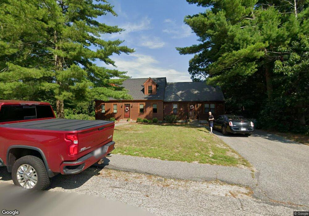
19 Packet Landing Unit B Pembroke, MA 02359
Estimated Value: $376,302 - $472,000
--
Bed
1
Bath
755
Sq Ft
$548/Sq Ft
Est. Value
About This Home
This home is located at 19 Packet Landing Unit B, Pembroke, MA 02359 and is currently estimated at $413,576, approximately $547 per square foot. 19 Packet Landing Unit B is a home located in Plymouth County with nearby schools including Pembroke High School, Cadence Academy Preschool - Hanover, and Cardinal Cushing Centers.
Ownership History
Date
Name
Owned For
Owner Type
Purchase Details
Closed on
Dec 8, 1997
Sold by
Water St T and Barrett Robert J
Bought by
Fay Michael P and Fay Julie A
Current Estimated Value
Home Financials for this Owner
Home Financials are based on the most recent Mortgage that was taken out on this home.
Original Mortgage
$121,600
Outstanding Balance
$20,663
Interest Rate
7.28%
Mortgage Type
Purchase Money Mortgage
Estimated Equity
$392,913
Create a Home Valuation Report for This Property
The Home Valuation Report is an in-depth analysis detailing your home's value as well as a comparison with similar homes in the area
Home Values in the Area
Average Home Value in this Area
Purchase History
| Date | Buyer | Sale Price | Title Company |
|---|---|---|---|
| Fay Michael P | $128,000 | -- |
Source: Public Records
Mortgage History
| Date | Status | Borrower | Loan Amount |
|---|---|---|---|
| Open | Fay Michael P | $121,600 |
Source: Public Records
Tax History Compared to Growth
Tax History
| Year | Tax Paid | Tax Assessment Tax Assessment Total Assessment is a certain percentage of the fair market value that is determined by local assessors to be the total taxable value of land and additions on the property. | Land | Improvement |
|---|---|---|---|---|
| 2025 | $3,812 | $317,100 | $0 | $317,100 |
| 2024 | $3,660 | $304,200 | $0 | $304,200 |
| 2023 | $3,656 | $287,400 | $0 | $287,400 |
| 2022 | $3,741 | $264,400 | $0 | $264,400 |
| 2021 | $3,439 | $235,900 | $0 | $235,900 |
| 2020 | $3,712 | $256,200 | $0 | $256,200 |
| 2019 | $3,517 | $240,900 | $0 | $240,900 |
| 2018 | $3,286 | $220,700 | $0 | $220,700 |
| 2017 | $3,221 | $213,300 | $0 | $213,300 |
| 2016 | $2,812 | $184,300 | $0 | $184,300 |
| 2015 | $2,730 | $185,200 | $0 | $185,200 |
Source: Public Records
Map
Nearby Homes
- 218 Schoosett St
- 21 Union St
- 21 Chowdermarch St
- 5 Royal Dane Dr Unit 46
- 5 Royal Dane Dr Unit 45
- 10 Penstock Ln
- 451 School St Unit 5-2
- 451 School St Unit 3-4
- 55 Shipyard Ln
- 172 Washington St
- 34 Canonchet Trail
- 261 Washington St
- 20 Meadow Brook Rd
- 10 Shrine Rd
- 26 Church St
- 56 Wiltshire Ln
- 33 Barker Square Dr Unit 33
- 899 Old Main Street Extension
- 330 Pleasant St
- 2 Proprietors Dr Unit 23
- 19 Packet Landing Unit A
- 19 Packet Landing
- 19 Packet Landing Unit 19A
- 13 Packet Landing Unit B
- 13 Packet Landing Unit A
- 25A Packet Landing Unit 25A
- 25 Packet Landing Unit B
- 25 Packet Landing Unit A
- 25 Packet Landing Unit 25B
- 25A Packet Landing
- 25A Packet Landing Unit A
- 16 Packet Landing Unit B
- 16 Packet Landing Unit A
- 16 Packet Landing Unit 16B
- 22 Packet Landing Unit B
- 22 Packet Landing Unit A
- 22 Packet Landing Unit 6
- 22 Packet Landing Unit 22B
- 22 Packet Landing Unit 22A
- 31 Packet Landing Unit B