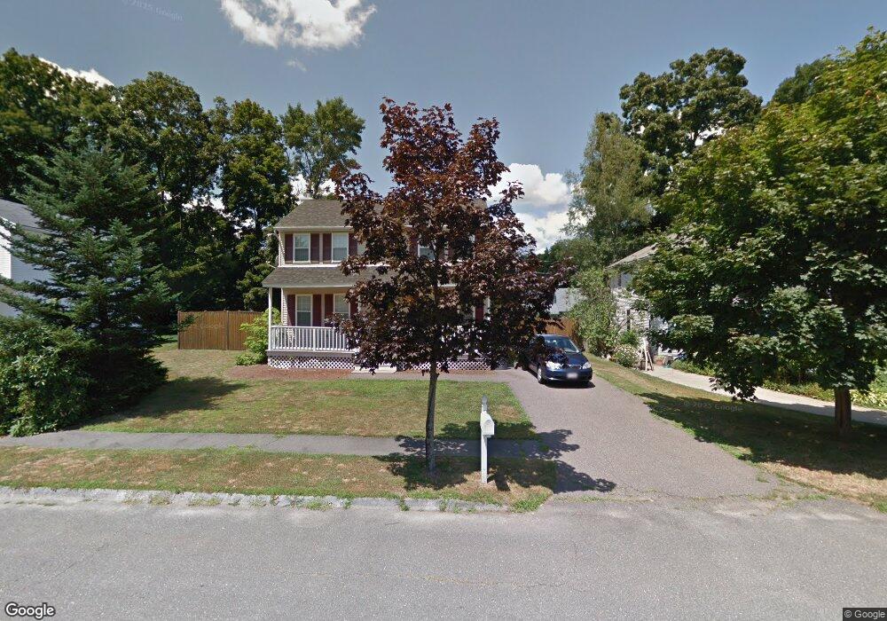
19 Paula Ln Haverhill, MA 01830
Riverside NeighborhoodEstimated Value: $544,000 - $609,451
3
Beds
2
Baths
1,470
Sq Ft
$392/Sq Ft
Est. Value
About This Home
This home is located at 19 Paula Ln, Haverhill, MA 01830 and is currently estimated at $576,863, approximately $392 per square foot. 19 Paula Ln is a home located in Essex County with nearby schools including Golden Hill, Dr. Paul Nettle Middle School, and Haverhill High School.
Ownership History
Date
Name
Owned For
Owner Type
Purchase Details
Closed on
Mar 25, 2011
Sold by
Charlton Andrew J
Bought by
Huberdeau Danielle M
Current Estimated Value
Home Financials for this Owner
Home Financials are based on the most recent Mortgage that was taken out on this home.
Original Mortgage
$145,000
Interest Rate
5.07%
Mortgage Type
Purchase Money Mortgage
Purchase Details
Closed on
Oct 25, 2007
Sold by
Milward Chris and Barratt Staci Lee
Bought by
Charlton Andrew J
Home Financials for this Owner
Home Financials are based on the most recent Mortgage that was taken out on this home.
Original Mortgage
$297,000
Interest Rate
6.39%
Mortgage Type
Purchase Money Mortgage
Purchase Details
Closed on
Jun 29, 2001
Sold by
Horgan Daniel E and Horgan Cindy L
Bought by
Milward Chris and Barratt Staci Lee
Create a Home Valuation Report for This Property
The Home Valuation Report is an in-depth analysis detailing your home's value as well as a comparison with similar homes in the area
Home Values in the Area
Average Home Value in this Area
Purchase History
| Date | Buyer | Sale Price | Title Company |
|---|---|---|---|
| Huberdeau Danielle M | $185,000 | -- | |
| Charlton Andrew J | $330,000 | -- | |
| Milward Chris | $239,900 | -- |
Source: Public Records
Mortgage History
| Date | Status | Borrower | Loan Amount |
|---|---|---|---|
| Open | Milward Chris | $167,000 | |
| Closed | Milward Chris | $145,000 | |
| Previous Owner | Milward Chris | $297,000 |
Source: Public Records
Tax History Compared to Growth
Tax History
| Year | Tax Paid | Tax Assessment Tax Assessment Total Assessment is a certain percentage of the fair market value that is determined by local assessors to be the total taxable value of land and additions on the property. | Land | Improvement |
|---|---|---|---|---|
| 2025 | $5,489 | $512,500 | $186,100 | $326,400 |
| 2024 | $5,116 | $480,800 | $176,800 | $304,000 |
| 2023 | $4,897 | $439,200 | $161,300 | $277,900 |
| 2022 | $4,705 | $369,900 | $142,700 | $227,200 |
| 2021 | $4,660 | $346,700 | $136,500 | $210,200 |
| 2020 | $4,624 | $340,000 | $134,900 | $205,100 |
| 2019 | $4,506 | $323,000 | $117,900 | $205,100 |
| 2018 | $4,435 | $311,000 | $117,900 | $193,100 |
| 2017 | $4,314 | $287,800 | $105,500 | $182,300 |
| 2016 | $4,367 | $284,300 | $105,500 | $178,800 |
| 2015 | $4,364 | $284,300 | $105,500 | $178,800 |
Source: Public Records
Map
Nearby Homes
- 29 Claremont Ave
- 420 Water St
- 121 Linwood St
- 190 &196 Summer St
- 26 Elmwood Ave
- 104 Keeley St Unit A
- 65 Madison St Unit 65
- 54 Lincoln Ave
- 2 S Summer St
- 26 Harding Ave
- 30 Colby St
- 52 Summer St Unit 4
- 1 Bartlett Ave Unit F
- 27 Webster St
- 32 Harding Ave
- 8 Bartlett Ave Unit 5
- 6 Summit Ave
- 4 Michael Anthony Rd
- 1 Michael Anthony Rd
- 61 Arlington St Unit 4
- 15 Paula Ln
- 23 Paula Ln
- 23 Garrison Ave
- 31 Garrison Ave Unit 31
- 33 Garrison Ave Unit 1
- 33 Garrison Ave
- 37 Garrison Ave
- 20 Paula Ln
- 19 Garrison Ave
- 11 Paula Ln
- 24 Paula Ln
- 45 Garrison Ave
- 3 Erika Way
- 11 Garrison Ave
- 28 Garrison Ave
- 32 Garrison Ave
- 24 Garrison Ave
- 38 Garrison Ave
- 20 Garrison Ave
- 47 Garrison Ave