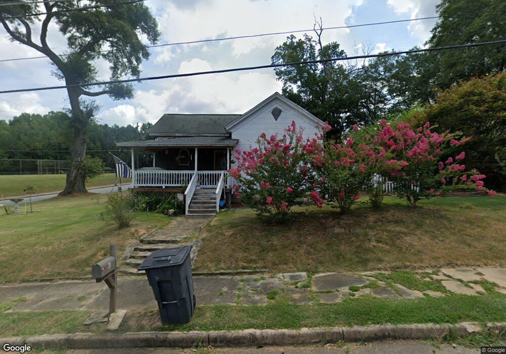
19 Pershing St Manchester, GA 31816
Estimated Value: $60,908 - $112,000
3
Beds
1
Bath
1,120
Sq Ft
$75/Sq Ft
Est. Value
About This Home
This home is located at 19 Pershing St, Manchester, GA 31816 and is currently estimated at $83,977, approximately $74 per square foot. 19 Pershing St is a home located in Meriwether County with nearby schools including Mountain View Elementary School, Manchester Middle School, and Manchester High School.
Ownership History
Date
Name
Owned For
Owner Type
Purchase Details
Closed on
Oct 2, 2006
Sold by
Not Provided
Bought by
Stirrup John
Current Estimated Value
Home Financials for this Owner
Home Financials are based on the most recent Mortgage that was taken out on this home.
Original Mortgage
$35,000
Outstanding Balance
$20,113
Interest Rate
6.36%
Mortgage Type
New Conventional
Estimated Equity
$63,864
Purchase Details
Closed on
Oct 5, 2001
Sold by
Hendrix Grace M
Bought by
Gibson Lynda H
Purchase Details
Closed on
Apr 4, 1997
Sold by
Hendrix Columbus L
Bought by
Hendrix Grace M
Purchase Details
Closed on
Jan 1, 1946
Bought by
Hendrix Columbus L
Create a Home Valuation Report for This Property
The Home Valuation Report is an in-depth analysis detailing your home's value as well as a comparison with similar homes in the area
Home Values in the Area
Average Home Value in this Area
Purchase History
| Date | Buyer | Sale Price | Title Company |
|---|---|---|---|
| Stirrup John | $35,000 | -- | |
| Gibson Lynda H | -- | -- | |
| Hendrix Grace M | -- | -- | |
| Hendrix Columbus L | -- | -- |
Source: Public Records
Mortgage History
| Date | Status | Borrower | Loan Amount |
|---|---|---|---|
| Open | Stirrup John | $35,000 | |
| Closed | Stirrup John | $35,000 |
Source: Public Records
Tax History
| Year | Tax Paid | Tax Assessment Tax Assessment Total Assessment is a certain percentage of the fair market value that is determined by local assessors to be the total taxable value of land and additions on the property. | Land | Improvement |
|---|---|---|---|---|
| 2024 | $510 | $12,080 | $3,800 | $8,280 |
| 2023 | $524 | $12,080 | $3,800 | $8,280 |
| 2022 | $524 | $12,080 | $3,800 | $8,280 |
| 2021 | $323 | $12,080 | $3,800 | $8,280 |
| 2020 | $325 | $12,080 | $3,800 | $8,280 |
| 2019 | $326 | $12,080 | $3,800 | $8,280 |
| 2018 | $330 | $12,080 | $3,800 | $8,280 |
| 2017 | $334 | $12,080 | $3,800 | $8,280 |
| 2016 | $333 | $12,080 | $3,800 | $8,280 |
| 2015 | $334 | $12,080 | $3,800 | $8,280 |
| 2014 | $334 | $12,080 | $3,800 | $8,280 |
| 2013 | -- | $12,080 | $3,800 | $8,280 |
Source: Public Records
Map
Nearby Homes
Your Personal Tour Guide
Ask me questions while you tour the home.