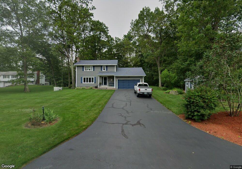
19 Pheasant Run MerriMacK, NH 03054
Estimated Value: $579,000 - $650,000
3
Beds
4
Baths
2,205
Sq Ft
$274/Sq Ft
Est. Value
About This Home
This home is located at 19 Pheasant Run, MerriMacK, NH 03054 and is currently estimated at $603,436, approximately $273 per square foot. 19 Pheasant Run is a home located in Hillsborough County with nearby schools including Reeds Ferry School, James Mastricola Upper Elementary School, and Merrimack Middle School.
Ownership History
Date
Name
Owned For
Owner Type
Purchase Details
Closed on
Nov 21, 2022
Sold by
Tilton Kenneth A and Tilton Marion L
Bought by
K A Tilton & Marion Ft
Current Estimated Value
Purchase Details
Closed on
May 22, 1987
Bought by
Tilton Kenneth A and Tilton Marion L
Create a Home Valuation Report for This Property
The Home Valuation Report is an in-depth analysis detailing your home's value as well as a comparison with similar homes in the area
Home Values in the Area
Average Home Value in this Area
Purchase History
| Date | Buyer | Sale Price | Title Company |
|---|---|---|---|
| K A Tilton & Marion Ft | -- | None Available | |
| Tilton Kenneth A | $156,000 | -- |
Source: Public Records
Mortgage History
| Date | Status | Borrower | Loan Amount |
|---|---|---|---|
| Previous Owner | Tilton Kenneth A | $52,500 |
Source: Public Records
Tax History Compared to Growth
Tax History
| Year | Tax Paid | Tax Assessment Tax Assessment Total Assessment is a certain percentage of the fair market value that is determined by local assessors to be the total taxable value of land and additions on the property. | Land | Improvement |
|---|---|---|---|---|
| 2024 | $8,624 | $416,800 | $221,400 | $195,400 |
| 2023 | $8,107 | $416,800 | $221,400 | $195,400 |
| 2022 | $7,244 | $416,800 | $221,400 | $195,400 |
| 2021 | $7,156 | $416,800 | $221,400 | $195,400 |
| 2020 | $7,386 | $307,000 | $155,400 | $151,600 |
| 2019 | $7,331 | $303,800 | $155,400 | $148,400 |
| 2018 | $7,328 | $303,800 | $155,400 | $148,400 |
| 2017 | $7,100 | $303,800 | $155,400 | $148,400 |
| 2016 | $6,924 | $303,800 | $155,400 | $148,400 |
| 2015 | $6,622 | $267,900 | $144,500 | $123,400 |
| 2014 | $6,454 | $267,900 | $144,500 | $123,400 |
| 2013 | $6,405 | $267,900 | $144,500 | $123,400 |
Source: Public Records
Map
Nearby Homes
- 29 Bedford Rd
- 22 Kimberly Dr
- 5 Barbie Ct
- 18 Horizon Dr
- 19 Vista Way
- 1 Pleasant St
- 38 Mallard Point
- 9 Mustang Dr Unit C
- 9 Mustang Dr Unit B
- 7 Mustang Dr Unit C
- 7 Mustang Dr Unit END UNIT-A
- 490 Charles Bancroft Hwy
- 3-C Mustang Dr Unit MODEL
- 10 Kingston Ct Unit 10
- 22 Essex Green Ct
- 11 Essex Green Ct
- 12 Clinton Ct
- 769 Daniel Webster Hwy
- 16 Summit Rd
- 56 Greenfield Pkwy
- 17 Pheasant Run
- 16 Pheasant Run
- 18 Pheasant Run
- 15 Pheasant Run
- 20 Pheasant Run
- 21 Pheasant Run
- 5 Liberty Ln
- 22 Pheasant Run
- 6 Liberty Ln
- 6 Liberty Ln Unit 331
- 23 Pheasant Run
- 87 Belmont Dr
- 89 Belmont Dr
- 91 Belmont Dr
- 85 Belmont Dr
- 3 Liberty Ln
- 4 Liberty Ln
- 93 Belmont Dr
- 25 Pheasant Run
- 83 Belmont Dr