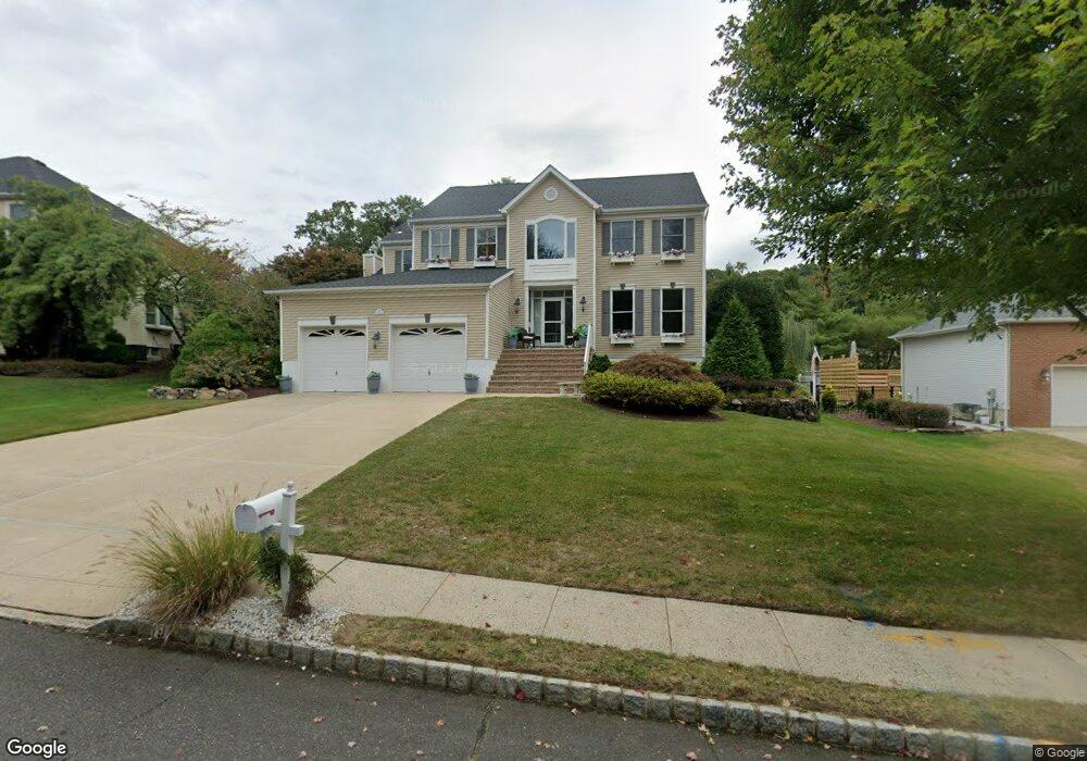
19 Presidential Path Atlantic Highlands, NJ 07716
New Monmouth NeighborhoodEstimated Value: $965,000 - $1,365,000
4
Beds
3
Baths
2,781
Sq Ft
$417/Sq Ft
Est. Value
About This Home
This home is located at 19 Presidential Path, Atlantic Highlands, NJ 07716 and is currently estimated at $1,159,318, approximately $416 per square foot. 19 Presidential Path is a home located in Monmouth County with nearby schools including Leonardo Elementary School, Bayshore Middle School, and Middletown - South High School.
Ownership History
Date
Name
Owned For
Owner Type
Purchase Details
Closed on
Mar 28, 2023
Sold by
Harrison Marc and Harrison Carrie
Bought by
Carrie Harrison Declaration Of Trust
Current Estimated Value
Purchase Details
Closed on
Jul 19, 2016
Sold by
Harrison Marc
Bought by
Harrison Marc and Harrison Carrie
Purchase Details
Closed on
Mar 8, 2004
Sold by
Dellanno Robert
Bought by
Newland Edward and Newland Laura
Home Financials for this Owner
Home Financials are based on the most recent Mortgage that was taken out on this home.
Original Mortgage
$532,000
Interest Rate
5.56%
Purchase Details
Closed on
Feb 8, 1996
Sold by
Spatial Design Inc
Bought by
Dell'Anno Robert and Dell'Anno Kathy
Home Financials for this Owner
Home Financials are based on the most recent Mortgage that was taken out on this home.
Original Mortgage
$30,000
Interest Rate
6.99%
Create a Home Valuation Report for This Property
The Home Valuation Report is an in-depth analysis detailing your home's value as well as a comparison with similar homes in the area
Home Values in the Area
Average Home Value in this Area
Purchase History
| Date | Buyer | Sale Price | Title Company |
|---|---|---|---|
| Carrie Harrison Declaration Of Trust | -- | None Listed On Document | |
| Carrie Harrison Declaration Of Trust | -- | None Listed On Document | |
| Harrison Marc | -- | None Available | |
| Newland Edward | $665,000 | -- | |
| Dell'Anno Robert | $330,000 | -- |
Source: Public Records
Mortgage History
| Date | Status | Borrower | Loan Amount |
|---|---|---|---|
| Previous Owner | Newland Edward | $532,000 | |
| Previous Owner | Dell'Anno Robert | $30,000 |
Source: Public Records
Tax History Compared to Growth
Tax History
| Year | Tax Paid | Tax Assessment Tax Assessment Total Assessment is a certain percentage of the fair market value that is determined by local assessors to be the total taxable value of land and additions on the property. | Land | Improvement |
|---|---|---|---|---|
| 2025 | $13,872 | $903,800 | $361,600 | $542,200 |
| 2024 | $13,546 | $843,300 | $297,400 | $545,900 |
| 2023 | $13,546 | $779,400 | $249,000 | $530,400 |
| 2022 | $14,406 | $760,300 | $249,000 | $511,300 |
| 2021 | $14,406 | $692,600 | $237,800 | $454,800 |
| 2020 | $14,701 | $687,600 | $237,600 | $450,000 |
| 2019 | $14,467 | $685,000 | $237,600 | $447,400 |
| 2018 | $14,506 | $669,400 | $237,600 | $431,800 |
| 2017 | $14,033 | $660,700 | $237,600 | $423,100 |
| 2016 | $14,902 | $699,300 | $292,600 | $406,700 |
| 2015 | $15,982 | $748,200 | $372,600 | $375,600 |
| 2014 | $16,133 | $737,000 | $372,600 | $364,400 |
Source: Public Records
Map
Nearby Homes
- 2 Constitution Dr
- 46 Hosford Ave
- 11 Beacon Hill Rd
- 120 Bowne Rd
- 34 Serpentine Dr
- 2 Pomo Ct
- 4 Runyon Rd
- 303 Hillside Ave
- 125 Oakland Ave
- 185 Monmouth Ave
- HAMPSHIRE Plan at Central Ave
- 498 Central Ave
- 500 Central Ave
- 31 Valiant Ct
- 43 Valiant Ct
- 502 Central Ave
- 35 Fairview Dr
- 86 Washington Ave
- 17 Washington Ave
- 22 Edmund Way
- 21 Presidential Path
- 17 Presidential Path
- 23 Presidential Path
- 27 Presidential Path
- 25 Presidential Path
- 29 Presidential Path
- 15 Presidential Path
- 20 Presidential Path
- 22 Presidential Path
- 16 Presidential Path
- 11 Presidential Path
- 24 Presidential Path
- 26 Presidential Path
- 32 Presidential Path
- 28 Presidential Path
- 14 Presidential Path
- 30 Presidential Path
- 9 Presidential Path
- 12 Presidential Path
- 7 Presidential Path