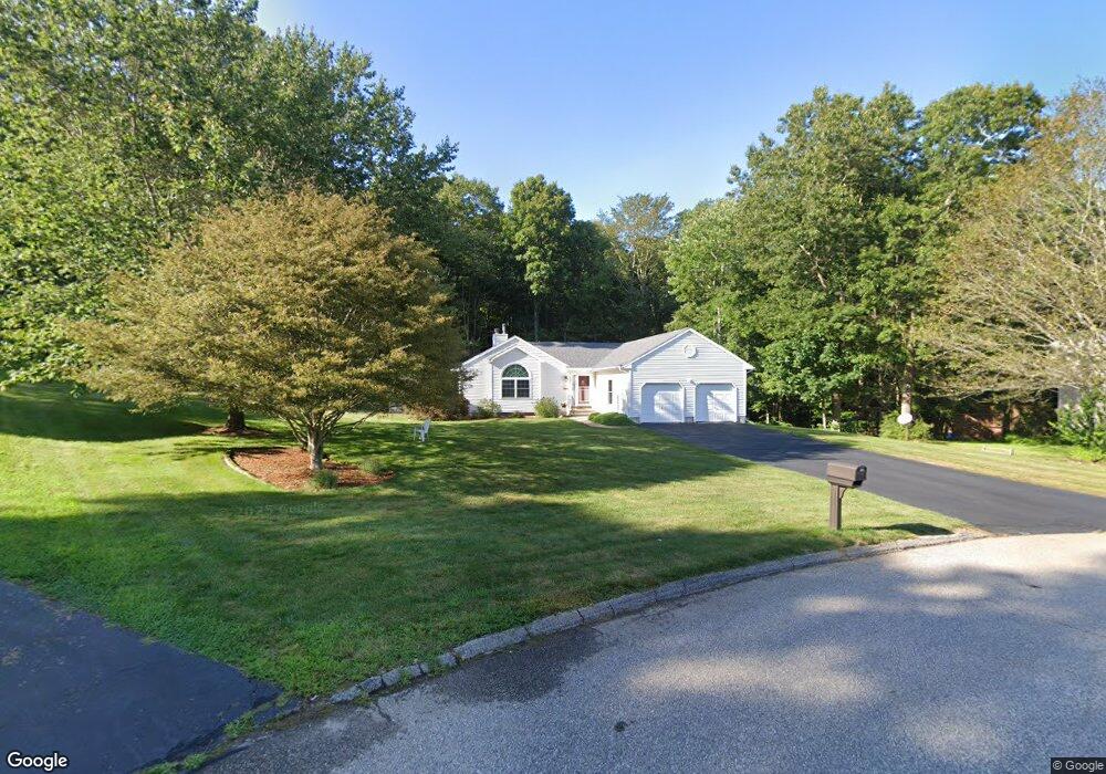
19 Sparrow Ct Oakdale, CT 06370
Estimated Value: $440,000 - $484,000
3
Beds
3
Baths
1,510
Sq Ft
$306/Sq Ft
Est. Value
About This Home
This home is located at 19 Sparrow Ct, Oakdale, CT 06370 and is currently estimated at $462,607, approximately $306 per square foot. 19 Sparrow Ct is a home located in New London County with nearby schools including Leonard J. Tyl Middle School and Montville High School.
Ownership History
Date
Name
Owned For
Owner Type
Purchase Details
Closed on
Aug 21, 2003
Sold by
Stansbury Jude and Stansbury Sandra
Bought by
Richter Warren and Richter Mary Lou
Current Estimated Value
Home Financials for this Owner
Home Financials are based on the most recent Mortgage that was taken out on this home.
Original Mortgage
$142,000
Interest Rate
5.52%
Purchase Details
Closed on
Jun 29, 2001
Sold by
Watch Hill Bldrs
Bought by
Stansbury Jude and Stansbury Sandra
Home Financials for this Owner
Home Financials are based on the most recent Mortgage that was taken out on this home.
Original Mortgage
$80,000
Interest Rate
7.14%
Create a Home Valuation Report for This Property
The Home Valuation Report is an in-depth analysis detailing your home's value as well as a comparison with similar homes in the area
Home Values in the Area
Average Home Value in this Area
Purchase History
| Date | Buyer | Sale Price | Title Company |
|---|---|---|---|
| Richter Warren | $225,000 | -- | |
| Richter Warren | $225,000 | -- | |
| Stansbury Jude | $186,400 | -- | |
| Stansbury Jude | $186,400 | -- |
Source: Public Records
Mortgage History
| Date | Status | Borrower | Loan Amount |
|---|---|---|---|
| Closed | Stansbury Jude | $142,000 | |
| Closed | Stansbury Jude | $50,000 | |
| Previous Owner | Stansbury Jude | $80,000 |
Source: Public Records
Tax History Compared to Growth
Tax History
| Year | Tax Paid | Tax Assessment Tax Assessment Total Assessment is a certain percentage of the fair market value that is determined by local assessors to be the total taxable value of land and additions on the property. | Land | Improvement |
|---|---|---|---|---|
| 2025 | $6,281 | $217,560 | $42,770 | $174,790 |
| 2024 | $6,042 | $217,560 | $42,770 | $174,790 |
| 2023 | $6,042 | $217,560 | $42,770 | $174,790 |
| 2022 | $5,811 | $217,560 | $42,770 | $174,790 |
| 2021 | $5,356 | $168,700 | $41,060 | $127,640 |
| 2020 | $5,463 | $168,700 | $41,060 | $127,640 |
| 2019 | $5,484 | $168,700 | $41,060 | $127,640 |
| 2018 | $5,353 | $168,700 | $41,060 | $127,640 |
| 2017 | $5,348 | $168,700 | $41,060 | $127,640 |
| 2016 | $5,131 | $167,630 | $49,760 | $117,870 |
| 2015 | $5,131 | $167,630 | $49,760 | $117,870 |
| 2014 | $4,923 | $167,630 | $49,760 | $117,870 |
Source: Public Records
Map
Nearby Homes
- 72 Pheasant Run
- 87 Oak Hill Rd
- 56 Evergreen Ln
- 7 Pennsylvania Ave
- 197 Connecticut Blvd
- 64 Pennsylvania Ave
- 29 Texas Dr
- 23 Glendale Rd
- 19 New Hampshire Ln
- 17 Manor Rd
- 69 Forsyth Rd
- 15 Jeffrey Manor Rd
- 727 Old Colchester Rd
- 2 Chesterfield Rd
- 79 Cottonwood Ln
- 33D Laurel Point Dr
- 33A Laurel Point Dr
- 53 Lake Dr
- 636 Connecticut 163
- 12 Eddy Ct
- 15 Sparrow Ct
- 21 Sparrow Ct
- 11 Sparrow Ct
- 31 Pheasant Run
- 20 Sparrow Ct
- 7 Sparrow Ct
- 12 Sparrow Ct
- 8 Sparrow Ct
- 45 Pheasant Run
- 41 Pheasant Run
- 268 Black Ash Rd
- 272 Black Ash Rd
- 276 Black Ash Rd
- 37 Pheasant Run
- 47 Pheasant Run
- 280 Black Ash Rd
- 264 Black Ash Rd
- 51 Pheasant Run
- 48 Pheasant Run
- 44 Pheasant Run