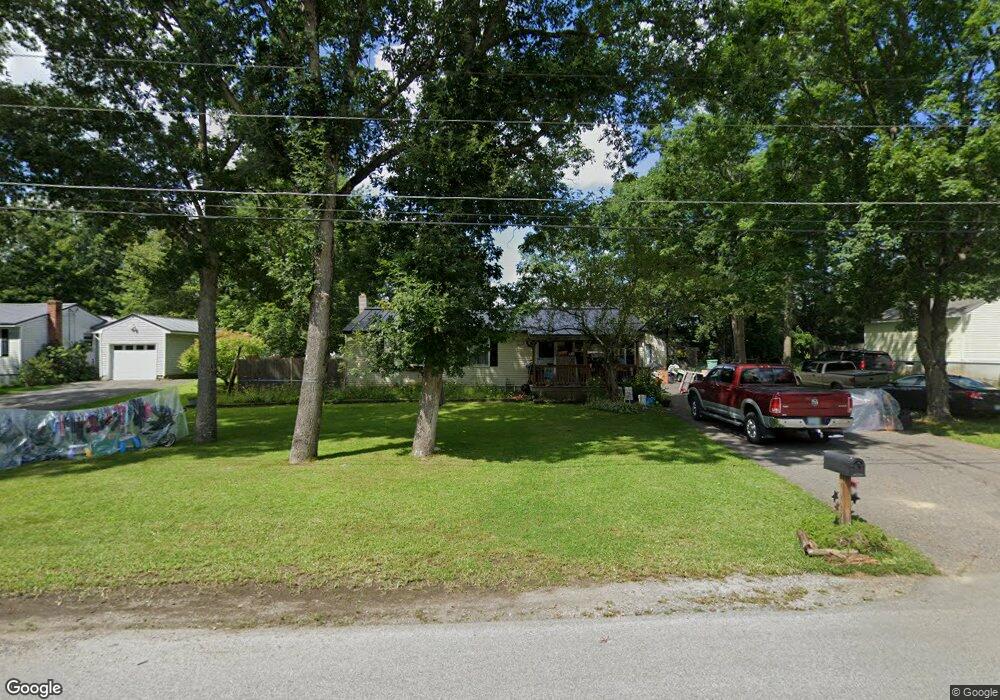
19 Toofs Dr Winchester, NH 03470
Estimated Value: $266,000 - $322,000
3
Beds
3
Baths
1,389
Sq Ft
$204/Sq Ft
Est. Value
About This Home
This home is located at 19 Toofs Dr, Winchester, NH 03470 and is currently estimated at $283,894, approximately $204 per square foot. 19 Toofs Dr is a home located in Cheshire County with nearby schools including Winchester School, Mayland Early College High School, and Keene High School.
Ownership History
Date
Name
Owned For
Owner Type
Purchase Details
Closed on
Oct 17, 2003
Sold by
Beals Kenneth W
Bought by
Bell Daniel and Bell Candy
Current Estimated Value
Home Financials for this Owner
Home Financials are based on the most recent Mortgage that was taken out on this home.
Original Mortgage
$123,020
Outstanding Balance
$58,273
Interest Rate
6.43%
Estimated Equity
$225,621
Purchase Details
Closed on
May 14, 1999
Sold by
Hks Associates Inc
Bought by
Beals Kenneth W
Home Financials for this Owner
Home Financials are based on the most recent Mortgage that was taken out on this home.
Original Mortgage
$77,400
Interest Rate
6.92%
Create a Home Valuation Report for This Property
The Home Valuation Report is an in-depth analysis detailing your home's value as well as a comparison with similar homes in the area
Home Values in the Area
Average Home Value in this Area
Purchase History
| Date | Buyer | Sale Price | Title Company |
|---|---|---|---|
| Bell Daniel | $129,500 | -- | |
| Beals Kenneth W | $82,500 | -- |
Source: Public Records
Mortgage History
| Date | Status | Borrower | Loan Amount |
|---|---|---|---|
| Open | Beals Kenneth W | $123,020 | |
| Previous Owner | Beals Kenneth W | $77,400 |
Source: Public Records
Tax History Compared to Growth
Tax History
| Year | Tax Paid | Tax Assessment Tax Assessment Total Assessment is a certain percentage of the fair market value that is determined by local assessors to be the total taxable value of land and additions on the property. | Land | Improvement |
|---|---|---|---|---|
| 2024 | $4,449 | $152,100 | $40,800 | $111,300 |
| 2023 | $4,819 | $152,100 | $40,800 | $111,300 |
| 2022 | $4,365 | $152,100 | $40,800 | $111,300 |
| 2021 | $4,835 | $152,100 | $40,800 | $111,300 |
| 2020 | $4,376 | $152,100 | $40,800 | $111,300 |
| 2019 | $4,982 | $139,800 | $37,900 | $101,900 |
| 2018 | $4,855 | $139,800 | $37,900 | $101,900 |
| 2016 | $4,204 | $137,700 | $37,900 | $99,800 |
| 2015 | $4,211 | $137,700 | $37,900 | $99,800 |
| 2014 | $4,413 | $144,300 | $41,300 | $103,000 |
| 2013 | $4,434 | $144,300 | $41,300 | $103,000 |
Source: Public Records
Map
Nearby Homes
- 143 Richmond Rd
- Map 6 Lot 15-1 Off Opportunity Dr Unit 15-1
- Map 6 Lot 15-5 Off Opportunity Dr
- 50 Parker St
- 111 Warwick Rd
- 100 Main St
- 56 Ashuelot St
- 19 Back Ashuelot Rd
- 9 Scotland Rd
- 9 Scotland Rd
- 49 Scotland Rd
- 82 Howard St
- 12 Miner Ct
- 240 Forest Lake Rd
- 21 Clark Rd
- 153 Back Ashuelot Rd
- 7 Lake Shore Dr
- 73 Lake Shore Dr
- 27 Headlands Rd
- 45 Forest Lake Cir