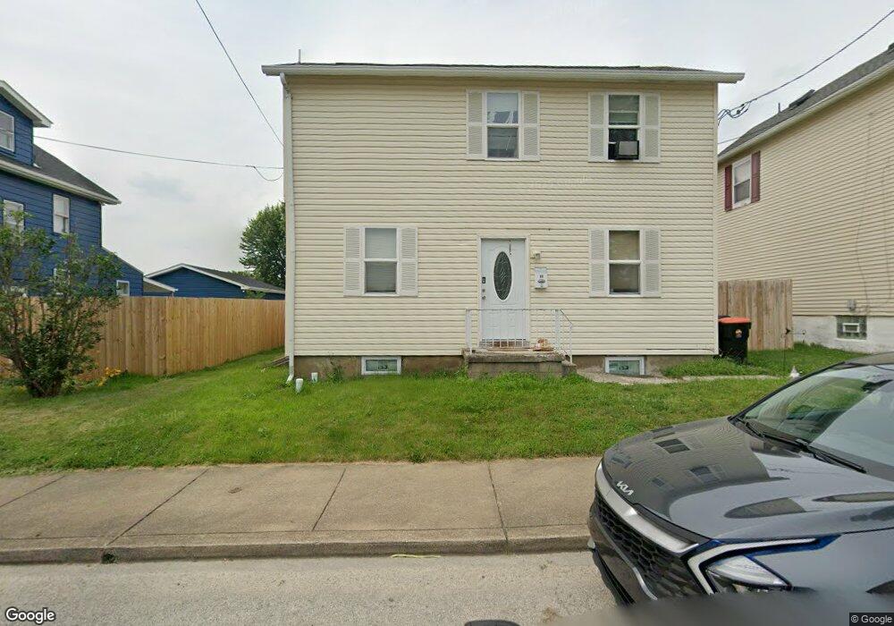
19 W Grant St Latrobe, PA 15650
Estimated Value: $97,128 - $156,000
--
Bed
--
Bath
--
Sq Ft
5,009
Sq Ft Lot
About This Home
This home is located at 19 W Grant St, Latrobe, PA 15650 and is currently estimated at $138,532. 19 W Grant St is a home located in Westmoreland County with nearby schools including Greater Latrobe Junior High School, Greater Latrobe Senior High School, and Christ the Divine Teacher School.
Ownership History
Date
Name
Owned For
Owner Type
Purchase Details
Closed on
Feb 1, 2019
Sold by
Carr Clinton E and Carr Stacey L
Bought by
Mulheren Emily Diane
Current Estimated Value
Home Financials for this Owner
Home Financials are based on the most recent Mortgage that was taken out on this home.
Original Mortgage
$98,188
Outstanding Balance
$86,325
Interest Rate
4.5%
Mortgage Type
FHA
Estimated Equity
$52,207
Purchase Details
Closed on
May 9, 2018
Sold by
Jones Michelle
Bought by
Carr Clinton E and Carr Stacey L
Create a Home Valuation Report for This Property
The Home Valuation Report is an in-depth analysis detailing your home's value as well as a comparison with similar homes in the area
Home Values in the Area
Average Home Value in this Area
Purchase History
| Date | Buyer | Sale Price | Title Company |
|---|---|---|---|
| Mulheren Emily Diane | $100,000 | None Available | |
| Carr Clinton E | $29,000 | None Available |
Source: Public Records
Mortgage History
| Date | Status | Borrower | Loan Amount |
|---|---|---|---|
| Open | Mulheren Emily Diane | $98,188 |
Source: Public Records
Tax History Compared to Growth
Tax History
| Year | Tax Paid | Tax Assessment Tax Assessment Total Assessment is a certain percentage of the fair market value that is determined by local assessors to be the total taxable value of land and additions on the property. | Land | Improvement |
|---|---|---|---|---|
| 2025 | $1,787 | $12,950 | $1,600 | $11,350 |
| 2024 | $1,787 | $12,950 | $1,600 | $11,350 |
| 2023 | $1,657 | $12,950 | $1,600 | $11,350 |
| 2022 | $1,657 | $12,950 | $1,600 | $11,350 |
| 2021 | $1,645 | $12,950 | $1,600 | $11,350 |
| 2020 | $1,622 | $12,950 | $1,600 | $11,350 |
| 2019 | $1,602 | $12,950 | $1,600 | $11,350 |
| 2018 | $1,596 | $12,950 | $1,600 | $11,350 |
| 2017 | $1,573 | $12,950 | $1,600 | $11,350 |
| 2016 | $1,560 | $12,950 | $1,600 | $11,350 |
| 2015 | $1,560 | $12,950 | $1,600 | $11,350 |
| 2014 | $1,547 | $12,950 | $1,600 | $11,350 |
Source: Public Records
Map
Nearby Homes
- 114 Avenue B
- 201 Avenue B
- 2133 Knox Ave
- 36 E Grant St
- 2713 Wilson St
- 1832 Raymond Ave
- 209 Gertrude St
- 1748 Dailey Ave
- 1607 Ligonier St
- 2023 Sylvan Ave
- 1939 Wood St
- 1710 Raymond Ave
- 107 Horseshoe Dr
- 2135 Wood St
- 721 Lehmer St
- 1505 Raymond Ave
- 1 Bankie Dr
- 701 Fairmont St
- 1300 Ridge Ave
- 213 Chestnut St
- 15 W Grant St
- 23 W Grant St
- 11 W Grant St
- 27 W Grant St
- 12 W Madison St
- 20 W Grant St
- 20 E Grant St
- 12 W Grant St
- 10 W Grant St
- 18 W Madison St
- 10 W Madison St
- 22 W Grant St
- 2215 Ligonier St
- 2217 Ligonier St
- 20 W Madison St
- 10 1/2 W Grant St
- 26 W Grant St
- 2213 Ligonier St
- 28 W Madison St
- 2301 Ligonier St