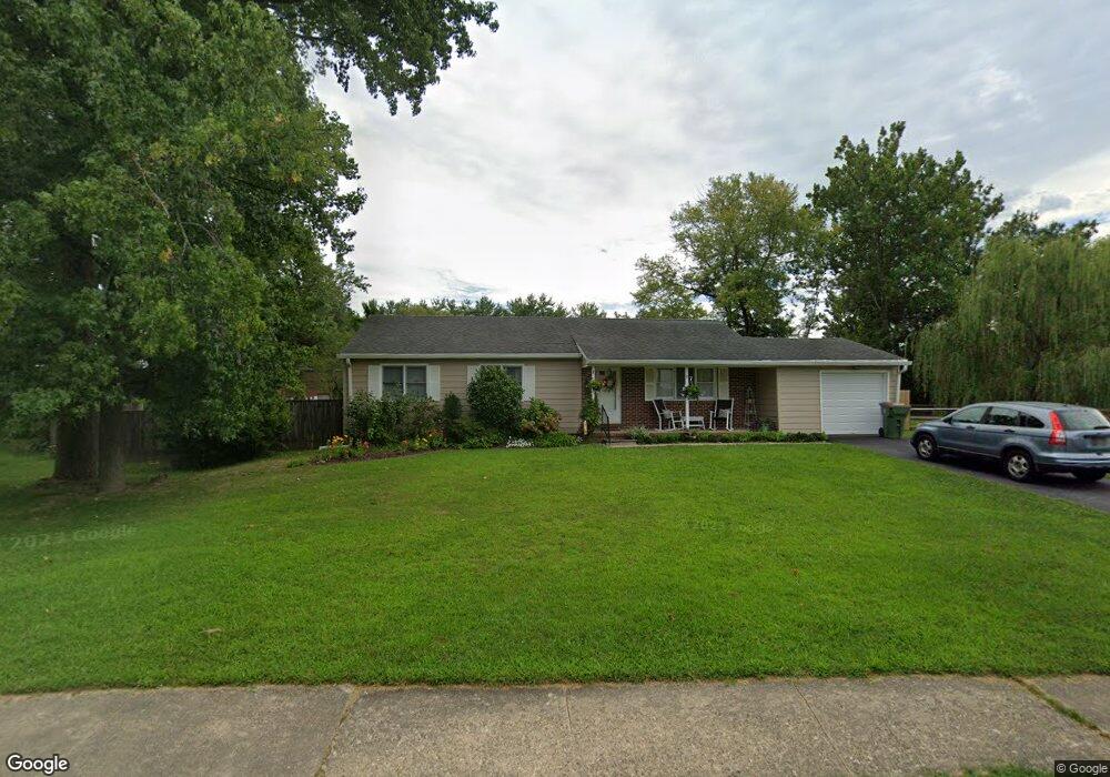
19 Westfield Dr Newark, DE 19711
Estimated Value: $362,000 - $471,000
3
Beds
1
Bath
1,296
Sq Ft
$316/Sq Ft
Est. Value
About This Home
This home is located at 19 Westfield Dr, Newark, DE 19711 and is currently estimated at $409,777, approximately $316 per square foot. 19 Westfield Dr is a home located in New Castle County with nearby schools including Downes (John R.) Elementary School, Shue-Medill Middle School, and Newark High School.
Ownership History
Date
Name
Owned For
Owner Type
Purchase Details
Closed on
Mar 6, 2008
Sold by
Burbidge Dennis
Bought by
Schwartz Jean D
Current Estimated Value
Home Financials for this Owner
Home Financials are based on the most recent Mortgage that was taken out on this home.
Original Mortgage
$196,000
Outstanding Balance
$120,987
Interest Rate
5.57%
Mortgage Type
Purchase Money Mortgage
Estimated Equity
$288,790
Create a Home Valuation Report for This Property
The Home Valuation Report is an in-depth analysis detailing your home's value as well as a comparison with similar homes in the area
Home Values in the Area
Average Home Value in this Area
Purchase History
| Date | Buyer | Sale Price | Title Company |
|---|---|---|---|
| Schwartz Jean D | -- | First American Title Ins Co |
Source: Public Records
Mortgage History
| Date | Status | Borrower | Loan Amount |
|---|---|---|---|
| Open | Schwartz Jean D | $196,000 |
Source: Public Records
Tax History Compared to Growth
Tax History
| Year | Tax Paid | Tax Assessment Tax Assessment Total Assessment is a certain percentage of the fair market value that is determined by local assessors to be the total taxable value of land and additions on the property. | Land | Improvement |
|---|---|---|---|---|
| 2024 | $352 | $65,400 | $12,800 | $52,600 |
| 2023 | $1,781 | $65,400 | $12,800 | $52,600 |
| 2022 | $1,753 | $65,400 | $12,800 | $52,600 |
| 2021 | $1,793 | $65,400 | $12,800 | $52,600 |
| 2020 | $1,726 | $65,400 | $12,800 | $52,600 |
| 2019 | $1,441 | $65,400 | $12,800 | $52,600 |
| 2018 | $1,404 | $65,400 | $12,800 | $52,600 |
| 2017 | $1,354 | $65,400 | $12,800 | $52,600 |
| 2016 | $1,249 | $65,400 | $12,800 | $52,600 |
| 2015 | $1,058 | $65,400 | $12,800 | $52,600 |
| 2014 | $1,057 | $65,400 | $12,800 | $52,600 |
Source: Public Records
Map
Nearby Homes
- 3 Julie Ln
- 181 Madison Dr
- 800 Kenyon Ln
- 34 Ethan Allen Ct
- 137 Madison Dr
- 36 Julie Ln
- 44 Cornwall Dr
- 117 W Shetland Ct
- 914 Quail Ln
- 9 Amherst Dr
- 3 Kayser Ct
- 100 Leahy Dr
- 102 Leahy Dr
- 104 Leahy Dr
- The Reid Plan at Briarcreek North
- The Vincent Plan at Briarcreek North
- The Murray Plan at Briarcreek North
- The Wyeth Plan at Briarcreek North
- 01a Leahy Dr
- 03a Leahy Dr
- 21 Westfield Dr
- 15 Westfield Dr
- 20 Westfield Dr
- 16 Westfield Dr
- 13 Westfield Dr
- 24 Westfield Dr
- 10 Westfield Dr
- 8 Westfield Dr
- 27 Westfield Dr
- 11 Westfield Dr
- 97 Munro Rd
- 6 Westfield Dr
- 9 Westfield Dr
- 29 Westfield Dr
- 13 Phelps Ln
- 95 Munro Rd
- 800 Elkton Rd
- 7 Westfield Dr
- 13 Odaniel Ave
- 4 Westfield Dr