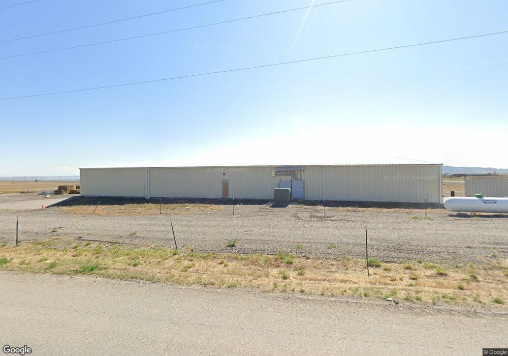
19 Wheatland Rd Three Forks, MT 59752
Estimated Value: $1,801,751
--
Bed
--
Bath
14,000
Sq Ft
$129/Sq Ft
Est. Value
About This Home
This home is located at 19 Wheatland Rd, Three Forks, MT 59752 and is currently estimated at $1,801,751, approximately $128 per square foot. 19 Wheatland Rd is a home located in Broadwater County with nearby schools including Three Forks Elementary School, Three Forks Junior High School, and Three Forks High School.
Ownership History
Date
Name
Owned For
Owner Type
Purchase Details
Closed on
Jun 13, 2023
Sold by
Visser Properties Llc
Bought by
Wheatland Rd Llc
Current Estimated Value
Home Financials for this Owner
Home Financials are based on the most recent Mortgage that was taken out on this home.
Original Mortgage
$1,200,000
Outstanding Balance
$980,205
Interest Rate
5.06%
Mortgage Type
Construction
Estimated Equity
$821,546
Purchase Details
Closed on
Jun 27, 2007
Bought by
Visser Properties Llc
Create a Home Valuation Report for This Property
The Home Valuation Report is an in-depth analysis detailing your home's value as well as a comparison with similar homes in the area
Home Values in the Area
Average Home Value in this Area
Purchase History
| Date | Buyer | Sale Price | Title Company |
|---|---|---|---|
| Wheatland Rd Llc | $1,500,000 | Rocky Mountain Title | |
| Visser Properties Llc | -- | -- |
Source: Public Records
Mortgage History
| Date | Status | Borrower | Loan Amount |
|---|---|---|---|
| Open | Wheatland Rd Llc | $1,200,000 |
Source: Public Records
Tax History Compared to Growth
Tax History
| Year | Tax Paid | Tax Assessment Tax Assessment Total Assessment is a certain percentage of the fair market value that is determined by local assessors to be the total taxable value of land and additions on the property. | Land | Improvement |
|---|---|---|---|---|
| 2025 | $5,511 | $674,999 | $0 | $0 |
| 2024 | $7,212 | $773,450 | $0 | $0 |
| 2023 | $7,232 | $773,450 | $0 | $0 |
| 2022 | $4,886 | $449,020 | $0 | $0 |
| 2021 | $4,402 | $449,020 | $0 | $0 |
| 2020 | $4,796 | $464,640 | $0 | $0 |
| 2019 | $3,590 | $464,640 | $0 | $0 |
| 2018 | $4,411 | $508,970 | $0 | $0 |
| 2017 | $3,690 | $508,970 | $0 | $0 |
| 2016 | $3,636 | $475,800 | $0 | $0 |
| 2015 | $3,520 | $475,800 | $0 | $0 |
| 2014 | $3,031 | $358,441 | $0 | $0 |
Source: Public Records
Map
Nearby Homes
- 20 Starview Dr
- 53 Starview Dr
- Lot 70 Wheatland Meadows Dr
- Lot 78 Wild Mint
- Lot 81 Tbd Wild Mint Ct
- 1 Horizon Loop
- 88 Wheatland Meadows
- Lot 95 Wheatland Meadows Dr
- 38 Horizon Loop
- TBD (Lot 54) Paddlefish Ct
- 2 Smooth Brome Ct
- TBD Rolling Prairie Way
- 39 Morning Sky Way
- Lot 90 Morning Sky Way
- TBD (Lot 260) Rolling Prairie
- TBD (Lot 24) Rolling Prairie
- 115 Rolling Prairie
- TBD Amber Way
- TBD Lot 68 Morning Sky Estates
- TBD Lot 70 Morning Sky Estates
- 42 Wheatland Rd
- 42 Wheatland Rd
- 20 Wheatland Rd
- 20 Wheatland Rd
- LOT 113 Grouseberry Ct
- 35 Wheatland Rd
- TBD 1 Wheatland Rd
- 36 Wheatland Rd
- 37 Wheatland Rd
- Lot 118 Gray Partridge Ct
- L113 S Grouseberry Ct
- L56 S Grouseberry Ct
- TBD 4 Wheatland Rd
- 6 Wheatland Rd
- 28 Starview Dr
- 9 Gray Partridge Ct
- TBD Corner of Us Hwy 287 & Wheatland Rd
- TBD Wheatland Meadows Dr Dr
- 2 Grouse Berry Ct
- TBD 2 Wheatland Rd