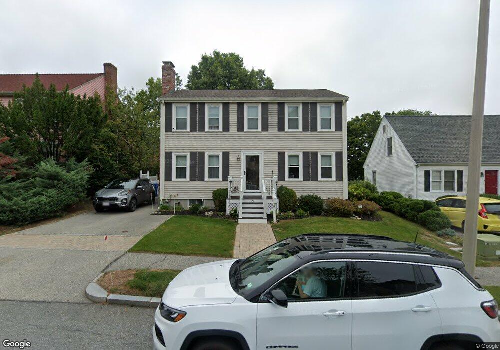
19 Wight St Waltham, MA 02452
North Waltham NeighborhoodEstimated Value: $897,000 - $1,056,000
3
Beds
3
Baths
1,920
Sq Ft
$508/Sq Ft
Est. Value
About This Home
This home is located at 19 Wight St, Waltham, MA 02452 and is currently estimated at $975,886, approximately $508 per square foot. 19 Wight St is a home located in Middlesex County with nearby schools including Northeast Elementary School, John F Kennedy Middle School, and Waltham Sr High School.
Ownership History
Date
Name
Owned For
Owner Type
Purchase Details
Closed on
Sep 6, 2024
Sold by
Guzzi Elizabeth J and Guzzi Michael L
Bought by
Guzzi Ft and Dell
Current Estimated Value
Purchase Details
Closed on
Jul 5, 2016
Sold by
Guzzi Michael and Guzzi Elizabeth J
Bought by
Guzzi Ft
Purchase Details
Closed on
May 29, 1992
Sold by
Snow Dev Corp
Bought by
Guzzi Michael and Guzzi Elizabeth
Home Financials for this Owner
Home Financials are based on the most recent Mortgage that was taken out on this home.
Original Mortgage
$184,000
Interest Rate
8.7%
Mortgage Type
Purchase Money Mortgage
Create a Home Valuation Report for This Property
The Home Valuation Report is an in-depth analysis detailing your home's value as well as a comparison with similar homes in the area
Home Values in the Area
Average Home Value in this Area
Purchase History
| Date | Buyer | Sale Price | Title Company |
|---|---|---|---|
| Guzzi Ft | -- | None Available | |
| Guzzi Ft | -- | None Available | |
| Guzzi Elizabeth J | -- | None Available | |
| Guzzi Ft | -- | -- | |
| Guzzi Ft | -- | -- | |
| Guzzi Michael | $197,000 | -- |
Source: Public Records
Mortgage History
| Date | Status | Borrower | Loan Amount |
|---|---|---|---|
| Previous Owner | Guzzi Michael | $185,000 | |
| Previous Owner | Guzzi Michael | $188,150 | |
| Previous Owner | Guzzi Michael | $184,000 |
Source: Public Records
Tax History Compared to Growth
Tax History
| Year | Tax Paid | Tax Assessment Tax Assessment Total Assessment is a certain percentage of the fair market value that is determined by local assessors to be the total taxable value of land and additions on the property. | Land | Improvement |
|---|---|---|---|---|
| 2025 | $7,868 | $801,200 | $395,500 | $405,700 |
| 2024 | $7,496 | $777,600 | $378,000 | $399,600 |
| 2023 | $7,392 | $716,300 | $343,000 | $373,300 |
| 2022 | $7,401 | $664,400 | $308,000 | $356,400 |
| 2021 | $7,258 | $641,200 | $308,000 | $333,200 |
| 2020 | $7,254 | $607,000 | $287,000 | $320,000 |
| 2019 | $6,974 | $550,900 | $283,500 | $267,400 |
| 2018 | $6,074 | $481,700 | $262,500 | $219,200 |
| 2017 | $5,742 | $457,200 | $238,000 | $219,200 |
| 2016 | $5,425 | $443,200 | $224,000 | $219,200 |
| 2015 | $5,227 | $398,100 | $196,000 | $202,100 |
Source: Public Records
Map
Nearby Homes
- 23 Wight St
- 65 Woburn St
- 55 Circle Dr
- 750 Trapelo Rd
- 170 Clocktower Dr Unit 5103
- 107 Clocktower Dr Unit 3302
- 87 Clocktower Dr Unit 2207
- 116 Raffaele Dr
- 70 Rosewood Dr
- 30 Jacqueline Rd Unit C
- 1105 Lexington St Unit 102
- 311 Concord Ave
- 38 Van Vechten St
- 45 Chase Rd
- 28 College Farm Rd Unit 2
- 5 April Ln Unit 12
- 30 Wampum Ave
- 14 Piedmont Ave
- 129 Lake St
- 6 Linc Cole Ln