
Seller's Agent in 2021
Dean Petty
Mountainlands of MT Realty
(406) 580-3372
271 Total Sales
Estimated Value: $295,000
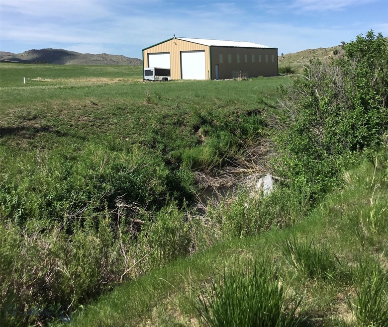
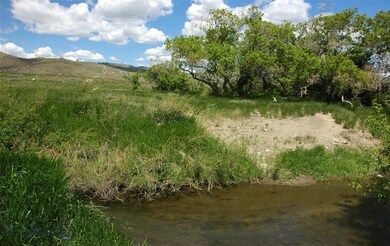
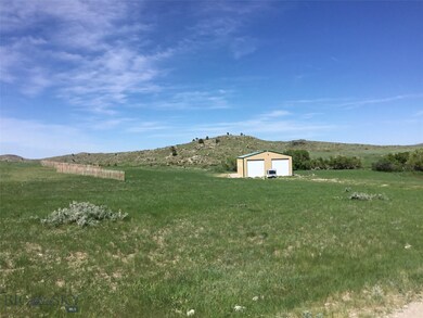
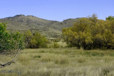
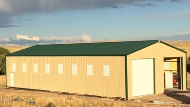
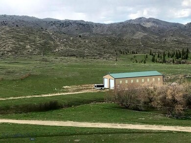
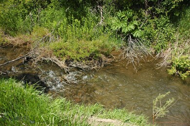
Are you looking to escape the city life? 35 Acres in the Laramie Mountains on Middle Sybille Creek only 2.5 miles off the state highway! This property is all set for your dream home or getaway cabin. It has a 40x80 all metal building with 16’ side walls and three 14x14 overhead doors. The building sits on a 6” monolithic poured concrete slab. The interior is spray foam insulated (2-3 inches thick). Electricity is 200 amp service in the building with 120/240 receptacles. Water is plumbed into the building. Septic is not installed, but it is plumbed to the building. There’s a Pacific Energy wood burning stove. The well is 35 ft deep and approximately 5+- gpm. Middle Sybille Creek is small, but it is reported to have trout in it.... Great grass for pasture, so bring the horses... only partially fenced. Located 45 miles northeast of Laramie (pop 30,000) and 34 miles southwest of Wheatland (pop 4000). Cheyenne is 90 miles to the southeast. Wildlife includes elk, deer & antelope.
Last Agent to Sell the Property
Mountainlands of MT Realty License #BRO-11777 Listed on: 06/14/2021
Property Type
Est. Annual Taxes
Lot Details
Property Views
Utilities
Community Details
Listing and Financial Details
| Date | Event | Price | Change | Sq Ft Price |
|---|---|---|---|---|
| 08/19/2021 08/19/21 | Sold | -- | -- | -- |
| 07/20/2021 07/20/21 | Pending | -- | -- | -- |
| 06/14/2021 06/14/21 | For Sale | $259,500 | -- | -- |
| Year | Tax Paid | Tax Assessment Tax Assessment Total Assessment is a certain percentage of the fair market value that is determined by local assessors to be the total taxable value of land and additions on the property. | Land | Improvement |
|---|---|---|---|---|
| 2024 | $713 | $10,968 | $7,141 | $3,827 |
| 2023 | $695 | $10,690 | $6,529 | $4,161 |
| 2022 | $702 | $10,806 | $7,144 | $3,662 |
| 2021 | $0 | $9,119 | $5,772 | $3,347 |
| 2020 | $583 | $8,971 | $5,593 | $3,378 |
| 2019 | $490 | $7,537 | $3,853 | $3,684 |
| 2018 | $448 | $6,888 | $3,395 | $3,493 |
| 2017 | $329 | $5,058 | $5,058 | $0 |
Seller's Agent in 2021
Dean Petty
Mountainlands of MT Realty
(406) 580-3372
271 Total Sales
Source: Big Sky Country MLS
MLS Number: 359653
APN: 05-2171-26-2-01-004.00
Disclaimer: Certain information contained herein is derived from information provided by parties other than Homes.com. All information provided is deemed reliable, but is not guaranteed to be accurate and should be independently verified.
![]() IDX information is provided exclusively for consumers' personal, non-commercial use, that it may not be used for any purpose other than to identify prospective properties consumers may be interested in purchasing, and that the data is deemed reliable but is not guaranteed accurate by the MLS.
IDX information is provided exclusively for consumers' personal, non-commercial use, that it may not be used for any purpose other than to identify prospective properties consumers may be interested in purchasing, and that the data is deemed reliable but is not guaranteed accurate by the MLS.