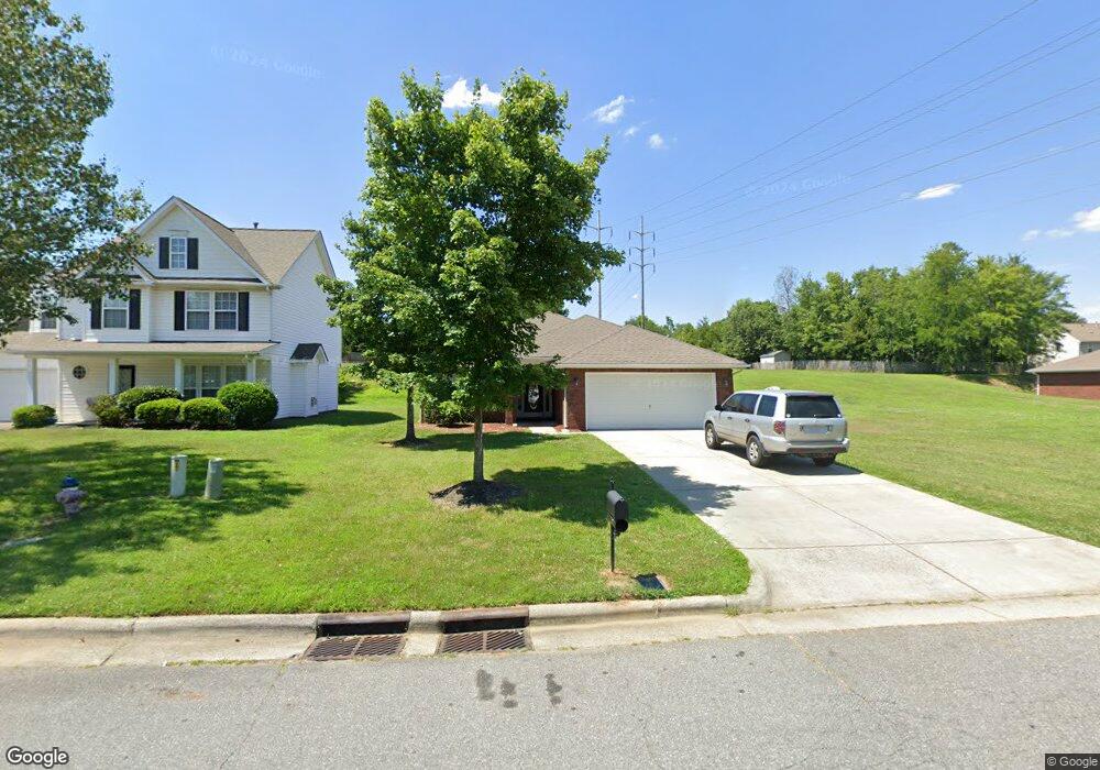
190 Ashmont Dr Kannapolis, NC 28081
Estimated Value: $349,601 - $393,000
4
Beds
2
Baths
1,861
Sq Ft
$198/Sq Ft
Est. Value
About This Home
This home is located at 190 Ashmont Dr, Kannapolis, NC 28081 and is currently estimated at $368,900, approximately $198 per square foot. 190 Ashmont Dr is a home located in Cabarrus County with nearby schools including Winecoff Elementary School, Northwest Cabarrus Middle School, and Northwest Cabarrus High.
Ownership History
Date
Name
Owned For
Owner Type
Purchase Details
Closed on
Apr 26, 2007
Sold by
Adams Homes Aec Llc
Bought by
Dunphy Cornelius and Dunphy Australia
Current Estimated Value
Home Financials for this Owner
Home Financials are based on the most recent Mortgage that was taken out on this home.
Original Mortgage
$134,600
Interest Rate
5.84%
Mortgage Type
New Conventional
Purchase Details
Closed on
Feb 21, 2006
Sold by
Bost Danny G
Bought by
Adams Homes Aec Llc
Create a Home Valuation Report for This Property
The Home Valuation Report is an in-depth analysis detailing your home's value as well as a comparison with similar homes in the area
Home Values in the Area
Average Home Value in this Area
Purchase History
| Date | Buyer | Sale Price | Title Company |
|---|---|---|---|
| Dunphy Cornelius | $168,500 | None Available | |
| Adams Homes Aec Llc | $1,007,500 | None Available |
Source: Public Records
Mortgage History
| Date | Status | Borrower | Loan Amount |
|---|---|---|---|
| Closed | Dunphy Cornelius | $134,600 |
Source: Public Records
Tax History Compared to Growth
Tax History
| Year | Tax Paid | Tax Assessment Tax Assessment Total Assessment is a certain percentage of the fair market value that is determined by local assessors to be the total taxable value of land and additions on the property. | Land | Improvement |
|---|---|---|---|---|
| 2025 | $4,096 | $360,730 | $65,000 | $295,730 |
| 2024 | $4,096 | $360,730 | $65,000 | $295,730 |
| 2023 | $2,953 | $215,560 | $45,000 | $170,560 |
| 2022 | $2,953 | $215,560 | $45,000 | $170,560 |
| 2021 | $2,953 | $215,560 | $45,000 | $170,560 |
| 2020 | $2,953 | $215,560 | $45,000 | $170,560 |
| 2019 | $2,172 | $158,540 | $22,000 | $136,540 |
| 2018 | $2,140 | $158,540 | $22,000 | $136,540 |
| 2017 | $2,109 | $158,540 | $22,000 | $136,540 |
| 2016 | $2,109 | $144,650 | $22,000 | $122,650 |
| 2015 | $1,823 | $144,650 | $22,000 | $122,650 |
| 2014 | $1,823 | $144,650 | $22,000 | $122,650 |
Source: Public Records
Map
Nearby Homes
- 128 Greenview Dr
- 135 Greenview Dr
- 251 Briarcliff Dr
- 210 Cliffside Dr
- 105 Ashmont Dr Unit 1
- 103 Carriage House Dr
- 2116 S Main St
- 301 Briarcliff Dr
- 325 Briarcliff Dr
- 307 Meadowood Cir
- 626 Flicker St
- 2301 S Ridge Ave
- 2448 Spruce St
- 2617 Shady Lane Ave
- 625 Fisher St
- 103 Crescent St
- 709 Carson Ct
- 303 Odell St
- 000 S Main St
- 617 Peace Haven Rd
- 194 Ashmont Dr
- 198 Ashmont Dr
- 184 Ashmont Dr
- 202 Ashmont Dr
- 325 Courtland Ct
- 191 Ashmont Dr
- 2206 Oakhurst Ct
- 195 Ashmont Dr
- 180 Ashmont Dr
- 331 Courtland Ct
- 206 Ashmont Dr
- 2200 Oakhurst Ct
- 183 Ashmont Dr
- 203 Ashmont Dr
- 176 Ashmont Dr
- 176 Ashmont Dr Unit 102
- 2210 Oakhurst Ct
- 326 Courtland Ct
- 207 Ashmont Dr
- 337 Courtland Ct