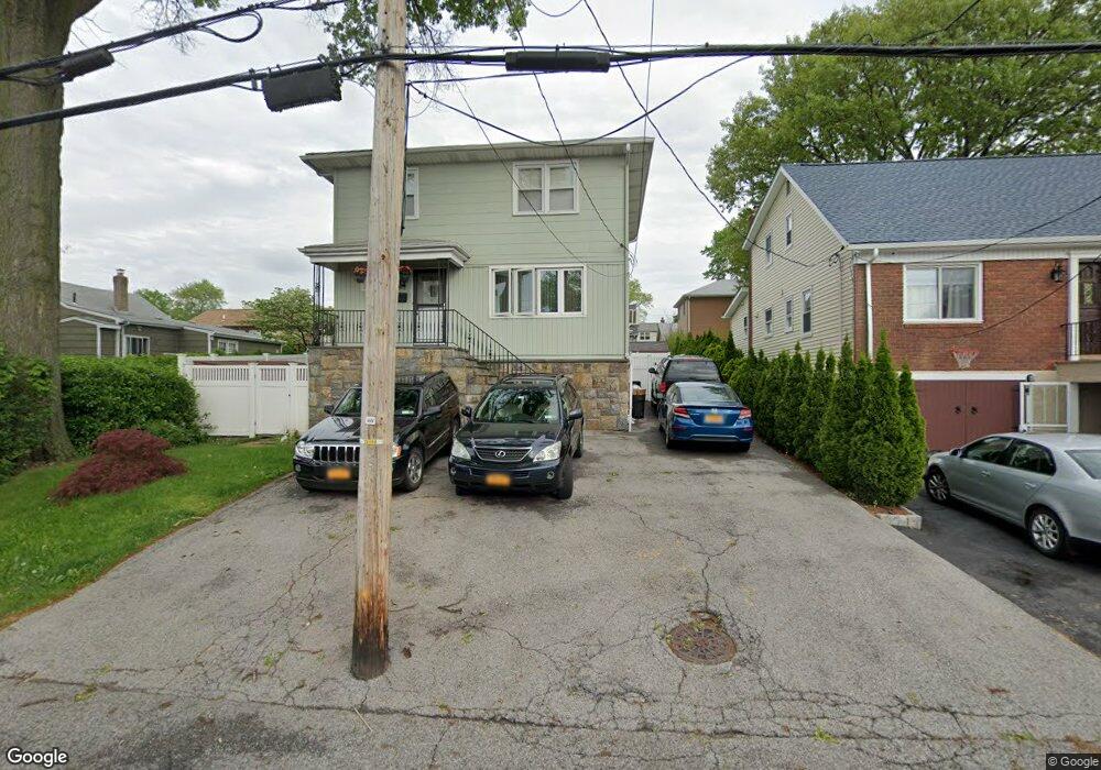
190 Bennett Ave Yonkers, NY 10701
Dunwoodie NeighborhoodEstimated Value: $719,000 - $782,000
3
Beds
2
Baths
1,512
Sq Ft
$493/Sq Ft
Est. Value
About This Home
This home is located at 190 Bennett Ave, Yonkers, NY 10701 and is currently estimated at $745,804, approximately $493 per square foot. 190 Bennett Ave is a home located in Westchester County with nearby schools including St. John the Baptist Catholic Church and Andalusia School.
Ownership History
Date
Name
Owned For
Owner Type
Purchase Details
Closed on
Jun 3, 2022
Sold by
Stefanik Scott V
Bought by
Lallbeharry Deodat and Lallbeharry Geeta
Current Estimated Value
Home Financials for this Owner
Home Financials are based on the most recent Mortgage that was taken out on this home.
Original Mortgage
$599,250
Outstanding Balance
$570,189
Interest Rate
5.27%
Mortgage Type
Balloon
Estimated Equity
$175,615
Purchase Details
Closed on
Sep 17, 2013
Sold by
Stefanik Scott
Bought by
Stefanik Scott and Stefanik Dawn M
Create a Home Valuation Report for This Property
The Home Valuation Report is an in-depth analysis detailing your home's value as well as a comparison with similar homes in the area
Home Values in the Area
Average Home Value in this Area
Purchase History
| Date | Buyer | Sale Price | Title Company |
|---|---|---|---|
| Lallbeharry Deodat | $700,000 | None Listed On Document | |
| Stefanik Scott | -- | Freedom Land Title Agency |
Source: Public Records
Mortgage History
| Date | Status | Borrower | Loan Amount |
|---|---|---|---|
| Open | Lallbeharry Deodat | $599,250 |
Source: Public Records
Tax History
| Year | Tax Paid | Tax Assessment Tax Assessment Total Assessment is a certain percentage of the fair market value that is determined by local assessors to be the total taxable value of land and additions on the property. | Land | Improvement |
|---|---|---|---|---|
| 2024 | $1,782 | $10,000 | $2,800 | $7,200 |
| 2023 | $1,773 | $10,000 | $2,800 | $7,200 |
| 2022 | $1,761 | $10,000 | $2,800 | $7,200 |
| 2021 | $7,614 | $10,000 | $2,800 | $7,200 |
| 2020 | $7,521 | $10,000 | $2,800 | $7,200 |
| 2019 | $9,133 | $10,000 | $2,800 | $7,200 |
| 2018 | $6,920 | $10,000 | $2,800 | $7,200 |
| 2017 | $0 | $10,000 | $2,800 | $7,200 |
| 2016 | $7,965 | $10,000 | $2,800 | $7,200 |
| 2015 | -- | $10,000 | $2,800 | $7,200 |
| 2014 | -- | $10,000 | $2,800 | $7,200 |
| 2013 | -- | $10,000 | $2,800 | $7,200 |
Source: Public Records
Map
Nearby Homes
- 20 Ashford Place
- 30 College Place
- 900 Midland Ave Unit 2G
- 900 Midland Ave Unit 1D
- 900 Midland Ave Unit 2E
- 116 Homewood Ave
- 98 University Ave
- 90 University Ave
- 194 Valentine St
- 58 Kingston Ave
- 419 Palmer Rd
- 466 Palmer Rd
- 219 Mile Square Rd
- 61 Devon Rd
- 130 Staunton St
- 1078 Midland Ave
- 1101 Midland Ave Unit 223
- 1101 Midland Ave Unit 323
- 1090 Midland Ave
- 1111 Midland Ave Unit 1P
- 190 aka 192 Bennett Ave
- 186 Bennett Ave
- 2 Ashford Place
- 6 Ashford Place
- 8 Ashford Place
- 182 Bennett Ave
- 10 Ashford Place
- 8 Ashford Place
- 85 Dunston Ave
- 81 Dunston Ave
- 191 Bennett Ave
- 193 Bennett Ave
- 75 Dunston Ave
- 185 Bennett Ave
- 14 Ashford Place
- 180 Bennett Ave
- 181 Bennett Ave
- 199 Bennett Ave
- 201 Bennett Ave Unit 1
- 177 Bennett Ave
Your Personal Tour Guide
Ask me questions while you tour the home.