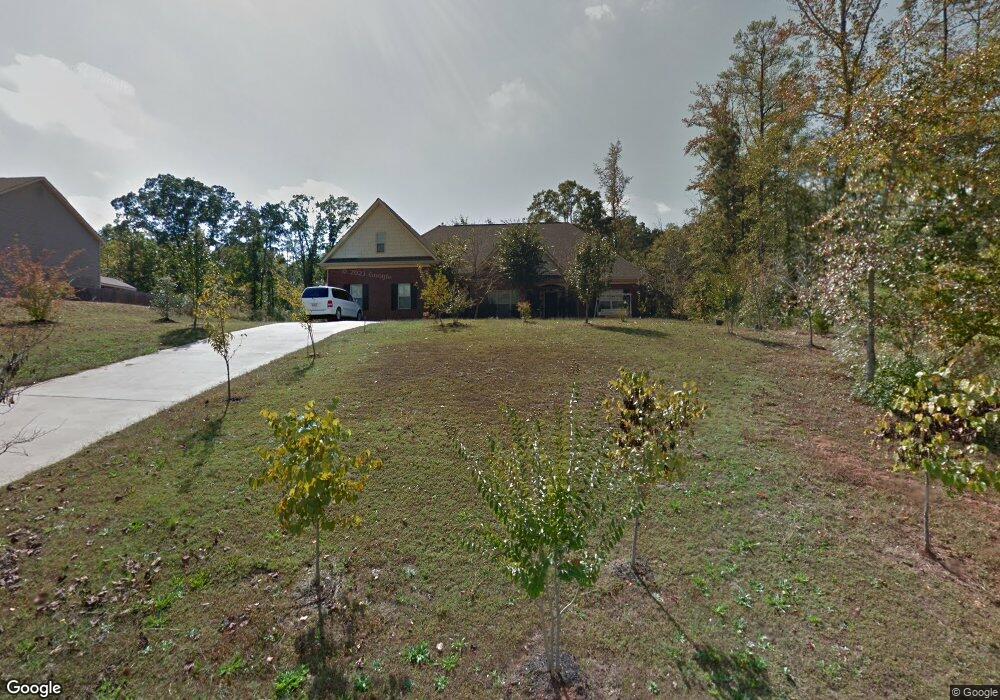
190 Brandish Dr Newnan, GA 30263
Estimated Value: $428,000 - $576,000
4
Beds
3
Baths
3,928
Sq Ft
$134/Sq Ft
Est. Value
About This Home
This home is located at 190 Brandish Dr, Newnan, GA 30263 and is currently estimated at $524,605, approximately $133 per square foot. 190 Brandish Dr is a home located in Coweta County with nearby schools including Atkinson Elementary School, Smokey Road Middle School, and Newnan High School.
Ownership History
Date
Name
Owned For
Owner Type
Purchase Details
Closed on
May 11, 2023
Sold by
Lin Lu
Bought by
Lin Meng Yaw
Current Estimated Value
Purchase Details
Closed on
Aug 17, 2007
Sold by
Jeff Lindsey Communities Inc
Bought by
Lin Lu and Lin Ming H
Purchase Details
Closed on
Jan 9, 2007
Sold by
David Lindsey Homes Inc
Bought by
Jeff Lindsey Communities Inc
Purchase Details
Closed on
Nov 8, 2005
Sold by
Scott Neely Construction Inc
Bought by
David Lindsey Homes Inc
Purchase Details
Closed on
Nov 30, 1986
Sold by
Robertson Carl A
Bought by
Robertson Carl A
Create a Home Valuation Report for This Property
The Home Valuation Report is an in-depth analysis detailing your home's value as well as a comparison with similar homes in the area
Home Values in the Area
Average Home Value in this Area
Purchase History
| Date | Buyer | Sale Price | Title Company |
|---|---|---|---|
| Lin Meng Yaw | -- | -- | |
| Lin Lu | $238,000 | -- | |
| Jeff Lindsey Communities Inc | $550,600 | -- | |
| David Lindsey Homes Inc | $1,829,000 | -- | |
| Robertson Carl A | $202,000 | -- |
Source: Public Records
Tax History Compared to Growth
Tax History
| Year | Tax Paid | Tax Assessment Tax Assessment Total Assessment is a certain percentage of the fair market value that is determined by local assessors to be the total taxable value of land and additions on the property. | Land | Improvement |
|---|---|---|---|---|
| 2024 | $4,602 | $198,254 | $24,000 | $174,254 |
| 2023 | $4,602 | $182,247 | $20,000 | $162,247 |
| 2022 | $2,734 | $153,347 | $20,000 | $133,347 |
| 2021 | $2,199 | $125,985 | $12,000 | $113,985 |
| 2020 | $2,210 | $125,985 | $12,000 | $113,985 |
| 2019 | $2,496 | $114,224 | $16,000 | $98,224 |
| 2018 | $2,503 | $114,224 | $16,000 | $98,224 |
| 2017 | $3,177 | $113,159 | $12,000 | $101,159 |
| 2016 | $2,737 | $99,216 | $12,000 | $87,216 |
| 2015 | $2,693 | $99,216 | $12,000 | $87,216 |
| 2014 | $2,218 | $91,878 | $12,000 | $79,878 |
Source: Public Records
Map
Nearby Homes
- 46 Brandish Dr
- 23 Corn Crib Ct
- 23 Corn Crib Dr
- 140 Beverly Park Ct
- 110 Corn Row Ct
- 1756 Millard Farmer Rd
- 135 Widgeon Dr
- 1967 Corinth Rd
- 972 Earl Rd N
- 130 Mallard Dr
- 58 Bailey Dr
- 31 Festiva Dr
- 0 Meadowsweet Ln Unit 10582479
- 25 Bailey Dr
- 75 Davis McLendon Way
- LOT 1 Joe Roberts Rd
- LOT 3 Joe Roberts Rd
- 0 Smokey Rd Unit 10495165
- 0000 Smokey Rd
- 68 Timberland Trail
- 178 Brandish Dr
- 224 Brandish Dr
- 224 Brandish Dr Unit B-52
- 162 Brandish Dr
- 0 Brandish Dr Unit 8932596
- 0 Brandish Dr Unit 3138396
- 0 Brandish Dr Unit 3172578
- 0 Brandish Dr Unit 3243280
- 0 Brandish Dr Unit 3290148
- 0 Brandish Dr Unit 7017237
- 0 Brandish Dr Unit 7046396
- 0 Brandish Dr Unit 7066158
- 0 Brandish Dr Unit 7090278
- 0 Brandish Dr Unit 7119938
- 0 Brandish Dr Unit 7255083
- 0 Brandish Dr Unit 7363900
- 0 Brandish Dr Unit 7423677
- 0 Brandish Dr Unit 7477790
- 0 Brandish Dr Unit 7529409
- 0 Brandish Dr Unit 7571740