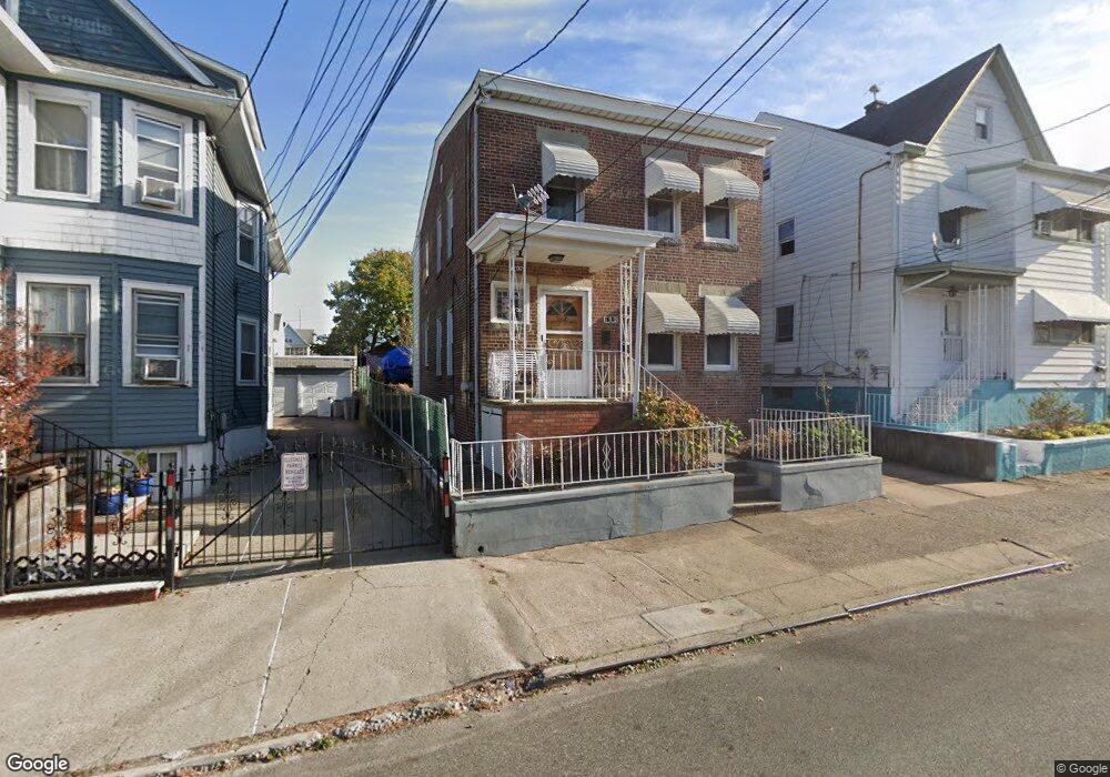
190 Lily St Unit 192 Paterson, NJ 07522
Northside NeighborhoodEstimated Value: $452,000 - $635,000
--
Bed
--
Bath
1,720
Sq Ft
$309/Sq Ft
Est. Value
About This Home
This home is located at 190 Lily St Unit 192, Paterson, NJ 07522 and is currently estimated at $531,205, approximately $308 per square foot. 190 Lily St Unit 192 is a home located in Passaic County with nearby schools including Edward W. Kilpatrick School of Discovery, Dale Avenue Elementary School, and Dr. Frank Napier, Jr. School of Technology.
Ownership History
Date
Name
Owned For
Owner Type
Purchase Details
Closed on
Jun 26, 2015
Sold by
Gangi Vincent Di and Onnembo Maria
Bought by
Gangi Vincent Di
Current Estimated Value
Home Financials for this Owner
Home Financials are based on the most recent Mortgage that was taken out on this home.
Original Mortgage
$120,000
Interest Rate
3.87%
Mortgage Type
New Conventional
Purchase Details
Closed on
Oct 28, 2014
Sold by
Onnembo Maria
Bought by
Gangi Vincenza Di
Create a Home Valuation Report for This Property
The Home Valuation Report is an in-depth analysis detailing your home's value as well as a comparison with similar homes in the area
Home Values in the Area
Average Home Value in this Area
Purchase History
| Date | Buyer | Sale Price | Title Company |
|---|---|---|---|
| Gangi Vincent Di | -- | None Available | |
| Gangi Vincenza Di | -- | None Available |
Source: Public Records
Mortgage History
| Date | Status | Borrower | Loan Amount |
|---|---|---|---|
| Previous Owner | Gangi Vincent Di | $120,000 |
Source: Public Records
Tax History Compared to Growth
Tax History
| Year | Tax Paid | Tax Assessment Tax Assessment Total Assessment is a certain percentage of the fair market value that is determined by local assessors to be the total taxable value of land and additions on the property. | Land | Improvement |
|---|---|---|---|---|
| 2025 | $9,456 | $185,600 | $50,300 | $135,300 |
| 2024 | $9,100 | $185,600 | $50,300 | $135,300 |
| 2022 | $8,616 | $185,600 | $50,300 | $135,300 |
| 2021 | $8,307 | $185,600 | $50,300 | $135,300 |
| 2020 | $7,749 | $185,600 | $50,300 | $135,300 |
| 2019 | $7,408 | $179,200 | $47,000 | $132,200 |
| 2018 | $7,644 | $176,700 | $46,600 | $130,100 |
| 2017 | $7,292 | $175,300 | $46,300 | $129,000 |
| 2016 | $8,036 | $185,200 | $48,800 | $136,400 |
| 2015 | $7,608 | $185,200 | $48,800 | $136,400 |
| 2014 | $9,045 | $311,900 | $161,300 | $150,600 |
Source: Public Records
Map
Nearby Homes
- 186 Carbon St Unit 188
- 186-188 Carbon St
- 222 Haledon Ave
- 237 Haledon Ave
- 144-146 N 8th St
- 93-99 N 9th St
- 97 Lily St Unit 101
- 123 Haledon Ave Unit 125
- 266 N 9th St
- 93 N 10th St
- 228 Temple St
- 206 N 6th St
- 73 N 6th St
- 289 N 8th St
- 12 Hopper St
- 86 N 7th St
- 61 N 5th St
- 116 Belmont Ave
- 158 N 4th St
- 131 N 3rd St Unit 3
- 192 Lily St Unit 194
- 186 Lily St Unit 188
- 194 Lily St Unit 198
- 182 Lily St Unit 184
- 198 Lily St Unit 200
- 198-200 Lily St
- 198 Lily St Unit 1
- 200 Lily St Unit 204
- 185 Lily St Unit 187
- 185-187 Lily St
- 191-193 Lily St
- 191 Lily St Unit 193
- 189 Lily St Unit 191
- 181 Carbon St Unit 183
- 180 Lily St Unit 182
- 177 Carbon St Unit 179
- 183 Carbon St Unit 187
- 189 Carbon St Unit 193
- 179-183 Lily St
- 176 Lily St Unit 178