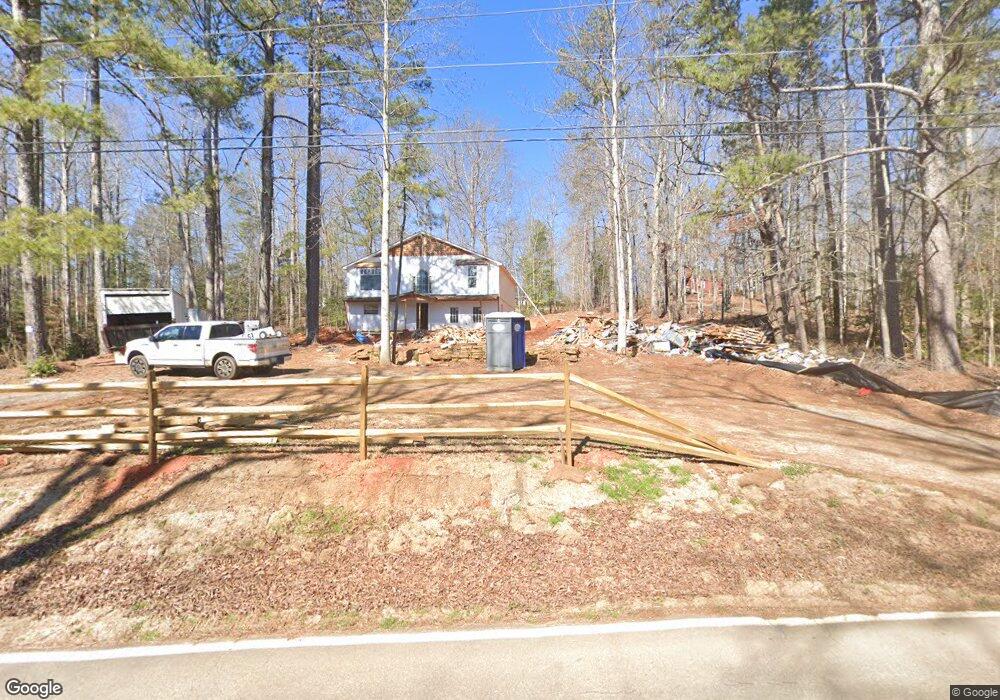
190 Little Refuge Rd Waleska, GA 30183
Estimated Value: $789,000 - $868,000
4
Beds
4
Baths
4,782
Sq Ft
$172/Sq Ft
Est. Value
About This Home
This home is located at 190 Little Refuge Rd, Waleska, GA 30183 and is currently estimated at $820,369, approximately $171 per square foot. 190 Little Refuge Rd is a home located in Cherokee County with nearby schools including R. M. Moore Elementary School, Teasley Middle School, and Cherokee High School.
Ownership History
Date
Name
Owned For
Owner Type
Purchase Details
Closed on
Feb 4, 2019
Sold by
Patrick Geraldine A
Bought by
Patrick Geraldine A and Galloway Elizabeth A
Current Estimated Value
Purchase Details
Closed on
Aug 3, 2009
Sold by
Galloway Elizabeth
Bought by
Patrick Michael D and Patrick Geraldine A
Home Financials for this Owner
Home Financials are based on the most recent Mortgage that was taken out on this home.
Original Mortgage
$163,000
Interest Rate
5.19%
Mortgage Type
New Conventional
Purchase Details
Closed on
Feb 13, 2003
Sold by
Sheffey Robert J and Sheffey Kathy B
Bought by
Patrick Michael D and Patrick Geraldine
Home Financials for this Owner
Home Financials are based on the most recent Mortgage that was taken out on this home.
Original Mortgage
$190,000
Interest Rate
3.25%
Mortgage Type
New Conventional
Create a Home Valuation Report for This Property
The Home Valuation Report is an in-depth analysis detailing your home's value as well as a comparison with similar homes in the area
Home Values in the Area
Average Home Value in this Area
Purchase History
| Date | Buyer | Sale Price | Title Company |
|---|---|---|---|
| Patrick Geraldine A | -- | -- | |
| Patrick Michael D | -- | -- | |
| Patrick Michael D | $320,000 | -- |
Source: Public Records
Mortgage History
| Date | Status | Borrower | Loan Amount |
|---|---|---|---|
| Previous Owner | Patrick Michael D | $163,000 | |
| Previous Owner | Patrick Michael D | $190,000 |
Source: Public Records
Tax History Compared to Growth
Tax History
| Year | Tax Paid | Tax Assessment Tax Assessment Total Assessment is a certain percentage of the fair market value that is determined by local assessors to be the total taxable value of land and additions on the property. | Land | Improvement |
|---|---|---|---|---|
| 2024 | $4,263 | $338,640 | $32,200 | $306,440 |
| 2023 | $4,035 | $343,160 | $32,200 | $310,960 |
| 2022 | $2,533 | $234,720 | $31,640 | $203,080 |
| 2021 | $1,448 | $170,560 | $21,160 | $149,400 |
| 2020 | $1,371 | $158,560 | $18,400 | $140,160 |
| 2019 | $1,376 | $156,440 | $18,400 | $138,040 |
| 2018 | $1,343 | $149,920 | $18,400 | $131,520 |
| 2017 | $1,393 | $379,200 | $18,400 | $133,280 |
| 2016 | $1,343 | $354,700 | $18,400 | $123,480 |
| 2015 | $1,391 | $358,600 | $18,400 | $125,040 |
| 2014 | $1,192 | $308,000 | $17,160 | $106,040 |
Source: Public Records
Map
Nearby Homes
- 194 Little Refuge Rd
- 140 Little Refuge Rd
- 150 Little Refuge Rd
- 213 Little Refuge Rd
- 138 Little Refuge Rd
- 003 Cable Rd
- 001 Cable Rd
- 0 Cable Rd
- 00 Cable Rd
- 0 Cable Rd Unit 8724907
- 0 Cable Rd Unit 8091910
- 0 Cable Rd Unit 3116491
- 0 Cable Rd Unit 8958122
- 0 Cable Rd Unit 8969186
- 0 Cable Rd Unit 9077616
- 0 Cable Rd Unit 8787718
- 0 Cable Rd Unit 8906914
- 0 Cable Rd Unit 3071014
- 0 Cable Rd Unit 7121754
- 0 Cable Rd Unit 7132550