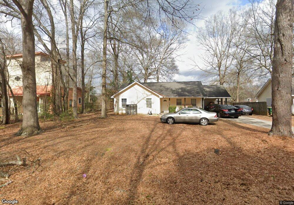
190 Northside Dr Athens, GA 30601
North Avenue NeighborhoodEstimated Value: $262,270 - $294,000
Studio
--
Bath
1,224
Sq Ft
$229/Sq Ft
Est. Value
About This Home
This home is located at 190 Northside Dr, Athens, GA 30601 and is currently estimated at $280,568, approximately $229 per square foot. 190 Northside Dr is a home located in Clarke County with nearby schools including Howard B. Stroud Elementary School, Coile Middle School, and Cedar Shoals High School.
Ownership History
Date
Name
Owned For
Owner Type
Purchase Details
Closed on
Mar 31, 2006
Sold by
Not Provided
Bought by
Ruff Brian K
Current Estimated Value
Purchase Details
Closed on
Nov 19, 2002
Sold by
Loyd Janice
Bought by
Ruff Janice Loyd
Purchase Details
Closed on
Apr 18, 2000
Sold by
V & M Construction Company Inc
Bought by
Loyd Janice
Purchase Details
Closed on
Feb 22, 1999
Sold by
M & V Development Company L L C
Bought by
V & M Construction Company Inc
Purchase Details
Closed on
Nov 13, 1997
Sold by
Global Properties Inc
Bought by
M & V Development Company L L C
Create a Home Valuation Report for This Property
The Home Valuation Report is an in-depth analysis detailing your home's value as well as a comparison with similar homes in the area
Home Values in the Area
Average Home Value in this Area
Purchase History
| Date | Buyer | Sale Price | Title Company |
|---|---|---|---|
| Ruff Brian K | -- | -- | |
| Ruff Janice Loyd | -- | -- | |
| Loyd Janice | $91,500 | -- | |
| V & M Construction Company Inc | -- | -- | |
| M & V Development Company L L C | $120,000 | -- |
Source: Public Records
Tax History
| Year | Tax Paid | Tax Assessment Tax Assessment Total Assessment is a certain percentage of the fair market value that is determined by local assessors to be the total taxable value of land and additions on the property. | Land | Improvement |
|---|---|---|---|---|
| 2025 | $2,451 | $98,886 | $18,000 | $80,886 |
| 2024 | $2,451 | $88,658 | $18,000 | $70,658 |
| 2023 | $2,271 | $80,927 | $18,000 | $62,927 |
| 2022 | $2,124 | $66,588 | $14,000 | $52,588 |
| 2021 | $1,800 | $53,412 | $12,000 | $41,412 |
| 2020 | $1,635 | $48,519 | $11,200 | $37,319 |
| 2019 | $1,510 | $44,477 | $11,200 | $33,277 |
| 2018 | $1,474 | $43,415 | $10,400 | $33,015 |
| 2017 | $1,401 | $41,281 | $10,400 | $30,881 |
| 2016 | $1,331 | $39,195 | $10,400 | $28,795 |
| 2015 | $1,211 | $35,629 | $10,400 | $25,229 |
| 2014 | $1,215 | $35,677 | $10,400 | $25,277 |
Source: Public Records
Map
Nearby Homes
- 464 Ruth St
- 211 North Ave Unit 1225
- 211 North Ave
- 211 North Ave Unit 1227
- 455 Ruth St
- 495 Boley Dr
- 145 Artisan Place
- 192 Sunny Hills Dr
- 118 Ruth Dr Unit 130
- 118 Ruth Dr Unit 140
- 239 Madison Heights
- 225 Fourth St
- 447 Rosa Nell Howard St
- 200 John St
- 220 John St
- 180 Ashmore Dr
- 295 First St
- 121 Kenwood Dr
- 121 Ashmore Ct
- 185 First St
- 200 Northside Dr
- 180 Northside Dr
- 210 Northside Dr
- 185 Northcrest Dr
- 170 Northside Dr
- 195 Northcrest Dr
- 165 Northcrest Dr
- 220 Northside Dr
- 195 Northside Dr
- 160 Northside Dr
- 205 Northside Dr
- 155 Northcrest Dr
- 0 Northcrest Dr Unit 8825020
- 215 Northside Dr
- 150 Northside Dr
- 180 Northcrest Dr
- 145 Northcrest Dr
- 240 Northside Dr
- 160 Northcrest Dr
- 190 Northcrest Dr
Your Personal Tour Guide
Ask me questions while you tour the home.