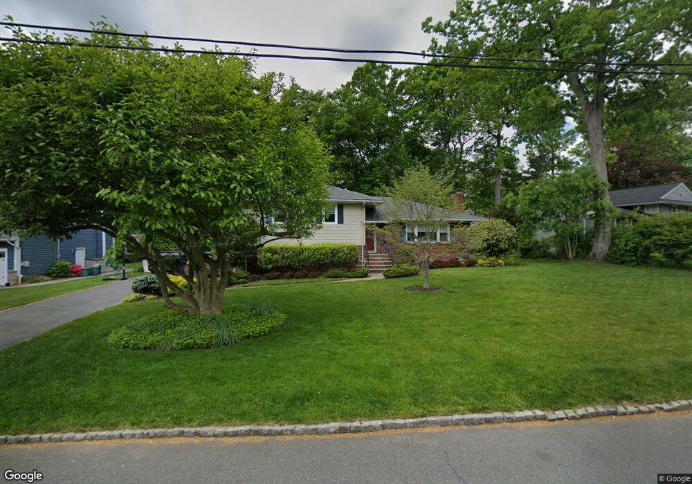
190 Pittsford Way New Providence, NJ 07974
Estimated Value: $900,479 - $1,230,000
--
Bed
--
Bath
1,929
Sq Ft
$548/Sq Ft
Est. Value
About This Home
This home is located at 190 Pittsford Way, New Providence, NJ 07974 and is currently estimated at $1,057,620, approximately $548 per square foot. 190 Pittsford Way is a home located in Union County with nearby schools including New Providence High School, The Academy of Our Lady of Peace, and Oak Knoll School of the Holy Child.
Ownership History
Date
Name
Owned For
Owner Type
Purchase Details
Closed on
Nov 24, 2015
Sold by
Ferrao Christine K
Bought by
Ferrao Gregory M and Ferrao Natalie F
Current Estimated Value
Home Financials for this Owner
Home Financials are based on the most recent Mortgage that was taken out on this home.
Original Mortgage
$150,000
Outstanding Balance
$118,703
Interest Rate
3.89%
Mortgage Type
Credit Line Revolving
Estimated Equity
$938,917
Create a Home Valuation Report for This Property
The Home Valuation Report is an in-depth analysis detailing your home's value as well as a comparison with similar homes in the area
Home Values in the Area
Average Home Value in this Area
Purchase History
| Date | Buyer | Sale Price | Title Company |
|---|---|---|---|
| Ferrao Gregory M | $600,000 | -- |
Source: Public Records
Mortgage History
| Date | Status | Borrower | Loan Amount |
|---|---|---|---|
| Open | Ferrao Gregory M | $150,000 | |
| Closed | Ferrao Gregory M | $150,000 |
Source: Public Records
Tax History Compared to Growth
Tax History
| Year | Tax Paid | Tax Assessment Tax Assessment Total Assessment is a certain percentage of the fair market value that is determined by local assessors to be the total taxable value of land and additions on the property. | Land | Improvement |
|---|---|---|---|---|
| 2025 | $16,111 | $312,100 | $155,200 | $156,900 |
| 2024 | $15,627 | $312,100 | $155,200 | $156,900 |
| 2023 | $15,627 | $312,100 | $155,200 | $156,900 |
| 2022 | $15,412 | $312,100 | $155,200 | $156,900 |
| 2021 | $15,299 | $312,100 | $155,200 | $156,900 |
| 2020 | $15,293 | $312,100 | $155,200 | $156,900 |
| 2019 | $15,199 | $312,100 | $155,200 | $156,900 |
| 2018 | $15,121 | $312,100 | $155,200 | $156,900 |
| 2017 | $14,460 | $303,400 | $155,200 | $148,200 |
| 2016 | $14,257 | $303,400 | $155,200 | $148,200 |
| 2015 | $14,060 | $303,400 | $155,200 | $148,200 |
| 2014 | $13,847 | $303,400 | $155,200 | $148,200 |
Source: Public Records
Map
Nearby Homes
- 283 Riveredge Dr
- 146 Riveredge Dr
- 100 Commonwealth Ave
- 2F Terrace Dr Unit F
- 19 Division Ave
- 22C Heritage Dr Unit C
- 21G Heritage Dr Unit G
- 54 Badgley Dr
- 29 Walton Ave
- 43 Passaic Ave
- 1200 Springfield Ave Unit 1B
- 5 Kincaid Ln
- 54 Canterbury Rd
- 32 Charnwood Rd
- 7 Carleen Ct
- 72 Central Ave
- 7 Oak Forest Ln
- 17 Hilltop Terrace
- 709 Springfield Ave Unit 4
- 709 Springfield Ave Unit 3