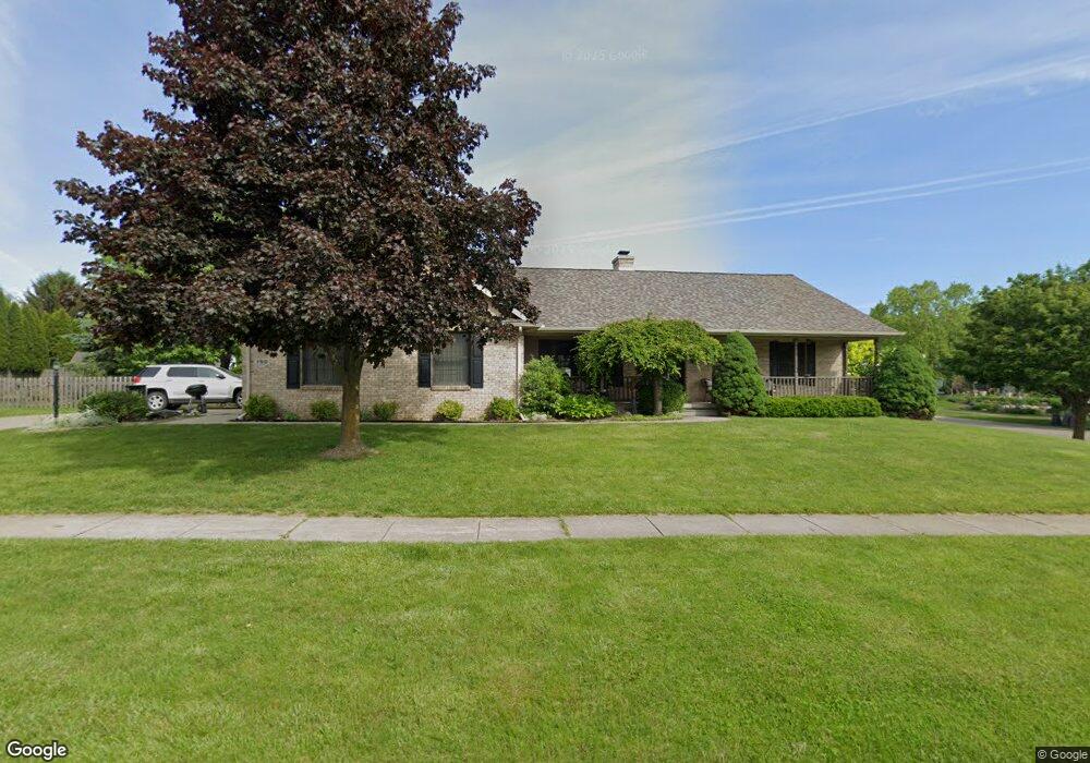
190 Primrose Ln Flushing, MI 48433
Estimated Value: $285,247 - $348,000
2
Beds
2
Baths
1,680
Sq Ft
$193/Sq Ft
Est. Value
About This Home
This home is located at 190 Primrose Ln, Flushing, MI 48433 and is currently estimated at $323,562, approximately $192 per square foot. 190 Primrose Ln is a home located in Genesee County with nearby schools including Central Elementary School, Flushing Middle School, and Flushing High School.
Ownership History
Date
Name
Owned For
Owner Type
Purchase Details
Closed on
May 22, 2025
Sold by
Hundley Amy Marie
Bought by
Hundley Amy Marie and Gonzalez Kylie J
Current Estimated Value
Purchase Details
Closed on
Feb 19, 2021
Sold by
Walling Judith and Jennie A Kalakey Trust
Bought by
Hundley Amy Marie
Home Financials for this Owner
Home Financials are based on the most recent Mortgage that was taken out on this home.
Original Mortgage
$214,578
Interest Rate
2.73%
Mortgage Type
New Conventional
Purchase Details
Closed on
Jan 29, 2019
Sold by
Kalakay Jennie A and Kalakay Fred
Bought by
Kalakay Jennie A and Jennie A Kalakay Trust
Create a Home Valuation Report for This Property
The Home Valuation Report is an in-depth analysis detailing your home's value as well as a comparison with similar homes in the area
Home Values in the Area
Average Home Value in this Area
Purchase History
| Date | Buyer | Sale Price | Title Company |
|---|---|---|---|
| Hundley Amy Marie | -- | None Listed On Document | |
| Hundley Amy Marie | $240,000 | Mason Burgess Title Agency | |
| Kalakay Jennie A | -- | None Available |
Source: Public Records
Mortgage History
| Date | Status | Borrower | Loan Amount |
|---|---|---|---|
| Previous Owner | Hundley Amy Marie | $214,578 |
Source: Public Records
Tax History
| Year | Tax Paid | Tax Assessment Tax Assessment Total Assessment is a certain percentage of the fair market value that is determined by local assessors to be the total taxable value of land and additions on the property. | Land | Improvement |
|---|---|---|---|---|
| 2025 | $5,337 | $134,000 | $0 | $0 |
| 2024 | $4,250 | $128,500 | $0 | $0 |
| 2023 | $4,081 | $109,300 | $0 | $0 |
| 2022 | $3,796 | $103,000 | $0 | $0 |
| 2021 | $3,796 | $95,500 | $0 | $0 |
| 2020 | $3,009 | $88,500 | $0 | $0 |
| 2019 | $2,972 | $82,900 | $0 | $0 |
| 2018 | $3,576 | $83,400 | $0 | $0 |
| 2017 | $3,320 | $82,600 | $0 | $0 |
| 2016 | $3,292 | $75,683 | $0 | $0 |
| 2015 | $3,281 | $0 | $0 | $0 |
| 2012 | -- | $72,900 | $72,900 | $0 |
Source: Public Records
Map
Nearby Homes
- 219 Primrose Ln
- 3500 Woodridge Ct
- 100 Aberdeen Dr Unit 36
- 321 Terrace Dr
- 0 W Pierson Rd Unit 50141989
- 315 N Maple St
- 229 Aberdeen Ct
- 6289 W River Rd
- 241 Aberdeen Ct Unit 11 bldg 6
- 113 N Mckinley Rd
- 501 Spring Ln
- 0 E River Rd Unit 50180952
- 0 Winters Eave Dr Unit 50117986
- 608 Autumn Dr
- 10101 Carpenter Rd
- 527 Oakbrook Cir Unit 14
- 3155 Beech Tree Ln
- 530 Coutant St
- 200 Boman St
- 516 Sunnyslope Dr
- 226 Brookside Dr
- 194 Primrose Ln
- 222 Brookside Dr
- 195 Primrose Ln
- 220 Brookside Dr
- 198 Primrose Ln
- 199 Primrose Ln
- 225 Brookside Dr
- 202 Primrose Ln
- 216 Brookside Dr
- 131 Brookside Dr
- 133 Brookside Dr
- 227 Brookside Dr
- 221 Brookside Dr
- 206 Primrose Ln
- 142 Brookside Dr
- 135 Brookside Dr
- 207 Primrose Ln
- 217 Brookside Dr
- 212 Brookside Dr
Your Personal Tour Guide
Ask me questions while you tour the home.