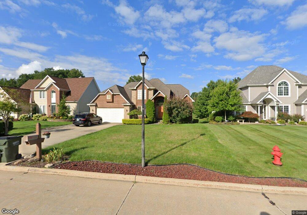
1900 Cedarhurst Dr Wickliffe, OH 44092
Estimated Value: $404,860 - $415,000
4
Beds
4
Baths
1,680
Sq Ft
$244/Sq Ft
Est. Value
About This Home
This home is located at 1900 Cedarhurst Dr, Wickliffe, OH 44092 and is currently estimated at $410,620, approximately $244 per square foot. 1900 Cedarhurst Dr is a home located in Lake County with nearby schools including Wickliffe Elementary School, Wickliffe Middle School, and Wickliffe High School.
Ownership History
Date
Name
Owned For
Owner Type
Purchase Details
Closed on
Jul 15, 1999
Sold by
F A Makoski Construction Co Inc and Makoski Frank A
Bought by
Kinney Eleare and Kinney Cheryl L
Current Estimated Value
Home Financials for this Owner
Home Financials are based on the most recent Mortgage that was taken out on this home.
Original Mortgage
$207,700
Outstanding Balance
$55,447
Interest Rate
7.69%
Mortgage Type
Construction
Estimated Equity
$355,173
Purchase Details
Closed on
Nov 20, 1996
Sold by
Key Louis A
Bought by
F A Makoski Const Co Inc
Home Financials for this Owner
Home Financials are based on the most recent Mortgage that was taken out on this home.
Original Mortgage
$57,000
Interest Rate
7.94%
Mortgage Type
New Conventional
Purchase Details
Closed on
Sep 27, 1991
Bought by
Key Louis A
Create a Home Valuation Report for This Property
The Home Valuation Report is an in-depth analysis detailing your home's value as well as a comparison with similar homes in the area
Home Values in the Area
Average Home Value in this Area
Purchase History
| Date | Buyer | Sale Price | Title Company |
|---|---|---|---|
| Kinney Eleare | $81,900 | Midland Title Security Inc | |
| F A Makoski Const Co Inc | $66,000 | -- | |
| Key Louis A | $43,000 | -- |
Source: Public Records
Mortgage History
| Date | Status | Borrower | Loan Amount |
|---|---|---|---|
| Open | Kinney Eleare | $207,700 | |
| Closed | F A Makoski Const Co Inc | $57,000 |
Source: Public Records
Tax History
| Year | Tax Paid | Tax Assessment Tax Assessment Total Assessment is a certain percentage of the fair market value that is determined by local assessors to be the total taxable value of land and additions on the property. | Land | Improvement |
|---|---|---|---|---|
| 2025 | -- | $132,600 | $20,960 | $111,640 |
| 2024 | -- | $132,600 | $20,960 | $111,640 |
| 2023 | $13,501 | $109,780 | $17,760 | $92,020 |
| 2022 | $7,258 | $109,780 | $17,760 | $92,020 |
| 2021 | $7,287 | $109,780 | $17,760 | $92,020 |
| 2020 | $6,896 | $89,980 | $14,550 | $75,430 |
| 2019 | $6,893 | $89,980 | $14,550 | $75,430 |
| 2018 | $5,595 | $83,110 | $30,810 | $52,300 |
| 2017 | $5,244 | $83,110 | $30,810 | $52,300 |
| 2016 | $5,218 | $83,110 | $30,810 | $52,300 |
| 2015 | $5,116 | $83,110 | $30,810 | $52,300 |
| 2014 | $4,506 | $83,110 | $30,810 | $52,300 |
| 2013 | $4,504 | $83,110 | $30,810 | $52,300 |
Source: Public Records
Map
Nearby Homes
- 30529 Ridge Rd
- 5642 Grand Place
- 1842 Eldon Dr
- 30530 Grant St
- 5430 Oak Ridge Dr
- 30200 Ridge Rd
- 1677 Mapledale Rd
- 5485 Wildwood Ct Unit D
- 2250 Pine Ridge Dr
- 1677 Douglas Rd
- 5548 Ivy Ct Unit C
- 2265 Country Club Dr
- 5481 Millwood Ln Unit C
- 5512 Sutton Ln Unit D
- 1648 Douglas Rd
- 5463 Millwood Ln Unit 42C
- 5520 Bretton Ct Unit A
- 5542 Bretton Ct Unit A
- 1719 E 300th St
- 5444 Som Center Rd
- 1904 Cedarhurst Dr
- 1894 Cedarhurst Dr
- 1886 Cedarhurst Dr
- 1908 Cedarhurst Dr
- 1878 Cedarhurst Dr
- 1912 Ridgehurst Dr
- 1916 Ridgehurst Dr
- 1870 Cedarhurst Dr
- 1905 Fairway Dr
- 1862 Cedarhurst Dr
- 1901 Fairway Dr
- 1920 Ridgehurst Dr
- 30601 Ridge Rd
- 1854 Cedarhurst Dr
- 1911 Fairway Dr
- 1915 Ridgehurst Dr
- 1911 Ridgehurst Dr
- 1861 Cedarhurst Dr
- 1919 Ridgehurst Dr
- 1924 Ridgehurst Dr
Your Personal Tour Guide
Ask me questions while you tour the home.