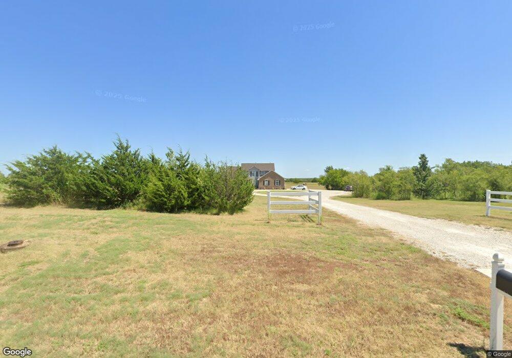
1900 Custer Ln Augusta, KS 67010
Estimated Value: $415,000 - $691,023
5
Beds
5
Baths
2,104
Sq Ft
$263/Sq Ft
Est. Value
About This Home
This home is located at 1900 Custer Ln, Augusta, KS 67010 and is currently estimated at $553,012, approximately $262 per square foot. 1900 Custer Ln is a home with nearby schools including Augusta Senior High School and St. James Catholic School.
Ownership History
Date
Name
Owned For
Owner Type
Purchase Details
Closed on
Nov 26, 2019
Sold by
Mccollom Construction Inc
Bought by
Ward Matthew Ryan
Current Estimated Value
Home Financials for this Owner
Home Financials are based on the most recent Mortgage that was taken out on this home.
Original Mortgage
$448,981
Outstanding Balance
$395,319
Interest Rate
3.75%
Mortgage Type
New Conventional
Estimated Equity
$157,693
Purchase Details
Closed on
Jan 15, 2019
Sold by
Mccollom Mark S and Mccollom Kay M
Bought by
Mccollom Construction Inc
Home Financials for this Owner
Home Financials are based on the most recent Mortgage that was taken out on this home.
Original Mortgage
$353,810
Interest Rate
4.8%
Mortgage Type
Construction
Create a Home Valuation Report for This Property
The Home Valuation Report is an in-depth analysis detailing your home's value as well as a comparison with similar homes in the area
Home Values in the Area
Average Home Value in this Area
Purchase History
| Date | Buyer | Sale Price | Title Company |
|---|---|---|---|
| Ward Matthew Ryan | -- | None Available | |
| Ward Matthew Ryan | $561,226 | Other | |
| Mccollom Construction Inc | -- | None Available |
Source: Public Records
Mortgage History
| Date | Status | Borrower | Loan Amount |
|---|---|---|---|
| Open | Ward Matthew Ryan | $448,981 | |
| Closed | Ward Matthew Ryan | $448,981 | |
| Previous Owner | Mccollom Construction Inc | $353,810 |
Source: Public Records
Tax History
| Year | Tax Paid | Tax Assessment Tax Assessment Total Assessment is a certain percentage of the fair market value that is determined by local assessors to be the total taxable value of land and additions on the property. | Land | Improvement |
|---|---|---|---|---|
| 2025 | $119 | $77,591 | $8,165 | $69,426 |
| 2024 | $119 | $74,279 | $5,520 | $68,759 |
| 2023 | $10,161 | $63,170 | $5,520 | $57,650 |
| 2022 | $1,001 | $57,201 | $5,520 | $51,681 |
| 2021 | $1,001 | $54,527 | $5,520 | $49,007 |
| 2020 | $9,278 | $54,350 | $5,491 | $48,859 |
| 2019 | $1,001 | $5,730 | $5,730 | $0 |
| 2018 | $29 | $165 | $165 | $0 |
| 2017 | $5,789 | $147 | $147 | $0 |
| 2014 | -- | $10 | $10 | $0 |
Source: Public Records
Map
Nearby Homes
- 1027 Pembroke Rd
- 2512 Mainsgate Dr
- 0 Ohio St
- 2008 Dearborn St
- 1500 Moyle St
- 2203 Moyle St
- 2701 N Mainsgate Dr
- 1032 E Stafford Ct
- 1923 Robbins St
- 2823 N Rutland Ln
- 2814 N Rutland Ln
- 2809 N Rutland Ln
- 1619 Robbins St
- 1207 Ohio St
- 710 Lakewood Ct
- 2813 N Rutland Ln
- 1928 Prairie Ln
- 2822 N Rutland Ln
- 1718 Socony St
- 2825 N Rutland Ln
- 0 Custer Ln
- 1712 Custer Ln
- 1712 Custer Ln Unit 608 State St
- 1704 Custer Ln
- 2200 Chestnut Ct
- 2201 Chestnut Ct
- 1713 Cedar Ln
- 2203 Chestnut Ct
- 1 Debra Cir
- 2202 Chestnut Ct
- 2 Debra Cir
- 2205 Chestnut Ct
- 2204 Chestnut Ct
- 2202 Foxfire Ct
- 2200 Foxfire Ct Unit LOTS 20,22,23 BLOCK
- 2200 Foxfire Ct
- 2206 Chestnut Ct
- 2207 Chestnut Ct
- 5 Debra Cir
- 2204 Foxfire Ct
Your Personal Tour Guide
Ask me questions while you tour the home.