Estimated Value: $718,902
Studio
2
Baths
7,500
Sq Ft
$96/Sq Ft
Est. Value
About This Home
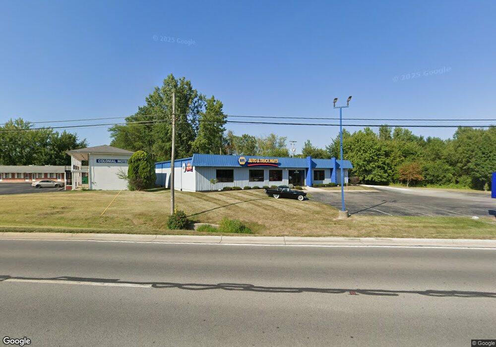
This home is located at 1900 Elida Rd, Lima, OH 45805 and is currently estimated at $718,902, approximately $95 per square foot. 1900 Elida Rd is a home located in Allen County with nearby schools including Elida Elementary School, Elida Middle School, and Elida High School.
Ownership History
Date
Name
Owned For
Owner Type
Purchase Details
Closed on
Jun 24, 2016
Sold by
Michael G Lawson Inc
Bought by
Bastress Realty Group Llc
Current Estimated Value
Purchase Details
Closed on
Jul 23, 1993
Sold by
Lawson Michael G
Bought by
Michael G Lawson Inc
Purchase Details
Closed on
Apr 3, 1987
Bought by
Lawson Michael G
Create a Home Valuation Report for This Property
The Home Valuation Report is an in-depth analysis detailing your home's value as well as a comparison with similar homes in the area
Purchase History
| Date | Buyer | Sale Price | Title Company |
|---|---|---|---|
| Bastress Realty Group Llc | $375,000 | None Available | |
| Michael G Lawson Inc | -- | -- | |
| Lawson Michael G | $23,000 | -- |
Source: Public Records
Tax History
| Year | Tax Paid | Tax Assessment Tax Assessment Total Assessment is a certain percentage of the fair market value that is determined by local assessors to be the total taxable value of land and additions on the property. | Land | Improvement |
|---|---|---|---|---|
| 2024 | $8,819 | $153,790 | $22,750 | $131,040 |
| 2023 | $8,809 | $139,830 | $20,690 | $119,140 |
| 2022 | $8,975 | $139,830 | $20,690 | $119,140 |
| 2021 | $8,954 | $139,830 | $20,690 | $119,140 |
| 2020 | $9,363 | $139,590 | $16,560 | $123,030 |
| 2019 | $9,363 | $139,590 | $16,560 | $123,030 |
| 2018 | $9,237 | $139,590 | $16,560 | $123,030 |
| 2017 | $9,050 | $139,590 | $16,560 | $123,030 |
| 2016 | $7,256 | $111,660 | $16,560 | $95,100 |
| 2015 | $7,817 | $111,660 | $16,560 | $95,100 |
| 2014 | $7,817 | $121,810 | $16,560 | $105,250 |
| 2013 | $7,304 | $121,810 | $16,560 | $105,250 |
Source: Public Records
Map
Nearby Homes
- 102 Charwood Dr
- 1580 W Robb Ave
- 1730 Homeward Ave
- 00 Homeward Ave
- 1883 Brookhaven Dr Unit 2
- 1919 Jared Place
- 1605 Hazel Ave
- 1164 Bahama Dr
- 1407 Latham Ave
- 1600 Leland Ave
- 3 Poulston Place
- 1753 Leland Ave
- 1245 Latham Ave
- 1015 N Cole St
- 2129 Reinell Ave
- 705 Cornell Dr
- 2113 Kimberly Dr
- 0 Latham
- 37 Beaumont Place
- 1209 Rice Ave
Your Personal Tour Guide
Ask me questions while you tour the home.