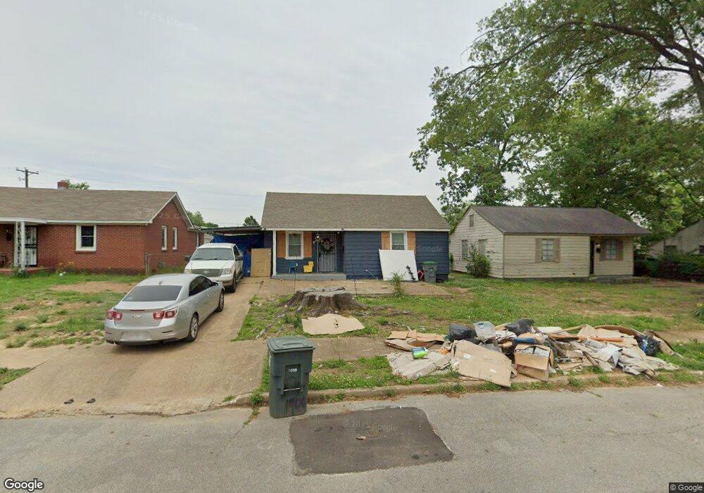
1900 Hearst Ave Memphis, TN 38114
Southeast Memphis NeighborhoodEstimated Value: $97,000 - $100,000
2
Beds
1
Bath
736
Sq Ft
$134/Sq Ft
Est. Value
About This Home
This home is located at 1900 Hearst Ave, Memphis, TN 38114 and is currently estimated at $98,667, approximately $134 per square foot. 1900 Hearst Ave is a home located in Shelby County with nearby schools including Hamilton High School, Memphis College Preparatory, and Veritas College Preparatory.
Ownership History
Date
Name
Owned For
Owner Type
Purchase Details
Closed on
Aug 16, 2022
Sold by
Gyn Realty Llc
Bought by
Icj Realty Llc
Current Estimated Value
Purchase Details
Closed on
Feb 15, 2022
Sold by
Charlie Jones
Bought by
Gyn Realty Llc
Purchase Details
Closed on
May 22, 1998
Sold by
Ron Taylor and Ron Beverly
Bought by
Jones Charlie W
Home Financials for this Owner
Home Financials are based on the most recent Mortgage that was taken out on this home.
Original Mortgage
$36,000
Interest Rate
7.23%
Create a Home Valuation Report for This Property
The Home Valuation Report is an in-depth analysis detailing your home's value as well as a comparison with similar homes in the area
Home Values in the Area
Average Home Value in this Area
Purchase History
| Date | Buyer | Sale Price | Title Company |
|---|---|---|---|
| Icj Realty Llc | -- | Apperson Crump Plc | |
| Gyn Realty Llc | $6,000 | Apperson Crump Plc | |
| Jones Charlie W | -- | First Title Corporation |
Source: Public Records
Mortgage History
| Date | Status | Borrower | Loan Amount |
|---|---|---|---|
| Previous Owner | Jones Charlie W | $36,000 |
Source: Public Records
Tax History Compared to Growth
Tax History
| Year | Tax Paid | Tax Assessment Tax Assessment Total Assessment is a certain percentage of the fair market value that is determined by local assessors to be the total taxable value of land and additions on the property. | Land | Improvement |
|---|---|---|---|---|
| 2025 | $135 | $24,675 | $1,500 | $23,175 |
| 2024 | $135 | $3,975 | $1,000 | $2,975 |
| 2023 | $242 | $3,975 | $1,000 | $2,975 |
| 2022 | $242 | $3,975 | $1,000 | $2,975 |
| 2021 | $137 | $3,975 | $1,000 | $2,975 |
| 2020 | $257 | $3,550 | $1,000 | $2,550 |
| 2019 | $113 | $3,550 | $1,000 | $2,550 |
| 2018 | $113 | $3,550 | $1,000 | $2,550 |
| 2017 | $116 | $3,550 | $1,000 | $2,550 |
| 2016 | $181 | $4,150 | $0 | $0 |
| 2014 | $181 | $4,150 | $0 | $0 |
Source: Public Records
Map
Nearby Homes
- 1817 S Barksdale St
- 1936 Frisco Ave
- 1971 Boyle Ave
- 1949 Lapaloma St
- 1824 Rozelle St
- 1832 Rozelle St
- 996 Rozelle St
- 2151 Goff Ave
- 2149 Wabash Ave
- 1998 Cloverdale Dr
- 1911 Quinn Ave
- 1493 Oaklawn St
- 1481 Oaklawn St
- 1698 Rayner St
- 0 Dublin Ave Unit LOTS 20 & 21 LAST TW
- 1816 Kerr Ave
- 1790 Westmore St
- 1720 Airways Blvd
- 1721 W Silver St
- 0 Airways Blvd Unit 10199303
- 1906 Hearst Ave
- 1894 Hearst Ave
- 1895 Carver Ave
- 1890 Hearst Ave
- 1910 Hearst Ave
- 1899 Carver Ave
- 1889 Carver Ave
- 1884 Hearst Ave
- 1793 S Barksdale St
- 1911 Carver Ave
- 1907 Carver Ave
- 1794 S Barksdale St
- 1885 Carver Ave
- 1880 Hearst Ave
- 1801 S Barksdale St
- 1794 State St
- 1800 S Barksdale St
- 1924 Hearst Ave
- 1876 Hearst Ave
- 1881 Carver Ave