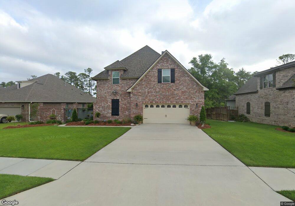
1900 Paul David Dr Biloxi, MS 39532
Estimated Value: $422,732 - $579,000
Studio
1
Bath
3,142
Sq Ft
$163/Sq Ft
Est. Value
About This Home
This home is located at 1900 Paul David Dr, Biloxi, MS 39532 and is currently estimated at $512,183, approximately $163 per square foot. 1900 Paul David Dr is a home with nearby schools including North Bay Elementary School, Biloxi Junior High School, and Biloxi High School.
Ownership History
Date
Name
Owned For
Owner Type
Purchase Details
Closed on
May 10, 2023
Sold by
Smith Marvin
Bought by
Whiteside Benjamin Lee
Current Estimated Value
Home Financials for this Owner
Home Financials are based on the most recent Mortgage that was taken out on this home.
Original Mortgage
$7,000
Outstanding Balance
$5,688
Interest Rate
6.32%
Mortgage Type
New Conventional
Estimated Equity
$506,495
Purchase Details
Closed on
Aug 7, 2014
Bought by
Charles Charles T and Charles Theresa Z
Home Financials for this Owner
Home Financials are based on the most recent Mortgage that was taken out on this home.
Original Mortgage
$44,000
Interest Rate
4.19%
Mortgage Type
Land Contract Argmt. Of Sale
Purchase Details
Closed on
Jul 24, 2014
Sold by
William Christopher William Christopher
Bought by
Loveless Bobbie Ann
Home Financials for this Owner
Home Financials are based on the most recent Mortgage that was taken out on this home.
Original Mortgage
$44,000
Interest Rate
4.19%
Mortgage Type
Land Contract Argmt. Of Sale
Create a Home Valuation Report for This Property
The Home Valuation Report is an in-depth analysis detailing your home's value as well as a comparison with similar homes in the area
Home Values in the Area
Average Home Value in this Area
Purchase History
| Date | Buyer | Sale Price | Title Company |
|---|---|---|---|
| Whiteside Benjamin Lee | -- | Integrity Land Title | |
| Charles Charles T | -- | -- | |
| Loveless Bobbie Ann | -- | -- |
Source: Public Records
Mortgage History
| Date | Status | Borrower | Loan Amount |
|---|---|---|---|
| Open | Whiteside Benjamin Lee | $7,000 | |
| Previous Owner | Charles Charles T | $44,000 |
Source: Public Records
Tax History
| Year | Tax Paid | Tax Assessment Tax Assessment Total Assessment is a certain percentage of the fair market value that is determined by local assessors to be the total taxable value of land and additions on the property. | Land | Improvement |
|---|---|---|---|---|
| 2025 | $3,125 | $37,003 | $0 | $0 |
| 2024 | $3,097 | $35,459 | $0 | $0 |
| 2023 | $3,069 | $35,459 | $0 | $0 |
| 2022 | $3,592 | $35,459 | $0 | $0 |
| 2021 | $3,592 | $35,459 | $0 | $0 |
| 2020 | $3,305 | $32,803 | $0 | $0 |
| 2019 | $3,305 | $32,803 | $0 | $0 |
| 2018 | $3,305 | $32,803 | $0 | $0 |
| 2017 | $3,305 | $32,803 | $0 | $0 |
| 2015 | $659 | $6,000 | $0 | $0 |
| 2014 | -- | $10,000 | $0 | $0 |
| 2013 | -- | $6,000 | $6,000 | $0 |
Source: Public Records
Map
Nearby Homes
- 1985 Kornman Dr
- 1884 Courtney Ln
- 0 Campbell Road Dr Unit 4027188
- 0 Jam Ln
- 939 Tommy Munro Dr
- 0 Popps Ferry Rd Unit 4138386
- 0 Popps Ferry Rd Unit 4108141
- 0 Popps Ferry Rd Unit 4108136
- 2106 Lauren Dr
- 830 Bluewood Dr
- 11532 Cedar Lake Rd
- 944 Cedar Lake Rd
- 856 Rustwood Dr
- 2091 Carolwood Dr
- 0 Silkwood Ln
- 694 Water's View Dr
- 712 Champagne Dr
- 844 Carolee Cir
- 796 Sharon Hills Dr
- 873 Carolee Cir
- 1898 Paul David Dr
- 1902 Paul David Dr
- 919 Caroline Dr
- 1904 Paul David Dr
- 1896 Paul David Dr
- 949 Caroline Dr
- 918 Caroline Dr
- 1894 Paul David Dr
- 921 Caroline Dr
- LOT 2 Lot 2 Paul David Dr
- 1906 Paul David Dr
- 947 Caroline Dr
- LOT 57 Lot 57 Caroline Dr
- 920 Caroline Dr
- 10352 Caroline Dr
- 10321 Caroline Dr
- 10313 Caroline Dr
- 10267 Caroline Dr
- 950 Caroline Dr
- 1892 Paul David Dr
Your Personal Tour Guide
Ask me questions while you tour the home.