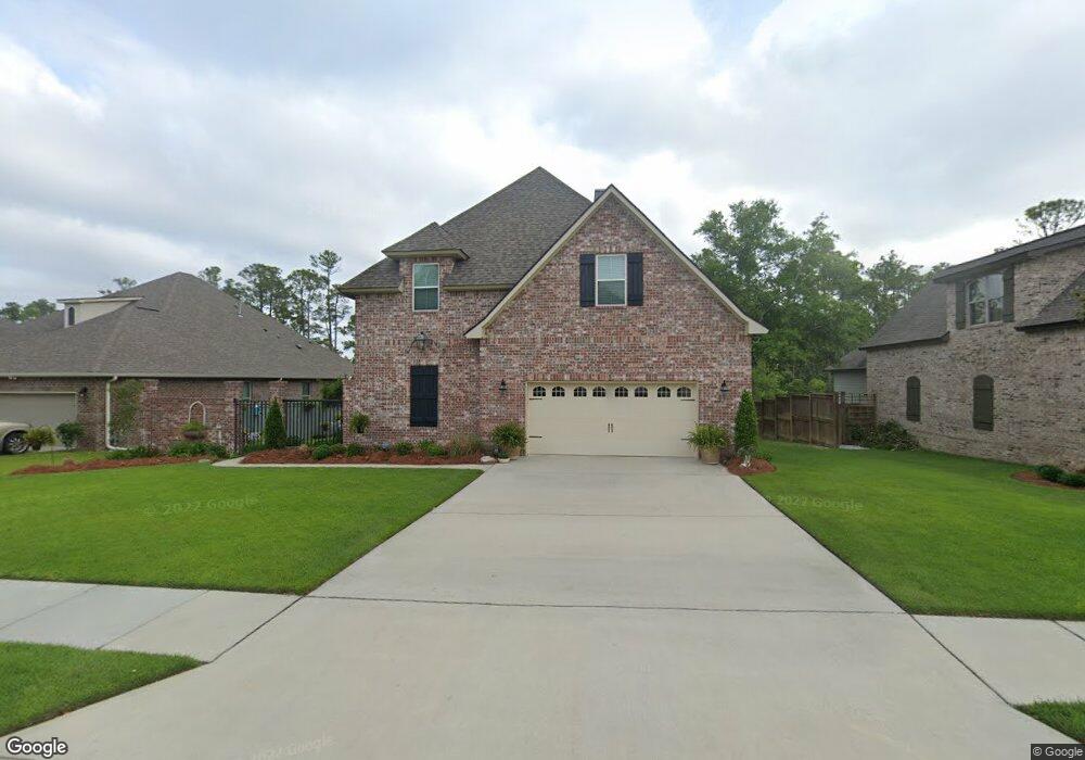
1900 Paul David Dr Biloxi, MS 39532
Estimated Value: $434,253 - $599,000
About This Home
This home is located at 1900 Paul David Dr, Biloxi, MS 39532 and is currently estimated at $536,813, approximately $170 per square foot. 1900 Paul David Dr is a home with nearby schools including North Bay Elementary School, Biloxi Junior High School, and Biloxi High School.
Ownership History
We collect this data history from publicly available records. To have your information removed, we recommend requesting removal directly through your county’s website.
Purchase Details
Home Financials for this Owner
Home Financials are based on the most recent Mortgage that was taken out on this home.Purchase Details
Home Financials for this Owner
Home Financials are based on the most recent Mortgage that was taken out on this home.Purchase Details
Home Financials for this Owner
Home Financials are based on the most recent Mortgage that was taken out on this home.Home Values in the Area
Average Home Value in this Area
Purchase History
We collect this data history from publicly available records. To have your information removed, we recommend requesting removal directly through your county’s website.
| Date | Buyer | Sale Price | Title Company |
|---|---|---|---|
| -- | Integrity Land Title | ||
| -- | -- | ||
| -- | -- |
Mortgage History
We collect this data history from publicly available records. To have your information removed, we recommend requesting removal directly through your county’s website.
| Date | Status | Borrower | Loan Amount |
|---|---|---|---|
| Open | $7,000 | ||
| Previous Owner | $44,000 |
Tax History
We collect this data history from publicly available records. To have your information removed, we recommend requesting removal directly through your county’s website.
| Year | Tax Paid | Tax Assessment Tax Assessment Total Assessment is a certain percentage of the fair market value that is determined by local assessors to be the total taxable value of land and additions on the property. | Land | Improvement |
|---|---|---|---|---|
| 2025 | $3,125 | $37,003 | $0 | $0 |
| 2024 | $3,097 | $35,459 | $0 | $0 |
| 2023 | $3,069 | $35,459 | $0 | $0 |
| 2022 | $3,592 | $35,459 | $0 | $0 |
| 2021 | $3,592 | $35,459 | $0 | $0 |
| 2020 | $3,305 | $32,803 | $0 | $0 |
| 2019 | $3,305 | $32,803 | $0 | $0 |
| 2018 | $3,305 | $32,803 | $0 | $0 |
| 2017 | $3,305 | $32,803 | $0 | $0 |
| 2015 | $659 | $6,000 | $0 | $0 |
| 2014 | -- | $10,000 | $0 | $0 |
| 2013 | -- | $6,000 | $6,000 | $0 |
Map
- 0 Jam Ln
- 939 Tommy Munro Dr
- 0 Popps Ferry Rd Unit 4138386
- 0 Popps Ferry Rd Unit 4108141
- 0 Popps Ferry Rd Unit 4108136
- 2071 Stone Bridge Dr
- 944 Cedar Lake Rd
- 11532 Cedar Lake Rd
- 835 Lakewood Place
- 745 Champagne Dr
- 851 Rustwood Dr
- 0 Silkwood Ln
- 694 Water's View Dr
- 757 Highland Dr
- 796 Sharon Hills Dr
- 1990 Brasher Rd
- 1867 Brasher Rd
- 5505 Leeds Ln
- 5416 Leeds Ln
- 2033 S Hill Dr
- 1898 Paul David Dr
- 1902 Paul David Dr
- 919 Caroline Dr
- 1904 Paul David Dr
- 1896 Paul David Dr
- 949 Caroline Dr
- 918 Caroline Dr
- 1894 Paul David Dr
- LOT 2 Lot 2 Paul David Dr
- 921 Caroline Dr
- 1906 Paul David Dr
- 947 Caroline Dr
- LOT 57 Lot 57 Caroline Dr
- 920 Caroline Dr
- 10352 Caroline Dr
- 10321 Caroline Dr
- 10313 Caroline Dr
- 10267 Caroline Dr
- 950 Caroline Dr
- 1892 Paul David Dr
Ask me questions while you tour the home.