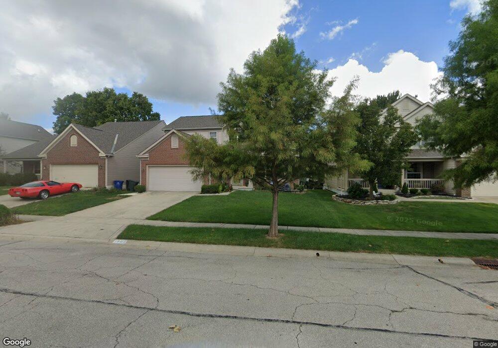
1900 Smoky Meadow Dr Columbus, OH 43235
Brookside Colony NeighborhoodEstimated Value: $502,693 - $632,000
4
Beds
3
Baths
2,602
Sq Ft
$216/Sq Ft
Est. Value
About This Home
This home is located at 1900 Smoky Meadow Dr, Columbus, OH 43235 and is currently estimated at $563,173, approximately $216 per square foot. 1900 Smoky Meadow Dr is a home located in Franklin County with nearby schools including Granby Elementary School, McCord Middle School, and Worthington Kilbourne High School.
Ownership History
Date
Name
Owned For
Owner Type
Purchase Details
Closed on
Aug 31, 2005
Sold by
Sovereign Development Corp
Bought by
Siva Ruthiran and Ruthiran Pathmarajini
Current Estimated Value
Home Financials for this Owner
Home Financials are based on the most recent Mortgage that was taken out on this home.
Original Mortgage
$236,052
Outstanding Balance
$126,050
Interest Rate
5.82%
Mortgage Type
Purchase Money Mortgage
Estimated Equity
$437,123
Purchase Details
Closed on
Sep 3, 2004
Sold by
Brehm Builders Inc
Bought by
Sovereign Development Corp
Purchase Details
Closed on
Mar 3, 1995
Sold by
Asssoc Keseg and Asssoc Brehm
Bought by
Brehm Builders Inc
Purchase Details
Closed on
Jan 21, 1992
Create a Home Valuation Report for This Property
The Home Valuation Report is an in-depth analysis detailing your home's value as well as a comparison with similar homes in the area
Home Values in the Area
Average Home Value in this Area
Purchase History
| Date | Buyer | Sale Price | Title Company |
|---|---|---|---|
| Siva Ruthiran | $295,100 | -- | |
| Sovereign Development Corp | $33,900 | -- | |
| Brehm Builders Inc | $187,500 | -- | |
| -- | $140,000 | -- |
Source: Public Records
Mortgage History
| Date | Status | Borrower | Loan Amount |
|---|---|---|---|
| Open | Siva Ruthiran | $236,052 |
Source: Public Records
Tax History Compared to Growth
Tax History
| Year | Tax Paid | Tax Assessment Tax Assessment Total Assessment is a certain percentage of the fair market value that is determined by local assessors to be the total taxable value of land and additions on the property. | Land | Improvement |
|---|---|---|---|---|
| 2024 | $9,721 | $158,340 | $42,000 | $116,340 |
| 2023 | $9,296 | $158,340 | $42,000 | $116,340 |
| 2022 | $8,634 | $116,690 | $17,850 | $98,840 |
| 2021 | $7,965 | $116,690 | $17,850 | $98,840 |
| 2020 | $7,672 | $116,690 | $17,850 | $98,840 |
| 2019 | $7,021 | $96,360 | $14,880 | $81,480 |
| 2018 | $6,494 | $96,360 | $14,880 | $81,480 |
| 2017 | $6,292 | $96,360 | $14,880 | $81,480 |
| 2016 | $6,185 | $87,120 | $11,870 | $75,250 |
| 2015 | $6,186 | $87,120 | $11,870 | $75,250 |
| 2014 | $6,184 | $87,120 | $11,870 | $75,250 |
| 2013 | $3,077 | $87,115 | $11,865 | $75,250 |
Source: Public Records
Map
Nearby Homes
- 1930 Shallowford Ave
- 6921 Spruce Pine Dr
- 2056 Fincastle Ct
- 1721 Worthington Run Dr Unit 1721-1731
- 1889 Slaton Ct Unit 1889
- 2161 Heatherfield Ave
- 1637 Park Row Dr Unit F
- 2001 Sawbury Blvd Unit 2001
- 1620 Park Row Dr Unit A
- 2687 Snouffer Rd
- 1828 Gardenstone Dr
- 7373 Palmleaf Ln
- 1380 Tiehack Ct
- 2074 Hard Rd
- 2220 Surreygate Dr
- 7164 Durness Place
- 2392 Dunsworth Dr
- 7734 Henry David Ct
- 2456 Sanford Dr
- 2469 Sandstrom Dr
- 1892 Smoky Meadow Dr
- 1908 Smoky Meadow Dr
- 6979 Shorehill Ln
- 1916 Smoky Meadow Dr
- 1884 Smoky Meadow Dr
- 1911 Smoky Meadow Dr
- 1917 Queensbridge Dr
- 6971 Shorehill Ln
- 1924 Smoky Meadow Dr
- 1924 Smoky Meadow Ct
- 6987 Shorehill Ln
- 1889 Smoky Meadow Ct
- 1919 Smoky Meadow Dr
- 1923 Queensbridge Dr
- 1919 Smoky Meadow Ct
- 1889 Smokey Meadow Dr
- 1932 Smoky Meadow Dr
- 1881 Smoky Meadow Dr
- 6986 Shorehill Ln
- 1873 Smoky Meadow Dr