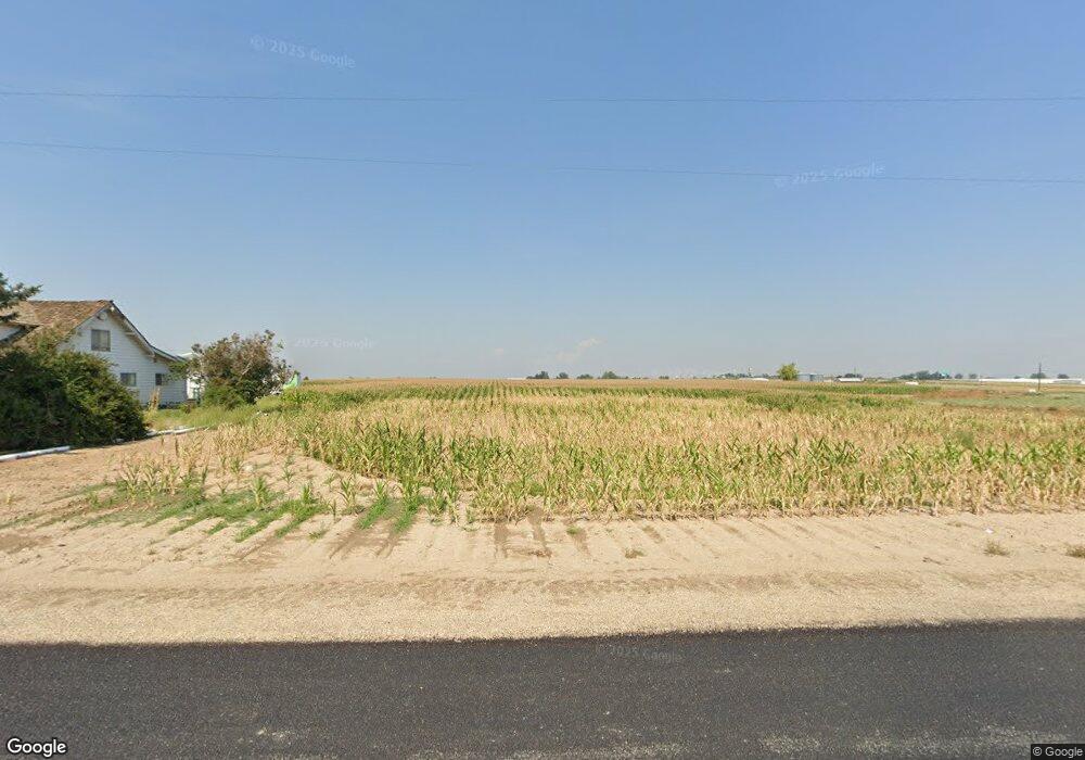
1900 SW 1st Ave Fruitland, ID 83619
Estimated Value: $580,000 - $671,429
4
Beds
2
Baths
1,924
Sq Ft
$316/Sq Ft
Est. Value
About This Home
This home is located at 1900 SW 1st Ave, Fruitland, ID 83619 and is currently estimated at $607,857, approximately $315 per square foot. 1900 SW 1st Ave is a home located in Payette County with nearby schools including Fruitland Elementary School, Fruitland Middle School, and Fruitland Preparatory Academy Alternative School.
Ownership History
Date
Name
Owned For
Owner Type
Purchase Details
Closed on
May 29, 2025
Sold by
Maverik Inc
Bought by
Idaho Transportation Department
Current Estimated Value
Purchase Details
Closed on
Jan 20, 2025
Sold by
Richard B And Joann Strawn Family Trust and Strawn Richard B
Bought by
Maverik Inc
Purchase Details
Closed on
Aug 26, 2015
Sold by
Strawn Richard B and Strawn Joann
Bought by
The Richard B And Joann Strawn Family Tr and Strawn Richard B
Create a Home Valuation Report for This Property
The Home Valuation Report is an in-depth analysis detailing your home's value as well as a comparison with similar homes in the area
Home Values in the Area
Average Home Value in this Area
Purchase History
| Date | Buyer | Sale Price | Title Company |
|---|---|---|---|
| Idaho Transportation Department | -- | Pioneer Title | |
| Maverik Inc | -- | None Listed On Document | |
| The Richard B And Joann Strawn Family Tr | -- | None Available |
Source: Public Records
Tax History Compared to Growth
Tax History
| Year | Tax Paid | Tax Assessment Tax Assessment Total Assessment is a certain percentage of the fair market value that is determined by local assessors to be the total taxable value of land and additions on the property. | Land | Improvement |
|---|---|---|---|---|
| 2025 | $1,491 | $481,192 | $288,701 | $192,491 |
| 2024 | $1,491 | $530,753 | $314,342 | $216,411 |
| 2023 | $1,491 | $510,171 | $299,317 | $210,854 |
| 2022 | $1,865 | $506,459 | $291,874 | $214,585 |
| 2021 | $1,585 | $363,327 | $201,231 | $162,096 |
| 2020 | $1,454 | $261,475 | $125,267 | $136,208 |
| 2017 | $2,113 | $0 | $0 | $0 |
| 2016 | $2,305 | $0 | $0 | $0 |
| 2015 | $2,010 | $229,402 | $116,010 | $113,392 |
| 2014 | $2,041 | $210,740 | $101,250 | $109,490 |
Source: Public Records
Map
Nearby Homes
- 2235 SW 1st Ave
- TBD Elmore
- TBD SW 1st Avenue Parcel 2
- TBD Fairview
- 1940 SW 3rd Ave
- 1750 SW 3rd Ave
- 6050 Elmore Rd
- 0 NW 1st Ave Unit 17642560
- 0 NW 1st Ave Unit 17642552
- tbd Finley Rd
- 5686 Finley Rd
- 1280 SW 3rd Ave
- 5805 Denver Rd Unit 2
- 2800 Highway 30 W
- 2022 Zach Blvd
- 5111 Barnard Ln
- 5176 Caleb Ct
- Parcel 3 NW 1st Ave
- Parcel 1 NW 1st Ave
- 1925 Glenway Ave
- 1929 SW 1st Ave
- 5975 Highway 95
- 5965 Highway 95 Unit 1
- 5915 Highway 95
- 5965 & 596 Us Highway 95
- 5965 & 5967 Us Highway 95
- 5955 Highway 95
- 5955 U S 95
- 6000 Highway 95
- 6000 Highway 95
- 5945 Highway 95
- 5935 Highway 95
- 6525 Highway 95
- 6525 Highway 95
- 5925 Highway 95
- TBD Crimson Maple Glen Sub
- TBD Magnolia Ave
- TBD Hwy 30
- TBD 1st Ln E
- tbd Custer Rd
