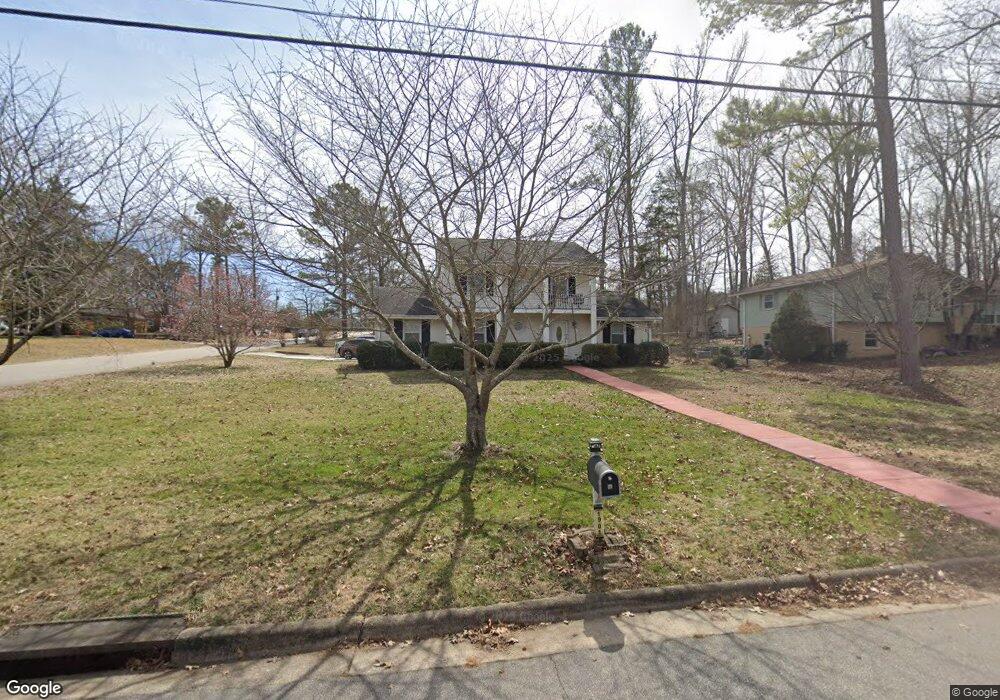
1901 Cannon Dr Durham, NC 27705
Duke Homestead NeighborhoodEstimated Value: $396,000 - $454,000
4
Beds
4
Baths
2,000
Sq Ft
$210/Sq Ft
Est. Value
About This Home
This home is located at 1901 Cannon Dr, Durham, NC 27705 and is currently estimated at $420,174, approximately $210 per square foot. 1901 Cannon Dr is a home located in Durham County with nearby schools including Easley Elementary, George L Carrington Middle, and Riverside High School.
Ownership History
Date
Name
Owned For
Owner Type
Purchase Details
Closed on
Aug 14, 1999
Sold by
Dysart Dorothea P
Bought by
Brunson Darryl B and Brunson Patricia M
Current Estimated Value
Home Financials for this Owner
Home Financials are based on the most recent Mortgage that was taken out on this home.
Original Mortgage
$138,380
Interest Rate
7.76%
Mortgage Type
FHA
Create a Home Valuation Report for This Property
The Home Valuation Report is an in-depth analysis detailing your home's value as well as a comparison with similar homes in the area
Home Values in the Area
Average Home Value in this Area
Purchase History
| Date | Buyer | Sale Price | Title Company |
|---|---|---|---|
| Brunson Darryl B | $140,000 | -- |
Source: Public Records
Mortgage History
| Date | Status | Borrower | Loan Amount |
|---|---|---|---|
| Previous Owner | Brunson Darryl B | $138,380 |
Source: Public Records
Tax History
| Year | Tax Paid | Tax Assessment Tax Assessment Total Assessment is a certain percentage of the fair market value that is determined by local assessors to be the total taxable value of land and additions on the property. | Land | Improvement |
|---|---|---|---|---|
| 2025 | $4,149 | $418,567 | $142,350 | $276,217 |
| 2024 | $2,934 | $210,328 | $43,740 | $166,588 |
| 2023 | $2,755 | $210,328 | $43,740 | $166,588 |
| 2022 | $2,692 | $210,328 | $43,740 | $166,588 |
| 2021 | $2,679 | $210,328 | $43,740 | $166,588 |
| 2020 | $2,616 | $210,328 | $43,740 | $166,588 |
| 2019 | $2,616 | $210,328 | $43,740 | $166,588 |
| 2018 | $2,182 | $160,871 | $32,805 | $128,066 |
| 2017 | $2,166 | $160,871 | $32,805 | $128,066 |
| 2016 | $2,093 | $160,871 | $32,805 | $128,066 |
| 2015 | $2,528 | $182,591 | $27,917 | $154,674 |
| 2014 | $2,528 | $182,591 | $27,917 | $154,674 |
Source: Public Records
Map
Nearby Homes
- 14 Justin Ct
- 34 Justin Ct
- 1918 Peppertree St
- 3650 Guess Rd
- 1 Signet Dr Unit A17
- 2605 Camellia Dr
- 32 Fashion Place
- 26 Fashion Place
- 2706 Ramblegate Ln
- 2207 Elk River Dr
- 3300 Alabama Ave
- 6 McBenson Place
- 1206A River Rock Dr
- 2900 Cammie St
- 1011 Wyldewood Rd
- 1904 Stadium Dr
- 4208 Convergence St
- 812 Sanderson Dr
- 2545 Bittersweet Dr
- 3256 Cascade Ln
- 1907 Cannon Dr
- 3823 Hermine St
- 3826 Hermine St
- 3718 Guess Rd
- 1904 Cannon Dr
- 3714 Guess Rd
- 3822 Hermine St
- 1906 Cannon Dr
- 1815 Cannon Dr
- 3819 Hermine St
- 1908 Cannon Dr
- 3704 Guess Rd
- 3818 Hermine St
- 3819 Zenith Place
- 1816 Cannon Dr
- 3815 Hermine St
- 1912 Cannon Dr
- 3823 Zenith Place
- 3817 Zenith Place
- 3702 Guess Rd
Your Personal Tour Guide
Ask me questions while you tour the home.