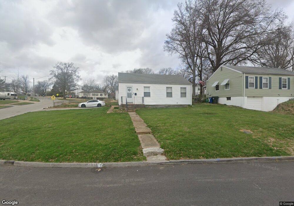
1901 Clare Ct Saint Louis, MO 63114
Estimated Value: $123,000 - $134,000
2
Beds
1
Bath
768
Sq Ft
$168/Sq Ft
Est. Value
About This Home
This home is located at 1901 Clare Ct, Saint Louis, MO 63114 and is currently estimated at $129,340, approximately $168 per square foot. 1901 Clare Ct is a home located in St. Louis County with nearby schools including Iveland Elementary School, Hoech Middle School, and Ritenour Senior High School.
Ownership History
Date
Name
Owned For
Owner Type
Purchase Details
Closed on
Dec 29, 2021
Sold by
Mfr 5 Llc
Bought by
Neal Kory
Current Estimated Value
Home Financials for this Owner
Home Financials are based on the most recent Mortgage that was taken out on this home.
Original Mortgage
$84,400
Outstanding Balance
$77,626
Interest Rate
3.11%
Mortgage Type
New Conventional
Estimated Equity
$51,714
Purchase Details
Closed on
Jul 30, 2021
Sold by
Swap 44 Llc
Bought by
Mfr 5 Llc
Purchase Details
Closed on
Jul 6, 2021
Sold by
Dahi Irma L
Bought by
Swap 44 Llc
Create a Home Valuation Report for This Property
The Home Valuation Report is an in-depth analysis detailing your home's value as well as a comparison with similar homes in the area
Home Values in the Area
Average Home Value in this Area
Purchase History
| Date | Buyer | Sale Price | Title Company |
|---|---|---|---|
| Neal Kory | $112,252 | Security Title | |
| Mfr 5 Llc | $40,000 | Integrity Title Sln Llc | |
| Swap 44 Llc | $20,000 | Integrity Title Sln Llc |
Source: Public Records
Mortgage History
| Date | Status | Borrower | Loan Amount |
|---|---|---|---|
| Open | Neal Kory | $84,400 |
Source: Public Records
Tax History
| Year | Tax Paid | Tax Assessment Tax Assessment Total Assessment is a certain percentage of the fair market value that is determined by local assessors to be the total taxable value of land and additions on the property. | Land | Improvement |
|---|---|---|---|---|
| 2025 | $1,639 | $26,220 | $6,950 | $19,270 |
| 2024 | $1,639 | $19,070 | $3,170 | $15,900 |
| 2023 | $1,604 | $19,070 | $3,170 | $15,900 |
| 2022 | $1,340 | $13,940 | $2,770 | $11,170 |
| 2021 | $1,340 | $13,940 | $2,770 | $11,170 |
| 2020 | $1,508 | $14,510 | $3,150 | $11,360 |
| 2019 | $1,493 | $14,510 | $3,150 | $11,360 |
| 2018 | $1,513 | $13,240 | $2,790 | $10,450 |
| 2017 | $1,443 | $13,240 | $2,790 | $10,450 |
| 2016 | $1,168 | $10,870 | $3,170 | $7,700 |
Source: Public Records
Map
Nearby Homes
- 1940 Stedman Ct
- 10027 Lackland Rd
- 1735 O Connell Ave
- 10024 Driver Ave
- 10239 Driver Ave
- 1805 Uceyle Ave
- 10111 Niblic Dr
- 10107 Niblic Dr
- 9822 Zykan Dr
- 1914 Overland Dr
- 2000 Wismer Ave
- 10416 Lackland Rd
- 2242 Huntington Ave
- 10327 Eaglewood Ave
- 1825 Ashby Rd
- 9741 Trescott Ave
- 2324 Huntington Ave
- 10508 Scotland Dr
- 9608 Miriam Ave
- 9726 Lackland Rd
- 1907 Clare Ct
- 1900 Bryant Ave
- 1911 Clare Ct
- 1908 Bryant Ave
- 10040 Eastbrook Dr
- 10044 Eastbrook Dr
- 1900 Clare Ct
- 1912 Bryant Ave
- 10036 Eastbrook Dr
- 1915 Clare Ct
- 10048 Eastbrook Dr
- 1904 Clare Ct
- 10032 Eastbrook Dr
- 1916 Bryant Ave
- 1908 Clare Ct
- 1919 Clare Ct
- 1912 Clare Ct
- 1920 Bryant Ave
- 1901 Stedman Ct
- 1901 Bryant Ave
Your Personal Tour Guide
Ask me questions while you tour the home.