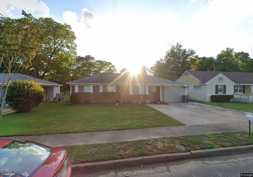
1901 Denison St Memphis, TN 38111
Colonial Acres NeighborhoodEstimated Value: $132,725 - $152,000
3
Beds
2
Baths
1,506
Sq Ft
$94/Sq Ft
Est. Value
About This Home
This home is located at 1901 Denison St, Memphis, TN 38111 and is currently estimated at $142,181, approximately $94 per square foot. 1901 Denison St is a home located in Shelby County with nearby schools including Willow Oaks Elementary School, Colonial Middle, and Overton High.
Ownership History
Date
Name
Owned For
Owner Type
Purchase Details
Closed on
Aug 13, 1999
Sold by
Hutchens Lillian D
Bought by
Clark Wanda E
Current Estimated Value
Home Financials for this Owner
Home Financials are based on the most recent Mortgage that was taken out on this home.
Original Mortgage
$61,968
Outstanding Balance
$17,153
Interest Rate
7.65%
Mortgage Type
FHA
Estimated Equity
$125,028
Create a Home Valuation Report for This Property
The Home Valuation Report is an in-depth analysis detailing your home's value as well as a comparison with similar homes in the area
Home Values in the Area
Average Home Value in this Area
Purchase History
| Date | Buyer | Sale Price | Title Company |
|---|---|---|---|
| Clark Wanda E | $62,000 | -- | |
| Clark Wanda E | $62,000 | -- |
Source: Public Records
Mortgage History
| Date | Status | Borrower | Loan Amount |
|---|---|---|---|
| Open | Clark Wanda E | $61,968 | |
| Closed | Clark Wanda E | $61,968 |
Source: Public Records
Tax History
| Year | Tax Paid | Tax Assessment Tax Assessment Total Assessment is a certain percentage of the fair market value that is determined by local assessors to be the total taxable value of land and additions on the property. | Land | Improvement |
|---|---|---|---|---|
| 2025 | $737 | $32,525 | $4,675 | $27,850 |
| 2024 | $737 | $21,750 | $4,675 | $17,075 |
| 2023 | $1,325 | $21,750 | $4,675 | $17,075 |
| 2022 | $1,325 | $21,750 | $4,675 | $17,075 |
| 2021 | $1,340 | $21,750 | $4,675 | $17,075 |
| 2020 | $1,273 | $17,575 | $2,750 | $14,825 |
| 2019 | $1,273 | $17,575 | $2,750 | $14,825 |
| 2018 | $1,273 | $17,575 | $2,750 | $14,825 |
| 2017 | $722 | $17,575 | $2,750 | $14,825 |
| 2016 | $764 | $17,475 | $0 | $0 |
| 2014 | $764 | $17,475 | $0 | $0 |
Source: Public Records
Map
Nearby Homes
- 1864 Denison St
- 1879 Ezell St
- 1809 Cherry Rd
- 4471 Jamaica Ave
- 4825 American Way
- 1886 Danville Rd
- 1903 Capri Rd
- 1783 Danville Rd
- 1869 Sea Isle Rd
- 1744 Dearing Rd
- 1771 Tahiti Ln
- 1731 Sea Isle Rd
- 1750 Sea Isle Rd
- 1628 Cherry Rd
- 4224 Arrowhead Rd
- 1776 Dorrie Ln
- 4261 Boyce Rd
- 2865 Danville Cove
- 1782 Cornelia Ln
- 4487 E Dearing Rd
- 1893 Denison St
- 1907 Denison St
- 1887 Denison St
- 1915 Denison St
- 1902 Denison St
- 1908 Denison St
- 1894 Denison St
- 1881 Denison St
- 1888 Denison St
- 1919 Denison St
- 1916 Denison St
- 1882 Denison St
- 1875 Denison St
- 1901 Lausanne St
- 1923 Denison St
- 1893 Lausanne St
- 1907 Lausanne St
- 1876 Denison St
- 1887 Lausanne St
- 1869 Denison St
Your Personal Tour Guide
Ask me questions while you tour the home.