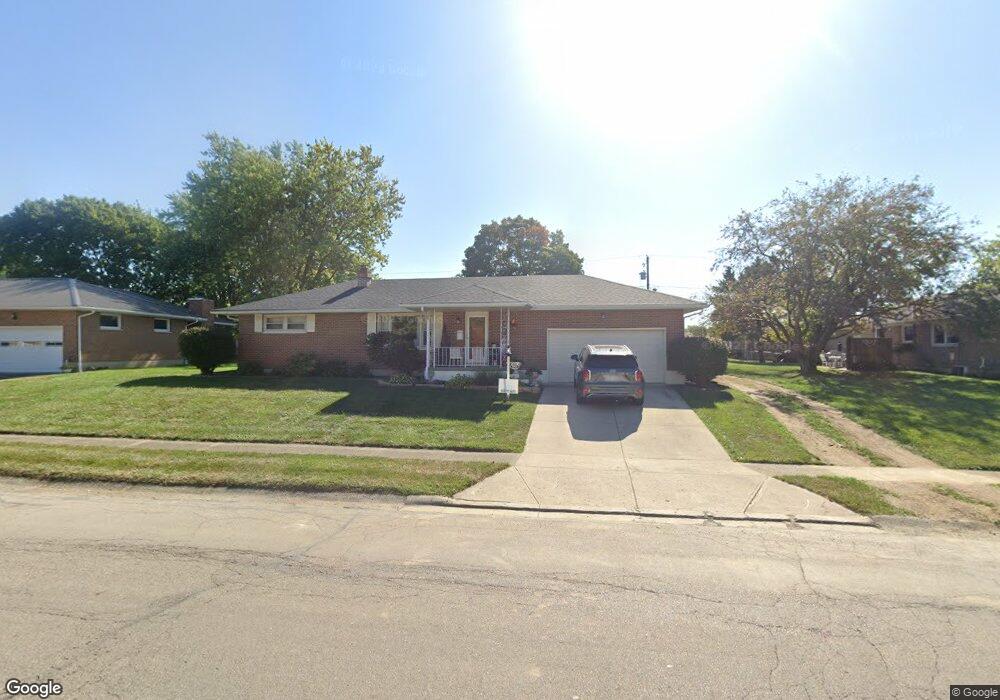
1901 Montego Dr Springfield, OH 45503
Estimated Value: $232,000 - $238,000
2
Beds
2
Baths
1,075
Sq Ft
$218/Sq Ft
Est. Value
About This Home
This home is located at 1901 Montego Dr, Springfield, OH 45503 and is currently estimated at $234,086, approximately $217 per square foot. 1901 Montego Dr is a home located in Clark County with nearby schools including Northridge Elementary School, Kenton Ridge Middle & High School, and Emmanuel Christian Academy.
Ownership History
Date
Name
Owned For
Owner Type
Purchase Details
Closed on
Mar 12, 2004
Sold by
Wagner Neal W and Wagner Paula M
Bought by
Cummins Joyce A
Current Estimated Value
Home Financials for this Owner
Home Financials are based on the most recent Mortgage that was taken out on this home.
Original Mortgage
$94,000
Outstanding Balance
$43,253
Interest Rate
5.78%
Mortgage Type
Purchase Money Mortgage
Estimated Equity
$190,833
Purchase Details
Closed on
Dec 10, 1993
Create a Home Valuation Report for This Property
The Home Valuation Report is an in-depth analysis detailing your home's value as well as a comparison with similar homes in the area
Home Values in the Area
Average Home Value in this Area
Purchase History
We collect this data history from publicly available records. To have your information removed, we recommend requesting removal directly through your county’s website.
| Date | Buyer | Sale Price | Title Company |
|---|---|---|---|
| Cummins Joyce A | $117,500 | -- | |
| -- | $79,000 | -- |
Source: Public Records
Mortgage History
We collect this data history from publicly available records. To have your information removed, we recommend requesting removal directly through your county’s website.
| Date | Status | Borrower | Loan Amount |
|---|---|---|---|
| Open | Cummins Joyce A | $94,000 |
Source: Public Records
Tax History
| Year | Tax Paid | Tax Assessment Tax Assessment Total Assessment is a certain percentage of the fair market value that is determined by local assessors to be the total taxable value of land and additions on the property. | Land | Improvement |
|---|---|---|---|---|
| 2025 | $2,463 | $75,400 | $16,700 | $58,700 |
| 2024 | $2,233 | $56,320 | $11,170 | $45,150 |
| 2023 | $2,233 | $52,800 | $11,170 | $41,630 |
| 2022 | $2,241 | $52,800 | $11,170 | $41,630 |
| 2021 | $2,377 | $47,450 | $8,870 | $38,580 |
| 2020 | $2,379 | $47,450 | $8,870 | $38,580 |
| 2019 | $2,424 | $47,450 | $8,870 | $38,580 |
| 2018 | $2,115 | $39,750 | $7,950 | $31,800 |
| 2017 | $1,813 | $40,779 | $7,949 | $32,830 |
| 2016 | $1,800 | $40,779 | $7,949 | $32,830 |
| 2015 | $1,815 | $38,661 | $7,644 | $31,017 |
| 2014 | $1,815 | $38,661 | $7,644 | $31,017 |
| 2013 | $1,772 | $38,661 | $7,644 | $31,017 |
Source: Public Records
Map
Nearby Homes
- 4385 Helena Ct
- 4028 Ryland Dr Unit 4028
- 4250 Midfield St
- 1415 Montego Dr
- 1505 Kingsgate Rd
- 1503 Kingsgate Rd
- 1507 Kingsgate Rd
- 1500 Kingsgate Rd Unit 19430
- 1502 Kingsgate Rd Unit 19432
- 1500 Kingsgate Rd
- 1502 Kingsgate Rd
- 4512 Ridgewood Rd E
- 3631 Kingsgate Ln
- 1341 Student Ave
- 4642 Laredo St
- 4008 Bosart Rd
- 4528 W Ridgewood Rd
- 4732 Lehigh Dr
- 4811 Middle Urbana Rd
- 1922 Wedgewood Cir
- 4058 Kimberly Dr
- 1909 Montego Dr
- 1918 Delmar Dr
- 4010 Kimberly Dr
- 1924 Delmar Dr
- 1840 Montego Dr
- 1917 Montego Dr
- 1906 Montego Dr
- 1932 Delmar Dr
- 1914 Montego Dr
- 4053 Kimberly Dr
- 4011 Kimberly Dr
- 1911 Kimberly Cir
- 1940 Delmar Dr
- 1925 Montego Dr
- 1987 Kimberly Cir
- 1902 Kimberly Cir
- 1902 Kimberly Cr
- 1907 Delmar Dr
- 1915 Delmar Dr
Your Personal Tour Guide
Ask me questions while you tour the home.