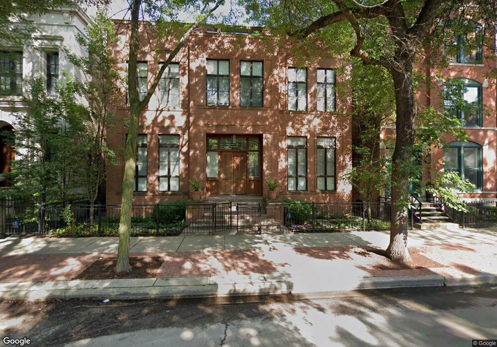
1901 N Howe St Chicago, IL 60614
Old Town NeighborhoodEstimated Value: $4,106,000 - $5,208,000
6
Beds
7
Baths
6,574
Sq Ft
$683/Sq Ft
Est. Value
About This Home
This home is located at 1901 N Howe St, Chicago, IL 60614 and is currently estimated at $4,489,207, approximately $682 per square foot. 1901 N Howe St is a home located in Cook County with nearby schools including Abraham Lincoln Elementary School, Lincoln Park High School, and Francis W Parker School.
Ownership History
Date
Name
Owned For
Owner Type
Purchase Details
Closed on
Jul 27, 2022
Sold by
Sullivan Stephen A
Bought by
1901 N Howe Llc
Current Estimated Value
Home Financials for this Owner
Home Financials are based on the most recent Mortgage that was taken out on this home.
Original Mortgage
$4,000,000
Outstanding Balance
$3,755,302
Interest Rate
4.2%
Mortgage Type
New Conventional
Estimated Equity
$733,905
Purchase Details
Closed on
May 19, 2020
Sold by
Weiss Donald J and Weiss Edna Louise
Bought by
Sullivan Stephen A and Sullivan Jennifer L
Home Financials for this Owner
Home Financials are based on the most recent Mortgage that was taken out on this home.
Original Mortgage
$2,922,500
Interest Rate
3.25%
Mortgage Type
New Conventional
Purchase Details
Closed on
Jun 2, 2003
Sold by
Chicago Title Land Trust Co
Bought by
Weiss Donald J and Weiss Edna Louise
Create a Home Valuation Report for This Property
The Home Valuation Report is an in-depth analysis detailing your home's value as well as a comparison with similar homes in the area
Home Values in the Area
Average Home Value in this Area
Purchase History
We collect this data history from publicly available records. To have your information removed, we recommend requesting removal directly through your county’s website.
| Date | Buyer | Sale Price | Title Company |
|---|---|---|---|
| 1901 N Howe Llc | $6,000,000 | None Listed On Document | |
| 1901 N Howe Llc | $6,000,000 | None Listed On Document | |
| Sullivan Stephen A | $4,175,000 | Chicago Title | |
| Sullivan Stephen A | $4,175,000 | Chicago Title | |
| Weiss Donald J | -- | -- | |
| Weiss Donald J | -- | -- |
Source: Public Records
Mortgage History
We collect this data history from publicly available records. To have your information removed, we recommend requesting removal directly through your county’s website.
| Date | Status | Borrower | Loan Amount |
|---|---|---|---|
| Open | 1901 N Howe Llc | $4,000,000 | |
| Previous Owner | Sullivan Stephen A | $2,922,500 |
Source: Public Records
Tax History
| Year | Tax Paid | Tax Assessment Tax Assessment Total Assessment is a certain percentage of the fair market value that is determined by local assessors to be the total taxable value of land and additions on the property. | Land | Improvement |
|---|---|---|---|---|
| 2025 | $49,766 | $238,454 | $48,438 | $190,016 |
| 2024 | $49,766 | $238,454 | $48,438 | $190,016 |
| 2023 | $48,514 | $235,872 | $39,063 | $196,809 |
| 2022 | $48,514 | $235,872 | $39,063 | $196,809 |
| 2021 | $47,431 | $235,870 | $39,062 | $196,808 |
| 2020 | $42,308 | $191,470 | $34,375 | $157,095 |
| 2019 | $41,457 | $208,060 | $34,375 | $173,685 |
| 2018 | $40,760 | $208,060 | $34,375 | $173,685 |
| 2017 | $40,752 | $190,996 | $28,125 | $162,871 |
| 2016 | $38,004 | $190,996 | $28,125 | $162,871 |
| 2015 | $34,759 | $190,996 | $28,125 | $162,871 |
| 2014 | $27,678 | $150,462 | $21,875 | $128,587 |
| 2013 | $27,126 | $150,462 | $21,875 | $128,587 |
Source: Public Records
Map
Nearby Homes
- 1818 N Larrabee St Unit A8
- 1846 N Mohawk St Unit B
- 1930 N Larrabee St Unit A7
- 1811 N Howe St
- 1926 N Mohawk St Unit 12
- 1878 N Orchard St
- 1755 N Mohawk St
- 1940 N Mohawk St Unit 1
- 1853 N Burling St
- 1865 N Burling St
- 1935 N Mohawk St Unit 3S
- 1733 N Mohawk St Unit 1N
- 1942 N Orchard St Unit 1N
- 1940 N Cleveland Ave Unit 4
- 1816 N Hudson Ave
- 1726 N Cleveland Ave
- 1838 N Burling St
- 2054 N Mohawk St
- 1954 N Cleveland Ave Unit 3
- 414 W Wisconsin St Unit 414H
- 1836 N Larrabee St Unit A17
- 1842 N Larrabee St Unit A20
- 1834 N Larrabee St Unit A16
- 1848 N Larrabee St Unit D23
- 1858 N Larrabee St Unit B28
- 1850 N Larrabee St Unit C24
- 1840 N Larrabee St Unit A19
- 1844 N Larrabee St Unit A21
- 1854 N Larrabee St Unit B26
- 1838 N Larrabee St Unit A18
- 1856 N Larrabee St Unit B27
- 1832 N Larrabee St Unit A15
- 1852 N Larrabee St Unit B25
- 1846 N Larrabee St Unit C22
- 1830 N Larrabee St Unit A14
- 1828 N Larrabee St Unit A13
- 1826 N Larrabee St Unit A12
- 1867 N Howe St
- 1871 N Howe St
- 1871 N Howe St
Your Personal Tour Guide
Ask me questions while you tour the home.