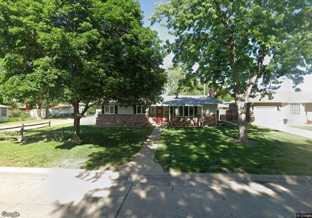
1901 Simmons St Salina, KS 67401
Estimated Value: $171,000 - $212,784
3
Beds
2
Baths
1,344
Sq Ft
$150/Sq Ft
Est. Value
About This Home
This home is located at 1901 Simmons St, Salina, KS 67401 and is currently estimated at $201,446, approximately $149 per square foot. 1901 Simmons St is a home located in Saline County with nearby schools including Stewart Elementary School, Salina South Middle School, and Salina High School South.
Ownership History
Date
Name
Owned For
Owner Type
Purchase Details
Closed on
Mar 9, 2018
Sold by
Thomas Thomas W and Thomas J T
Bought by
Purdue Richard C and Purdue Carolyn J
Current Estimated Value
Home Financials for this Owner
Home Financials are based on the most recent Mortgage that was taken out on this home.
Original Mortgage
$132,000
Interest Rate
3.7%
Mortgage Type
New Conventional
Create a Home Valuation Report for This Property
The Home Valuation Report is an in-depth analysis detailing your home's value as well as a comparison with similar homes in the area
Home Values in the Area
Average Home Value in this Area
Purchase History
| Date | Buyer | Sale Price | Title Company |
|---|---|---|---|
| Purdue Richard C | -- | -- |
Source: Public Records
Mortgage History
| Date | Status | Borrower | Loan Amount |
|---|---|---|---|
| Previous Owner | Purdue Richard C | $132,000 |
Source: Public Records
Tax History Compared to Growth
Tax History
| Year | Tax Paid | Tax Assessment Tax Assessment Total Assessment is a certain percentage of the fair market value that is determined by local assessors to be the total taxable value of land and additions on the property. | Land | Improvement |
|---|---|---|---|---|
| 2025 | $2,974 | $23,702 | $1,640 | $22,062 |
| 2024 | $2,974 | $22,609 | $2,284 | $20,325 |
| 2023 | $2,974 | $21,977 | $2,200 | $19,777 |
| 2022 | $2,856 | $21,718 | $2,082 | $19,636 |
| 2021 | $2,586 | $18,976 | $2,082 | $16,894 |
| 2020 | $2,617 | $18,975 | $2,270 | $16,705 |
| 2019 | $1,348 | $19,538 | $2,270 | $17,268 |
| 2018 | $2,549 | $18,756 | $2,270 | $16,486 |
| 2017 | $0 | $16,722 | $2,082 | $14,640 |
| 2016 | $0 | $15,931 | $2,082 | $13,849 |
| 2015 | -- | $16,181 | $2,082 | $14,099 |
| 2013 | -- | $0 | $0 | $0 |
Source: Public Records
Map
Nearby Homes
- 1945 Gebhart St
- 366 Maple Ave
- 415 Garden Ave
- 639 Ralph Ave
- 1402 S 9th St
- 603 Smith Ave
- 719 Maple Ave
- 220 E Ellsworth Ave
- 2037 Roach St
- 1100 S 9th St
- 1908 Marc St
- 1418 Sunrise Dr
- 500 E Jewell Ave
- 1100 Quincy St
- 1110 Andrew Ave
- 813 E Claflin Ave
- 944 S 10th St
- 960 S 9th St
- 828 E Claflin Ave
- 951 S 2nd St
- 1907 Simmons St
- 1908 Larson St
- 1913 Simmons St
- 1851 Simmons St
- 1900 Simmons St
- 1912 Larson St
- 1850 Larson St
- 1906 Simmons St
- 1919 Simmons St
- 1852 Simmons St
- 1912 Simmons St
- 1918 Larson St
- 1846 Larson St
- 1843 Simmons St
- 1914 Simmons St
- 1923 Simmons St
- 1842 Larson St
- 1901 Highland Ave
- 1920 Larson St
- 100 E Charlotte St