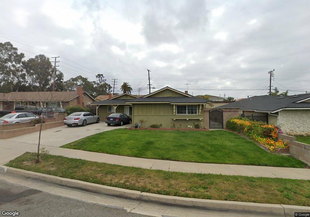
19010 Enslow Dr Carson, CA 90746
Estimated Value: $773,283 - $856,000
4
Beds
2
Baths
1,534
Sq Ft
$540/Sq Ft
Est. Value
About This Home
This home is located at 19010 Enslow Dr, Carson, CA 90746 and is currently estimated at $828,571, approximately $540 per square foot. 19010 Enslow Dr is a home located in Los Angeles County with nearby schools including Leapwood Avenue Elementary School, Glenn Hammond Curtiss Middle School, and Rancho Dominguez Preparatory School.
Ownership History
Date
Name
Owned For
Owner Type
Purchase Details
Closed on
May 10, 2010
Sold by
Teysko William E and Teysko Revocable Trust
Bought by
Lucas Jerry and Stubbs Khaalisa M
Current Estimated Value
Home Financials for this Owner
Home Financials are based on the most recent Mortgage that was taken out on this home.
Original Mortgage
$340,415
Outstanding Balance
$233,135
Interest Rate
5.5%
Mortgage Type
FHA
Estimated Equity
$595,436
Purchase Details
Closed on
Oct 7, 1994
Sold by
Teysko Edward and Teysko Loleitha
Bought by
Teysko Edward and Teysko Loleitha
Create a Home Valuation Report for This Property
The Home Valuation Report is an in-depth analysis detailing your home's value as well as a comparison with similar homes in the area
Home Values in the Area
Average Home Value in this Area
Purchase History
| Date | Buyer | Sale Price | Title Company |
|---|---|---|---|
| Lucas Jerry | $345,000 | Stewart Title Of California | |
| Teysko Edward | -- | -- |
Source: Public Records
Mortgage History
| Date | Status | Borrower | Loan Amount |
|---|---|---|---|
| Open | Lucas Jerry | $340,415 |
Source: Public Records
Tax History
| Year | Tax Paid | Tax Assessment Tax Assessment Total Assessment is a certain percentage of the fair market value that is determined by local assessors to be the total taxable value of land and additions on the property. | Land | Improvement |
|---|---|---|---|---|
| 2025 | $6,070 | $445,319 | $260,739 | $184,580 |
| 2024 | $6,070 | $436,588 | $255,627 | $180,961 |
| 2023 | $5,949 | $428,028 | $250,615 | $177,413 |
| 2022 | $5,658 | $419,636 | $245,701 | $173,935 |
| 2021 | $5,588 | $411,409 | $240,884 | $170,525 |
| 2019 | $5,385 | $399,209 | $233,741 | $165,468 |
| 2018 | $5,259 | $391,382 | $229,158 | $162,224 |
| 2016 | $5,034 | $376,186 | $220,260 | $155,926 |
| 2015 | $4,934 | $370,536 | $216,952 | $153,584 |
| 2014 | $4,924 | $363,279 | $212,703 | $150,576 |
Source: Public Records
Map
Nearby Homes
- 19202 Campaign Dr
- 19221 Scobey Ave
- 19426 Belshaw Ave
- 19603 Enslow Dr
- 19203 Galway Ave
- 19327 Galway Ave
- 879 E Turmont St
- 994 E Gladwick St
- 19717 Alonda Dr
- 20019 Belshaw Ave
- 18325 Mettler Ave
- 900 E Sagebank St
- 1351 E Bankers Dr
- 20222 Belshaw Ave
- 20241 Galway Ave
- 19008 Hillford Ave
- 17815 Lysander Dr
- 20317 Annalee Ave
- 17700 Avalon Blvd Unit 387
- 966 Apricot Way
- 19016 Enslow Dr
- 19004 Enslow Dr
- 19013 Fariman Dr
- 19005 Fariman Dr
- 19102 Enslow Dr
- 19021 Fariman Dr
- 19011 Enslow Dr
- 19017 Enslow Dr
- 19003 Enslow Dr
- 19108 Enslow Dr
- 19103 Enslow Dr
- 19105 Fariman Dr
- 19109 Enslow Dr
- 19116 Enslow Dr
- 19010 Campaign Dr
- 19014 Fariman Dr
- 19004 Fariman Dr
- 19111 Fariman Dr
- 19018 Campaign Dr
- 19004 Campaign Dr
Your Personal Tour Guide
Ask me questions while you tour the home.