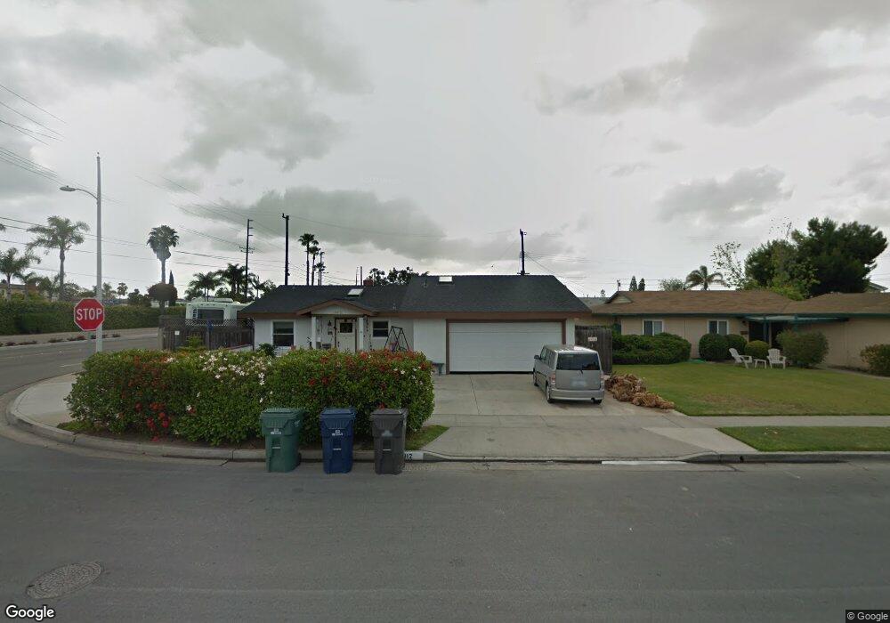
19012 Pauline Ln Huntington Beach, CA 92646
Estimated Value: $1,257,000 - $1,396,000
2
Beds
2
Baths
1,684
Sq Ft
$789/Sq Ft
Est. Value
About This Home
This home is located at 19012 Pauline Ln, Huntington Beach, CA 92646 and is currently estimated at $1,329,220, approximately $789 per square foot. 19012 Pauline Ln is a home located in Orange County with nearby schools including Isojiro Oka Elementary, Talbert Middle School, and Huntington Beach High School.
Ownership History
Date
Name
Owned For
Owner Type
Purchase Details
Closed on
Jan 4, 2012
Sold by
Harper Marjorie H
Bought by
Harper Marjorie H and Harper Gregory E
Current Estimated Value
Purchase Details
Closed on
May 14, 1997
Sold by
Hoag Hospital Foundation
Bought by
Mullins Dean and Mullins Denise
Home Financials for this Owner
Home Financials are based on the most recent Mortgage that was taken out on this home.
Original Mortgage
$139,400
Outstanding Balance
$19,308
Interest Rate
8.13%
Estimated Equity
$1,309,912
Purchase Details
Closed on
Apr 4, 1997
Sold by
Smith W Bailey
Bought by
Hoag Hospital Foundation and Occidental College
Home Financials for this Owner
Home Financials are based on the most recent Mortgage that was taken out on this home.
Original Mortgage
$139,400
Outstanding Balance
$19,308
Interest Rate
8.13%
Estimated Equity
$1,309,912
Create a Home Valuation Report for This Property
The Home Valuation Report is an in-depth analysis detailing your home's value as well as a comparison with similar homes in the area
Home Values in the Area
Average Home Value in this Area
Purchase History
| Date | Buyer | Sale Price | Title Company |
|---|---|---|---|
| Harper Marjorie H | -- | None Available | |
| Mullins Dean | $155,000 | Guardian Title Company | |
| Hoag Hospital Foundation | -- | -- |
Source: Public Records
Mortgage History
| Date | Status | Borrower | Loan Amount |
|---|---|---|---|
| Open | Mullins Dean | $139,400 |
Source: Public Records
Tax History Compared to Growth
Tax History
| Year | Tax Paid | Tax Assessment Tax Assessment Total Assessment is a certain percentage of the fair market value that is determined by local assessors to be the total taxable value of land and additions on the property. | Land | Improvement |
|---|---|---|---|---|
| 2025 | $4,202 | $362,761 | $187,244 | $175,517 |
| 2024 | $4,202 | $355,649 | $183,573 | $172,076 |
| 2023 | $4,100 | $348,676 | $179,974 | $168,702 |
| 2022 | $4,037 | $341,840 | $176,445 | $165,395 |
| 2021 | $3,959 | $335,138 | $172,986 | $162,152 |
| 2020 | $3,934 | $331,702 | $171,212 | $160,490 |
| 2019 | $3,855 | $325,199 | $167,855 | $157,344 |
| 2018 | $3,781 | $318,823 | $164,564 | $154,259 |
| 2017 | $3,721 | $312,572 | $161,337 | $151,235 |
| 2016 | $3,565 | $306,444 | $158,174 | $148,270 |
| 2015 | $3,510 | $301,841 | $155,798 | $146,043 |
| 2014 | $3,439 | $295,929 | $152,746 | $143,183 |
Source: Public Records
Map
Nearby Homes
- 9462 Litchfield Dr
- 18820 Cordata St
- 19051 Randi Ln
- 19202 Hickory Ln
- 9331 Grand Dr
- 9850 Garfield Ave Unit 18
- 9850 Garfield Ave Unit 91
- 9850 Garfield Ave Unit 35
- 9850 Garfield Ave Unit 5
- 9850 Garfield Ave Unit 130
- 9850 Garfield Ave Unit 33
- 19251 Brookhurst St Unit 137
- 19251 Brookhurst St Unit 13
- 19251 Brookhurst St Unit 48
- 19251 Brookhurst St Unit 11
- 19251 Brookhurst St Unit 38
- 19251 Brookhurst St Unit 69
- 19251 Brookhurst St Unit 22
- 19352 Sailwind Ln
- 9172 Veronica Dr
- 19022 Pauline Ln
- 19011 Hillsboro Cir
- 19021 Hillsboro Cir
- 19032 Pauline Ln
- 19011 Pauline Ln
- 19031 Hillsboro Cir
- 19021 Pauline Ln
- 9364 Warbler Ave
- 9376 Warbler Ave
- 19042 Pauline Ln
- 19031 Pauline Ln
- 19041 Hillsboro Cir
- 9340 Warbler Ave
- 9400 Warbler Ave
- 19041 Pauline Ln
- 19012 Hillsboro Cir
- 19062 Pauline Ln
- 19012 Woodward Ln
- 19022 Woodward Ln
- 19022 Hillsboro Cir