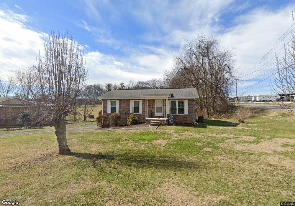
1902 Alcorn Dr Jefferson City, TN 37760
Estimated Value: $209,000 - $285,000
--
Bed
2
Baths
1,025
Sq Ft
$234/Sq Ft
Est. Value
About This Home
This home is located at 1902 Alcorn Dr, Jefferson City, TN 37760 and is currently estimated at $239,355, approximately $233 per square foot. 1902 Alcorn Dr is a home located in Jefferson County with nearby schools including Heritage Christian Academy.
Ownership History
Date
Name
Owned For
Owner Type
Purchase Details
Closed on
Nov 16, 2004
Sold by
Purkey Laura T
Bought by
Cooper Jeremy S
Current Estimated Value
Home Financials for this Owner
Home Financials are based on the most recent Mortgage that was taken out on this home.
Original Mortgage
$138,897
Outstanding Balance
$81,376
Interest Rate
5.66%
Estimated Equity
$157,979
Purchase Details
Closed on
Aug 14, 1991
Bought by
Purkey Laura T
Create a Home Valuation Report for This Property
The Home Valuation Report is an in-depth analysis detailing your home's value as well as a comparison with similar homes in the area
Home Values in the Area
Average Home Value in this Area
Purchase History
| Date | Buyer | Sale Price | Title Company |
|---|---|---|---|
| Cooper Jeremy S | $89,900 | -- | |
| Purkey Laura T | $49,000 | -- |
Source: Public Records
Mortgage History
| Date | Status | Borrower | Loan Amount |
|---|---|---|---|
| Open | Purkey Laura T | $138,897 |
Source: Public Records
Tax History Compared to Growth
Tax History
| Year | Tax Paid | Tax Assessment Tax Assessment Total Assessment is a certain percentage of the fair market value that is determined by local assessors to be the total taxable value of land and additions on the property. | Land | Improvement |
|---|---|---|---|---|
| 2025 | $647 | $53,925 | $9,000 | $44,925 |
| 2023 | $930 | $26,550 | $0 | $0 |
| 2022 | $900 | $26,550 | $6,250 | $20,300 |
| 2021 | $900 | $26,550 | $6,250 | $20,300 |
| 2020 | $900 | $26,550 | $6,250 | $20,300 |
| 2019 | $900 | $26,550 | $6,250 | $20,300 |
| 2018 | $787 | $22,175 | $4,500 | $17,675 |
| 2017 | $787 | $22,175 | $4,500 | $17,675 |
| 2016 | $787 | $22,175 | $4,500 | $17,675 |
| 2015 | $776 | $22,175 | $4,500 | $17,675 |
| 2014 | $765 | $22,175 | $4,500 | $17,675 |
Source: Public Records
Map
Nearby Homes
- 431 Clearbrook Dr
- 409 Clearbrook Dr
- 1819 Brookline Ct
- 230 Fieldcrest Dr
- 1366 Clinch View Cir
- 1015 Battle Ridge
- Macon Plan at Battle Ridge
- Cabral Plan at Battle Ridge
- Cali Plan at Battle Ridge
- Glendale Plan at Battle Ridge
- Freeport Plan at Battle Ridge
- Belhaven Plan at Battle Ridge
- 1004 Battle Ridge
- Sullivan Plan at Battle Ridge
- Aria Plan at Battle Ridge
- 902 N College St
- 1905 Walnut Ave
- 3011 Mason Ave
- 846 N Chucky Pike
- Parcel 086 N Chucky Pike
- 1906 Alcorn Dr
- 1903 Alcorn Dr
- 1907 Alcorn Dr
- 1910 Alcorn Dr
- 1151 N Chucky Pike
- 1911 Alcorn Dr
- 1806 Clover Brook Dr
- 1802 Clover Brook Dr
- 1914 Alcorn Dr
- 1810 Clover Brook Dr
- 1915 Alcorn Dr
- 1826 Clover Brook Dr
- 1832 Clover Brook Dr
- 1803 Clover Brook Dr
- 1807 Clover Brook Dr
- 1815 Clover Brook Dr
- 1811 Clover Brook Dr
- 1836 Clover Brook Dr
- 1819 Clover Brook Dr
- 1823 Clover Brook Dr