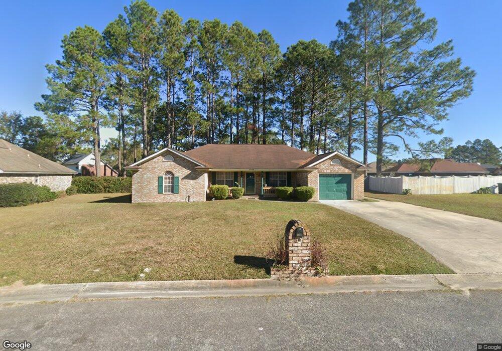
1902 Bluestone Loop Hinesville, GA 31313
Estimated Value: $252,525 - $272,000
4
Beds
2
Baths
1,865
Sq Ft
$140/Sq Ft
Est. Value
About This Home
This home is located at 1902 Bluestone Loop, Hinesville, GA 31313 and is currently estimated at $261,881, approximately $140 per square foot. 1902 Bluestone Loop is a home located in Liberty County with nearby schools including Taylors Creek Elementary School, Lewis Frasier Middle School, and Bradwell Institute.
Ownership History
Date
Name
Owned For
Owner Type
Purchase Details
Closed on
Oct 25, 2006
Sold by
Clarks Anthony
Bought by
Stoner Carlistia C and Stoner Frederick L
Current Estimated Value
Home Financials for this Owner
Home Financials are based on the most recent Mortgage that was taken out on this home.
Original Mortgage
$161,000
Outstanding Balance
$93,561
Interest Rate
6.27%
Mortgage Type
VA
Estimated Equity
$168,320
Purchase Details
Closed on
Sep 17, 2003
Sold by
Haymon Regina L
Bought by
Clarks Anthony R
Purchase Details
Closed on
Feb 27, 1995
Bought by
Haymon Regina L
Create a Home Valuation Report for This Property
The Home Valuation Report is an in-depth analysis detailing your home's value as well as a comparison with similar homes in the area
Home Values in the Area
Average Home Value in this Area
Purchase History
| Date | Buyer | Sale Price | Title Company |
|---|---|---|---|
| Stoner Carlistia C | $161,000 | -- | |
| Clarks Anthony R | $121,000 | -- | |
| Haymon Regina L | $95,600 | -- |
Source: Public Records
Mortgage History
| Date | Status | Borrower | Loan Amount |
|---|---|---|---|
| Open | Stoner Carlistia C | $161,000 |
Source: Public Records
Tax History
| Year | Tax Paid | Tax Assessment Tax Assessment Total Assessment is a certain percentage of the fair market value that is determined by local assessors to be the total taxable value of land and additions on the property. | Land | Improvement |
|---|---|---|---|---|
| 2025 | $4,539 | $93,476 | $18,000 | $75,476 |
| 2024 | $4,539 | $86,002 | $8,000 | $78,002 |
| 2023 | $4,221 | $76,078 | $8,000 | $68,078 |
| 2022 | $2,933 | $63,015 | $8,000 | $55,015 |
| 2021 | $2,693 | $56,768 | $8,000 | $48,768 |
| 2020 | $2,534 | $52,903 | $8,000 | $44,903 |
| 2019 | $2,542 | $53,471 | $8,000 | $45,471 |
| 2018 | $2,555 | $54,040 | $8,000 | $46,040 |
| 2017 | $1,798 | $54,608 | $8,000 | $46,608 |
| 2016 | $2,485 | $55,176 | $8,000 | $47,176 |
| 2015 | $2,497 | $50,459 | $8,000 | $42,459 |
| 2014 | $2,497 | $54,836 | $10,000 | $44,836 |
| 2013 | -- | $56,002 | $10,000 | $46,002 |
Source: Public Records
Map
Nearby Homes
- 1905 Stonehenge Dr
- 1950 Woking Ct
- 1932 Salisbury Way
- 1956 Heathrow Dr
- 1936 Heathrow Dr
- 1806 Blair Ct
- 122 Joann Lewis Ln
- 505 Rutledge Dr
- 315 Joann Lewis Ln
- 170 Joann Lewis Ln
- 131 Battalion Ln
- 2131 Walberg Dr
- 100 Kentucky Derby
- 4.25 AC Barry McCaffrey Blvd
- 2502 Nordeoff Ct
- 2352 Rowe St
- 2411 Fernando Ct
- 401 Barry McCaffrey Blvd Unit E1
- 1325 Loblolly Dr
- 203 Barcalay Ln
- 1904 Bluestone Loop
- 1909 Stonehenge Dr
- 1956 Woking Ct
- 1911 Stonehenge Dr
- 1957 Woking Ct Unit LT 147
- 1957 Woking Ct
- 1913 Stonehenge Dr
- 1912 Bluestone Loop
- 1954 Woking Ct
- 1903 Bluestone Loop
- 1901 Bluestone Loop
- 95 Stonehenge Dr
- 1905 Bluestone Loop
- 1914 Bluestone Loop
- 1915 Stonehenge Dr
- 1955 Woking Ct
- 1921 Wessex Ct
- 1907 Bluestone Loop
- 1952 Woking Ct
- 1908 Stonehenge Dr
Your Personal Tour Guide
Ask me questions while you tour the home.