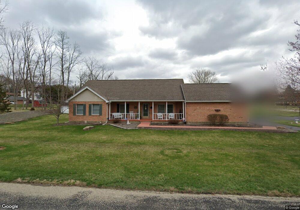
1902 Granada Dr Springfield, OH 45503
Estimated Value: $270,000 - $294,000
3
Beds
2
Baths
1,793
Sq Ft
$157/Sq Ft
Est. Value
About This Home
This home is located at 1902 Granada Dr, Springfield, OH 45503 and is currently estimated at $281,793, approximately $157 per square foot. 1902 Granada Dr is a home located in Clark County with nearby schools including Northridge Elementary School, Kenton Ridge Middle & High School, and Emmanuel Christian Academy.
Ownership History
Date
Name
Owned For
Owner Type
Purchase Details
Closed on
Sep 4, 1998
Sold by
Morris Gary A and Morris Cheri A
Bought by
Woodruff William H and Woodruff Patricia A
Current Estimated Value
Home Financials for this Owner
Home Financials are based on the most recent Mortgage that was taken out on this home.
Original Mortgage
$58,300
Outstanding Balance
$11,653
Interest Rate
7.04%
Mortgage Type
Purchase Money Mortgage
Estimated Equity
$270,140
Purchase Details
Closed on
Sep 16, 1992
Create a Home Valuation Report for This Property
The Home Valuation Report is an in-depth analysis detailing your home's value as well as a comparison with similar homes in the area
Home Values in the Area
Average Home Value in this Area
Purchase History
| Date | Buyer | Sale Price | Title Company |
|---|---|---|---|
| Woodruff William H | $130,000 | -- | |
| -- | $13,000 | -- |
Source: Public Records
Mortgage History
| Date | Status | Borrower | Loan Amount |
|---|---|---|---|
| Open | Woodruff William H | $58,300 |
Source: Public Records
Tax History
| Year | Tax Paid | Tax Assessment Tax Assessment Total Assessment is a certain percentage of the fair market value that is determined by local assessors to be the total taxable value of land and additions on the property. | Land | Improvement |
|---|---|---|---|---|
| 2025 | $2,890 | $86,700 | $13,270 | $73,430 |
| 2024 | $2,821 | $75,890 | $11,640 | $64,250 |
| 2023 | $2,821 | $75,890 | $11,640 | $64,250 |
| 2022 | $2,850 | $75,890 | $11,640 | $64,250 |
| 2021 | $2,135 | $51,380 | $8,310 | $43,070 |
| 2020 | $2,137 | $51,380 | $8,310 | $43,070 |
| 2019 | $2,177 | $51,380 | $8,310 | $43,070 |
| 2018 | $2,020 | $46,700 | $7,900 | $38,800 |
| 2017 | $1,731 | $49,095 | $7,896 | $41,199 |
| 2016 | $2,171 | $49,095 | $7,896 | $41,199 |
| 2015 | $2,037 | $49,512 | $8,313 | $41,199 |
| 2014 | $2,037 | $49,512 | $8,313 | $41,199 |
| 2013 | $1,990 | $49,512 | $8,313 | $41,199 |
Source: Public Records
Map
Nearby Homes
- 1811 Devon Dr
- 2529 Marinette Dr
- 2400 Thor Dr
- 1924 Marinette Dr
- 2043 Providence Ave
- 1516 Hyannis Dr
- 3214 Revels St
- 1628 Yorkshire Ct
- 3300 Revels St
- 1948 Falmouth Ave
- 2553 Derr Rd
- 2022 Westboro Ave
- 1046 Fruitland Rd
- 1705 Magnolia Blvd
- 2861 Ashlar Dr
- 2153 Olympic St Unit 2153
- 3124 El Camino Dr
- 1032 Armsgate Rd
- 1535 Winding Trail
- 1040 Carson Ln
- 1914 Granada Dr
- 2505 Brookside Dr
- 1924 Granada Dr
- 1901 Granada Dr
- 2509 Brookside Dr
- 1915 Granada Dr
- 2555 Marinette Dr
- 1849 Granada Dr
- 1923 Granada Dr
- 1827 Devon Dr
- 2545 Marinette Dr
- 1819 Devon Dr
- 1839 Granada Dr
- 2477 Thor Dr
- 0 Brookside Dr
- 1948 Granada Dr
- 1830 Granada Dr
- 2537 Marinette Dr
- 2465 Thor Dr
- 1834 Devon Dr
Your Personal Tour Guide
Ask me questions while you tour the home.