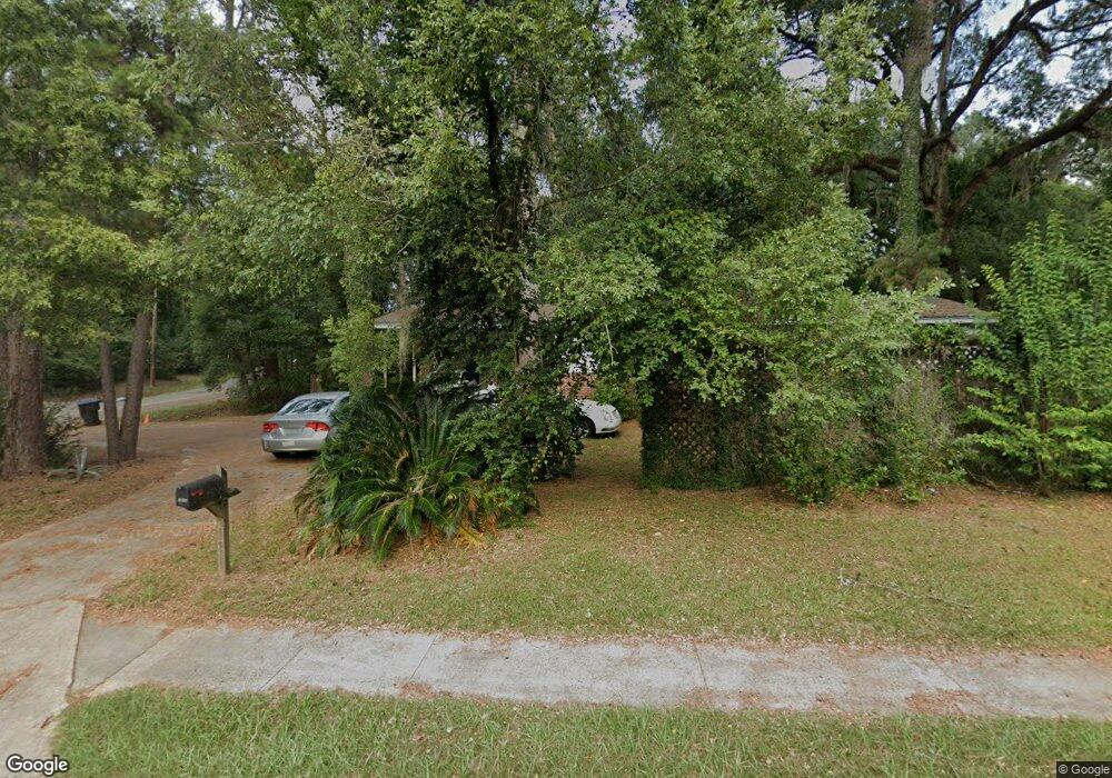
1902 High Rd Unit 1 Tallahassee, FL 32303
Hartsfield NeighborhoodEstimated Value: $205,000 - $226,000
3
Beds
2
Baths
1,356
Sq Ft
$159/Sq Ft
Est. Value
About This Home
This home is located at 1902 High Rd Unit 1, Tallahassee, FL 32303 and is currently estimated at $215,692, approximately $159 per square foot. 1902 High Rd Unit 1 is a home located in Leon County with nearby schools including Astoria Park Elementary School, Griffin Middle School, and Amos P. Godby High School.
Ownership History
Date
Name
Owned For
Owner Type
Purchase Details
Closed on
Jul 12, 2006
Sold by
Mchaffie Thomas N and Mchaffie Jacqueline M
Bought by
Kariko Daniel and Kariko Annette Marie
Current Estimated Value
Home Financials for this Owner
Home Financials are based on the most recent Mortgage that was taken out on this home.
Original Mortgage
$130,000
Outstanding Balance
$76,148
Interest Rate
6.6%
Mortgage Type
Purchase Money Mortgage
Estimated Equity
$139,544
Purchase Details
Closed on
Nov 20, 2001
Sold by
Davis James E and Davis Wendy M
Bought by
Mchaffle Thomas N and Mchaffle Jacqueline M
Home Financials for this Owner
Home Financials are based on the most recent Mortgage that was taken out on this home.
Original Mortgage
$71,600
Interest Rate
6.57%
Create a Home Valuation Report for This Property
The Home Valuation Report is an in-depth analysis detailing your home's value as well as a comparison with similar homes in the area
Home Values in the Area
Average Home Value in this Area
Purchase History
| Date | Buyer | Sale Price | Title Company |
|---|---|---|---|
| Kariko Daniel | $145,000 | Attorney | |
| Mchaffle Thomas N | $89,500 | -- |
Source: Public Records
Mortgage History
| Date | Status | Borrower | Loan Amount |
|---|---|---|---|
| Open | Kariko Daniel | $130,000 | |
| Previous Owner | Mchaffle Thomas N | $71,600 |
Source: Public Records
Tax History Compared to Growth
Tax History
| Year | Tax Paid | Tax Assessment Tax Assessment Total Assessment is a certain percentage of the fair market value that is determined by local assessors to be the total taxable value of land and additions on the property. | Land | Improvement |
|---|---|---|---|---|
| 2025 | $3,439 | $179,061 | $35,000 | $144,061 |
| 2024 | $3,314 | $172,274 | $35,000 | $137,274 |
| 2023 | $3,099 | $160,181 | $35,000 | $125,181 |
| 2022 | $2,738 | $145,787 | $32,000 | $113,787 |
| 2021 | $2,374 | $124,920 | $32,000 | $92,920 |
| 2020 | $2,117 | $111,967 | $20,000 | $91,967 |
| 2019 | $2,058 | $107,660 | $20,000 | $87,660 |
| 2018 | $1,998 | $103,556 | $20,000 | $83,556 |
| 2017 | $1,901 | $97,369 | $0 | $0 |
| 2016 | $1,901 | $96,003 | $0 | $0 |
| 2015 | $1,727 | $88,516 | $0 | $0 |
| 2014 | $1,727 | $86,646 | $0 | $0 |
Source: Public Records
Map
Nearby Homes
- 1506 W Tharpe St
- 1912 W Nelson Cir
- 1821 Myrick Rd
- 1407 Raa Ave
- 2007 Rosedale Dr
- 2106 Great Oak Dr
- 1402 W Tharpe St
- 1318 W Tharpe St
- 422 Westwood Dr
- 316 Westwood Dr
- 301 Westwood Dr
- 1742 Hartsfield Rd Unit A-D
- 1802 Hartsfield Rd Unit A,B,C,D
- 2216 Woodlawn Dr
- 208 Westwood Dr
- 201 Westwood Dr Unit 201-A
- 2107 Old Bainbridge Rd
- 1908 Skyland Dr
- 1846 Sylvan Ct
- 1214 High Rd
- 1902 High Rd
- 1904 High Rd Unit 2
- 1904 High Rd
- 1706 Sharon Rd
- 1606 Sharon Rd
- 1903 High Rd Unit 2
- 1903 High Rd
- 1812 High Rd
- 1705 Sunset Ln Unit 3
- 1705 Sunset Ln
- 1906 High Rd Unit 2
- 1906 High Rd
- 1709 Sunset Ln Unit 3
- 1709 Sunset Ln
- 1710 Sharon Rd
- 1813 High Rd
- 1905 High Rd
- 1711 Sharon Rd
- 1713 Sunset Ln
- 1609 Sunset Ln
