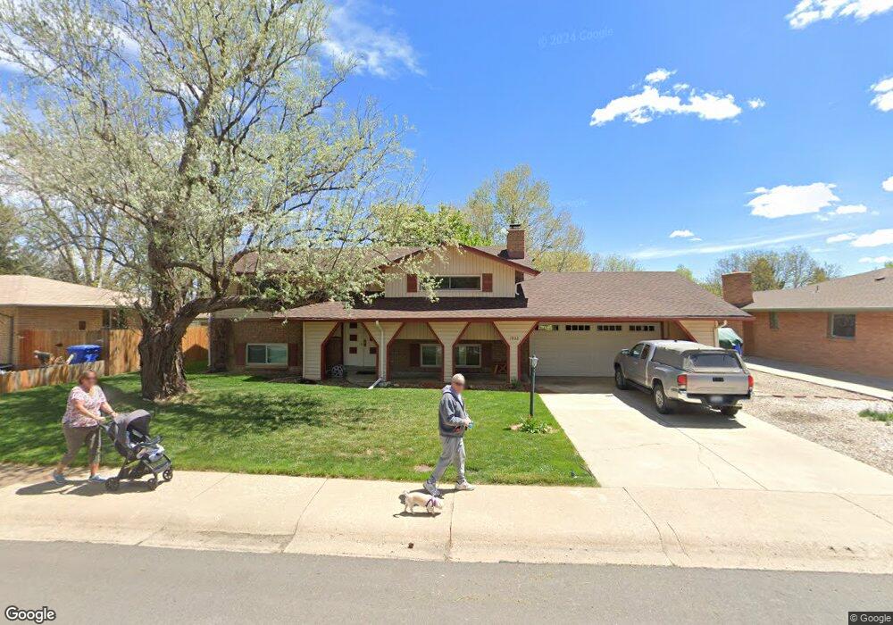
1902 James Dr Loveland, CO 80538
Estimated Value: $481,512 - $547,000
3
Beds
2
Baths
2,258
Sq Ft
$228/Sq Ft
Est. Value
About This Home
This home is located at 1902 James Dr, Loveland, CO 80538 and is currently estimated at $515,128, approximately $228 per square foot. 1902 James Dr is a home located in Larimer County with nearby schools including Van Buren Elementary School, Bill Reed Middle School, and Loveland High School.
Ownership History
Date
Name
Owned For
Owner Type
Purchase Details
Closed on
Sep 10, 2021
Sold by
Fisher Wayne Allen
Bought by
Fisher Wayne Allen and Fisher Christy Laree
Current Estimated Value
Purchase Details
Closed on
May 12, 2006
Sold by
Fisher Wayne A and Fisher Christy L
Bought by
Fisher Wayne A
Home Financials for this Owner
Home Financials are based on the most recent Mortgage that was taken out on this home.
Original Mortgage
$162,000
Outstanding Balance
$93,824
Interest Rate
6.4%
Mortgage Type
Fannie Mae Freddie Mac
Estimated Equity
$421,304
Purchase Details
Closed on
Oct 31, 2003
Sold by
Fisher Wayne A
Bought by
Fisher Wayne A and Fisher Christy L
Purchase Details
Closed on
Jan 29, 1999
Sold by
Pratt Joan
Bought by
Fisher Wayne A
Home Financials for this Owner
Home Financials are based on the most recent Mortgage that was taken out on this home.
Original Mortgage
$136,395
Interest Rate
6.79%
Mortgage Type
FHA
Create a Home Valuation Report for This Property
The Home Valuation Report is an in-depth analysis detailing your home's value as well as a comparison with similar homes in the area
Home Values in the Area
Average Home Value in this Area
Purchase History
| Date | Buyer | Sale Price | Title Company |
|---|---|---|---|
| Fisher Wayne Allen | -- | None Available | |
| Fisher Wayne A | -- | None Available | |
| Fisher Wayne A | -- | -- | |
| Fisher Wayne A | $138,000 | North American Title |
Source: Public Records
Mortgage History
| Date | Status | Borrower | Loan Amount |
|---|---|---|---|
| Open | Fisher Wayne A | $162,000 | |
| Closed | Fisher Wayne A | $136,395 |
Source: Public Records
Tax History Compared to Growth
Tax History
| Year | Tax Paid | Tax Assessment Tax Assessment Total Assessment is a certain percentage of the fair market value that is determined by local assessors to be the total taxable value of land and additions on the property. | Land | Improvement |
|---|---|---|---|---|
| 2025 | $2,271 | $32,140 | $3,685 | $28,455 |
| 2024 | $2,190 | $32,140 | $3,685 | $28,455 |
| 2022 | $2,006 | $25,208 | $3,823 | $21,385 |
| 2021 | $2,061 | $25,934 | $3,933 | $22,001 |
| 2020 | $2,051 | $25,791 | $3,933 | $21,858 |
| 2019 | $2,016 | $25,791 | $3,933 | $21,858 |
| 2018 | $1,808 | $21,967 | $3,960 | $18,007 |
| 2017 | $1,557 | $21,967 | $3,960 | $18,007 |
| 2016 | $1,439 | $19,621 | $4,378 | $15,243 |
| 2015 | $1,427 | $19,620 | $4,380 | $15,240 |
| 2014 | $1,138 | $15,140 | $4,380 | $10,760 |
Source: Public Records
Map
Nearby Homes
- 2001 Cameo Ave
- 1812 Van Buren Ave
- 1805 W 22nd St
- 1633 Van Buren Ave Unit 1
- 2306 Cameo Ave
- 1718 Dotsero Ave
- 1607 W U S 34
- 2030 W 17th St Unit A8
- 1428 W 25th St
- 2503 N Taft Ave
- 2468 Chama Ct
- 1510 Westshore Dr
- 1502 Westshore Dr
- 1534 W 28th St
- 2503 N Estrella Ave
- 1205 Loch Mount Dr
- 2387 W U S 34
- 2467 Farisita Dr
- 1100 Taft Ave
- 1100 Taft Ave Unit 46