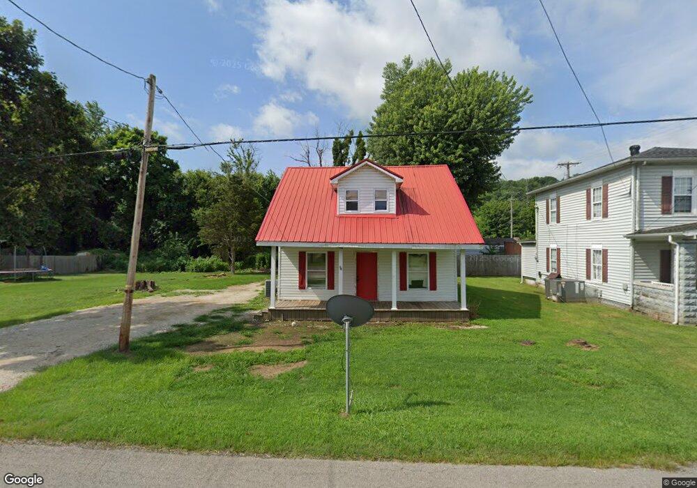
1902 Main St Greenup, KY 41144
Estimated Value: $103,000 - $122,000
4
Beds
2
Baths
1,152
Sq Ft
$96/Sq Ft
Est. Value
About This Home
This home is located at 1902 Main St, Greenup, KY 41144 and is currently estimated at $110,778, approximately $96 per square foot. 1902 Main St is a home located in Greenup County with nearby schools including Greenup County High School.
Ownership History
Date
Name
Owned For
Owner Type
Purchase Details
Closed on
May 18, 2009
Sold by
Federal Home Loan Mortgage Corporation
Bought by
Baldridge Mark and Baldridge Pamela
Current Estimated Value
Home Financials for this Owner
Home Financials are based on the most recent Mortgage that was taken out on this home.
Original Mortgage
$100,795
Outstanding Balance
$63,135
Interest Rate
4.77%
Estimated Equity
$47,643
Purchase Details
Closed on
Mar 9, 2009
Sold by
Flagstar Bank Fsb
Bought by
Flagstar Bank Fsb and Federal Home Loan Mortgage Corporation
Purchase Details
Closed on
Oct 27, 2006
Sold by
Russell Mark and Russell Tammy
Bought by
Russell Mark E and Russell Joanna Marie
Home Financials for this Owner
Home Financials are based on the most recent Mortgage that was taken out on this home.
Original Mortgage
$70,000
Interest Rate
6.27%
Create a Home Valuation Report for This Property
The Home Valuation Report is an in-depth analysis detailing your home's value as well as a comparison with similar homes in the area
Purchase History
| Date | Buyer | Sale Price | Title Company |
|---|---|---|---|
| Baldridge Mark | $49,000 | -- | |
| Flagstar Bank Fsb | $46,667 | -- | |
| Russell Mark E | $70,000 | Title First Agency |
Source: Public Records
Mortgage History
| Date | Status | Borrower | Loan Amount |
|---|---|---|---|
| Open | Baldridge Mark | $100,795 | |
| Previous Owner | Russell Mark E | $70,000 |
Source: Public Records
Tax History
| Year | Tax Paid | Tax Assessment Tax Assessment Total Assessment is a certain percentage of the fair market value that is determined by local assessors to be the total taxable value of land and additions on the property. | Land | Improvement |
|---|---|---|---|---|
| 2025 | $1,123 | $70,000 | $15,000 | $55,000 |
| 2024 | $1,121 | $70,000 | $15,000 | $55,000 |
| 2023 | $1,124 | $70,000 | $15,000 | $55,000 |
| 2022 | $1,089 | $70,000 | $15,000 | $55,000 |
| 2021 | $1,084 | $70,000 | $15,000 | $55,000 |
| 2020 | $1,067 | $70,000 | $15,000 | $55,000 |
| 2019 | $1,077 | $70,000 | $15,000 | $55,000 |
| 2018 | $1,103 | $70,000 | $15,000 | $55,000 |
| 2017 | $1,061 | $70,000 | $15,000 | $55,000 |
| 2016 | $1,061 | $70,000 | $15,000 | $55,000 |
| 2015 | $1,054 | $70,000 | $15,000 | $55,000 |
| 2014 | $1,044 | $70,000 | $15,000 | $55,000 |
| 2011 | -- | $70,000 | $15,000 | $55,000 |
Source: Public Records
Map
Nearby Homes
- 1425 Walnut St
- 00 Us 23 & Preston Ave
- 000 Seaton Ave
- 1201 Walnut St
- 3365 St Rt 827
- 40 Griffith Ct
- 42 Griffith Ct
- 537 Laurel St
- 529 Laurel St
- 0 Private Drive 411
- 404 Sycamore St
- 219 Main St
- 11593 U S 23 Hwy
- 1516 Gallia Pike
- 0 Treasure Cove Rd
- 0 Whetstone Rd
- 0 Shepherd Loop Rd
- 1803 Back Rd
- 707 State Route 503
- 686 Kentucky 827
Your Personal Tour Guide
Ask me questions while you tour the home.