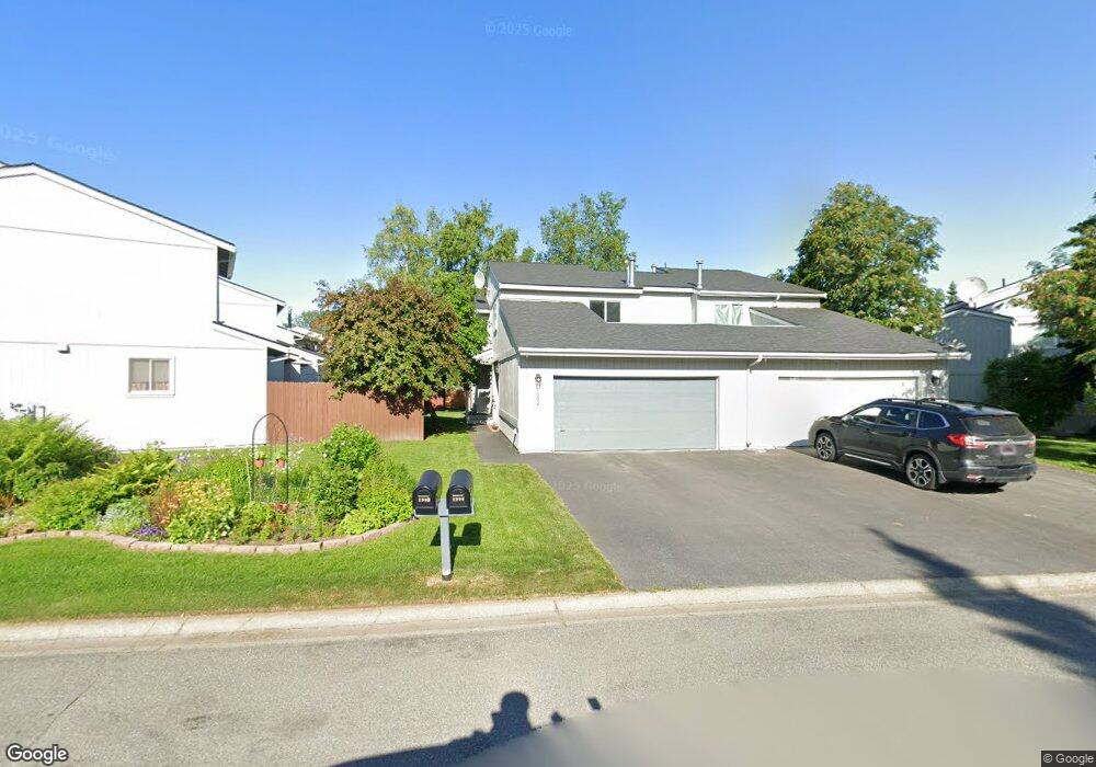
1902 Parkside Dr Anchorage, AK 99501
Airport Heights NeighborhoodEstimated Value: $237,000 - $384,093
3
Beds
3
Baths
1,788
Sq Ft
$187/Sq Ft
Est. Value
About This Home
This home is located at 1902 Parkside Dr, Anchorage, AK 99501 and is currently estimated at $333,698, approximately $186 per square foot. 1902 Parkside Dr is a home located in Anchorage Municipality with nearby schools including Airport Heights Elementary School, Wendler Middle School, and Bettye Davis East Anchorage High School.
Ownership History
Date
Name
Owned For
Owner Type
Purchase Details
Closed on
Mar 30, 2004
Sold by
Lash Michael A and Lash Shawna E
Bought by
Sheasley Richard and Chalker Kelsey E
Current Estimated Value
Home Financials for this Owner
Home Financials are based on the most recent Mortgage that was taken out on this home.
Original Mortgage
$161,600
Outstanding Balance
$74,419
Interest Rate
5.57%
Mortgage Type
Purchase Money Mortgage
Estimated Equity
$259,279
Purchase Details
Closed on
Mar 30, 1998
Sold by
Wilson Douglas A and Wilson Victoria S
Bought by
Lash Michael A and Lash Shawna E
Purchase Details
Closed on
Sep 28, 1992
Sold by
Koehler Dennis L and Koehler Donna J
Bought by
Wilson Douglas A and Wilson Victoria S
Home Financials for this Owner
Home Financials are based on the most recent Mortgage that was taken out on this home.
Original Mortgage
$112,500
Interest Rate
7.95%
Mortgage Type
New Conventional
Create a Home Valuation Report for This Property
The Home Valuation Report is an in-depth analysis detailing your home's value as well as a comparison with similar homes in the area
Home Values in the Area
Average Home Value in this Area
Purchase History
| Date | Buyer | Sale Price | Title Company |
|---|---|---|---|
| Sheasley Richard | -- | -- | |
| Lash Michael A | -- | -- | |
| Lash Michael A | -- | -- | |
| Wilson Douglas A | -- | -- |
Source: Public Records
Mortgage History
| Date | Status | Borrower | Loan Amount |
|---|---|---|---|
| Open | Sheasley Richard | $161,600 | |
| Previous Owner | Wilson Douglas A | $112,500 | |
| Closed | Lash Michael A | $0 |
Source: Public Records
Tax History
| Year | Tax Paid | Tax Assessment Tax Assessment Total Assessment is a certain percentage of the fair market value that is determined by local assessors to be the total taxable value of land and additions on the property. | Land | Improvement |
|---|---|---|---|---|
| 2025 | $1,815 | $351,700 | $79,900 | $271,800 |
| 2024 | $1,815 | $337,400 | $79,900 | $257,500 |
| 2023 | $5,262 | $309,000 | $79,900 | $229,100 |
| 2022 | $1,632 | $296,900 | $79,900 | $217,000 |
| 2021 | $4,900 | $271,900 | $79,900 | $192,000 |
| 2020 | $1,012 | $260,700 | $79,900 | $180,800 |
| 2019 | $3,580 | $268,800 | $79,900 | $188,900 |
| 2018 | $3,551 | $266,500 | $75,100 | $191,400 |
| 2017 | $3,956 | $272,600 | $75,100 | $197,500 |
| 2016 | $3,433 | $268,400 | $72,100 | $196,300 |
| 2015 | $3,433 | $266,700 | $78,500 | $188,200 |
| 2014 | $3,433 | $263,600 | $78,500 | $185,100 |
Source: Public Records
Map
Nearby Homes
- 2007 Parkview Cir
- 1913 Parkview Cir
- 1620 Eastridge Dr Unit 203
- 2089 Cliffside Dr Unit 29B-6
- 1625 Sitka St Unit 103
- 1701 Aleutian St
- 2518 Crestwood St
- 1703 Alder Dr
- 1403 Nelchina St
- 2601 Darby Cir
- 000 Tr A Thurston
- 3215 E 18th Cir
- 890 Orca St
- 1524 Rosemary St
- 1327 Ingra St
- 943 E 12th Ave Unit 3
- 1310 Ingra St
- 3401 E 15th Ave
- 3514 E 19th Ave
- 3276 Vassar Dr
- 1900 Parkside Dr
- 1842 Parkside Dr
- 1840 Parkside Dr
- 2009 Parkview Cir
- 2005 Parkview Cir
- 2003 Parkview Cir
- 1822 Parkside Dr
- 1820 Parkside Dr
- 2001 Parkview Cir
- 1903 Parkside Dr
- 1901 Parkside Dr
- 1905 Parkside Dr
- 1818 Parkside Dr
- 1845 Parkside Dr
- 1843 Parkside Dr
- 1907 Parkside Dr
- 1921 Parkview Cir
- 1816 Parkside Dr
- 1841 Parkside Dr
- 1909 Parkside Dr
Your Personal Tour Guide
Ask me questions while you tour the home.