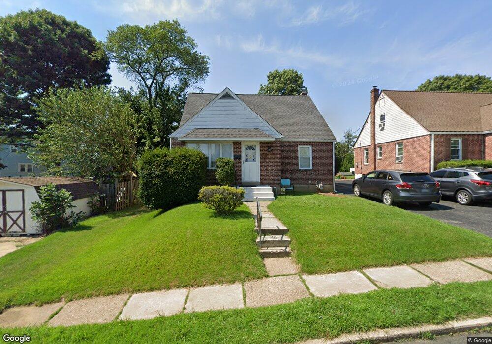
1903 Armstrong Ave Morton, PA 19070
Estimated Value: $340,138 - $385,000
4
Beds
1
Bath
1,397
Sq Ft
$257/Sq Ft
Est. Value
About This Home
This home is located at 1903 Armstrong Ave, Morton, PA 19070 and is currently estimated at $359,285, approximately $257 per square foot. 1903 Armstrong Ave is a home located in Delaware County with nearby schools including Amosland El School, Ridley Middle School, and Ridley High School.
Ownership History
Date
Name
Owned For
Owner Type
Purchase Details
Closed on
Sep 19, 1996
Sold by
Kobasic Linda Susan and Legge Ethel M
Bought by
Mccaul Wayne A and Mccaul Jean L
Current Estimated Value
Home Financials for this Owner
Home Financials are based on the most recent Mortgage that was taken out on this home.
Original Mortgage
$114,162
Outstanding Balance
$9,544
Interest Rate
7.9%
Mortgage Type
FHA
Estimated Equity
$349,741
Create a Home Valuation Report for This Property
The Home Valuation Report is an in-depth analysis detailing your home's value as well as a comparison with similar homes in the area
Home Values in the Area
Average Home Value in this Area
Purchase History
| Date | Buyer | Sale Price | Title Company |
|---|---|---|---|
| Mccaul Wayne A | $114,500 | -- |
Source: Public Records
Mortgage History
| Date | Status | Borrower | Loan Amount |
|---|---|---|---|
| Open | Mccaul Wayne A | $114,162 |
Source: Public Records
Tax History Compared to Growth
Tax History
| Year | Tax Paid | Tax Assessment Tax Assessment Total Assessment is a certain percentage of the fair market value that is determined by local assessors to be the total taxable value of land and additions on the property. | Land | Improvement |
|---|---|---|---|---|
| 2025 | $6,121 | $176,280 | $58,320 | $117,960 |
| 2024 | $6,121 | $176,280 | $58,320 | $117,960 |
| 2023 | $5,854 | $176,280 | $58,320 | $117,960 |
| 2022 | $5,667 | $176,280 | $58,320 | $117,960 |
| 2021 | $8,772 | $176,280 | $58,320 | $117,960 |
| 2020 | $5,810 | $102,850 | $35,000 | $67,850 |
| 2019 | $5,704 | $102,850 | $35,000 | $67,850 |
| 2018 | $5,633 | $102,850 | $0 | $0 |
| 2017 | $5,633 | $102,850 | $0 | $0 |
| 2016 | $564 | $102,850 | $0 | $0 |
| 2015 | $564 | $102,850 | $0 | $0 |
| 2014 | $564 | $102,850 | $0 | $0 |
Source: Public Records
Map
Nearby Homes
- 742 Agnes Ave
- 136 Linden Ave
- 216-218 President Ave
- 810 Quince Ln
- 115 President Ave
- 916 Brooke Ave
- 668 Hutchinson Terrace
- 31 Silver Lake Terrace Unit 32
- 339 Sutton Ave
- 2330 Poe Rd
- 1828 5th Ave
- 357 Cedar Ave
- 363 Holmes Rd
- 2 Yale Ave
- 7 & 0 Woodland Ave
- 120 Bridge St
- 226 W Sylvan Ave
- 614 Highland Terrace
- 601 Country Ln
- 880 Quaint St
- 1907 Armstrong Ave
- 728 Kedron Ave
- 1911 Armstrong Ave
- 736 Kedron Ave
- 1915 Armstrong Ave
- 1908 Armstrong Ave
- 1904 Armstrong Ave
- 1919 Armstrong Ave
- 1916 Armstrong Ave
- 675 Acer Ave
- 720 Kedron Ave
- 737 Amosland Rd
- 674 Acer Ave
- 752 Kedron Ave
- 733 Amosland Rd
- 729 Amosland Rd
- 1917 Shasta Cir
- 741 Amosland Rd
- 727 Kedron Ave
- 1924 Armstrong Ave